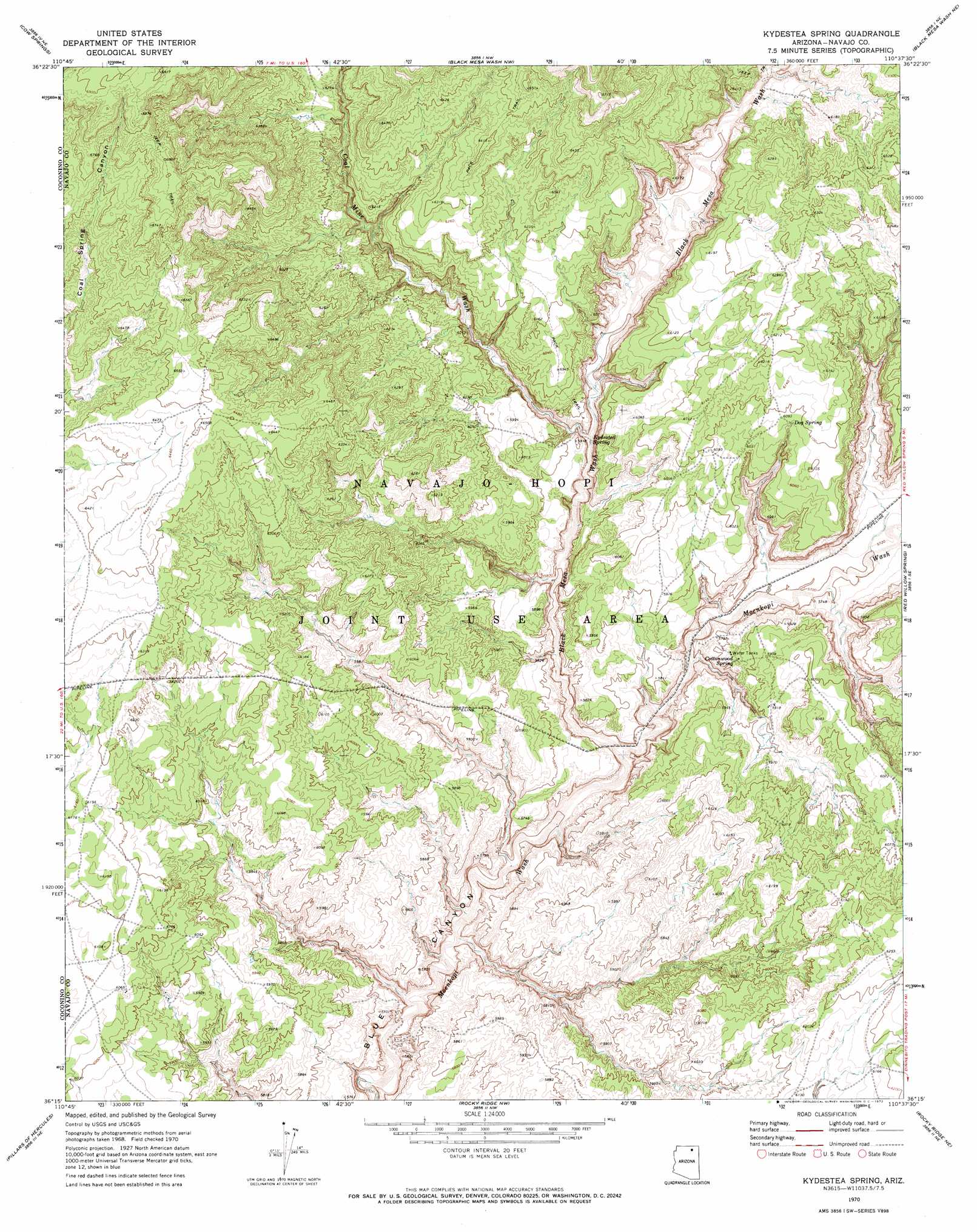
Kydestea Spring Topo Map Arizona
To zoom in, hover over the map of Kydestea Spring
USGS Topo Quad 36110c6 - 1:24,000 scale
| Topo Map Name: | Kydestea Spring |
| USGS Topo Quad ID: | 36110c6 |
| Print Size: | ca. 21 1/4" wide x 27" high |
| Southeast Coordinates: | 36.25° N latitude / 110.625° W longitude |
| Map Center Coordinates: | 36.3125° N latitude / 110.6875° W longitude |
| U.S. State: | AZ |
| Filename: | o36110c6.jpg |
| Download Map JPG Image: | Kydestea Spring topo map 1:24,000 scale |
| Map Type: | Topographic |
| Topo Series: | 7.5´ |
| Map Scale: | 1:24,000 |
| Source of Map Images: | United States Geological Survey (USGS) |
| Alternate Map Versions: |
Kydestea Spring AZ 1970, updated 1972 Download PDF Buy paper map Kydestea Spring AZ 2011 Download PDF Buy paper map Kydestea Spring AZ 2014 Download PDF Buy paper map |
1:24,000 Topo Quads surrounding Kydestea Spring
Square Butte |
Whirlwind Rock |
Shonto |
Shonto Se |
Long House Valley |
White Mesa Arch |
Cow Springs |
Black Mesa Wash Nw |
Black Mesa Wash Ne |
Great Spring |
Tonalea |
John Daw Mesa |
Kydestea Spring |
Red Willow Spring |
Owl Valley |
Begashibito Canyon |
Pillars Of Hercules |
Rocky Ridge Nw |
Rocky Ridge Ne |
Big Mountain Dam |
Bat Canyon |
Bat Spring |
Rocky Ridge Sw |
Rocky Ridge Se |
Hard Rocks |
> Back to 36110a1 at 1:100,000 scale
> Back to 36110a1 at 1:250,000 scale
> Back to U.S. Topo Maps home
Kydestea Spring topo map: Gazetteer
Kydestea Spring: Springs
Cottonwood Spring elevation 1788m 5866′Kydestia Spring elevation 1754m 5754′
Kydestea Spring: Summits
Yellow Butte elevation 2090m 6856′Kydestea Spring: Valleys
Black Mesa Wash elevation 1714m 5623′Coal Mine Wash elevation 1770m 5807′
Kydestea Spring digital topo map on disk
Buy this Kydestea Spring topo map showing relief, roads, GPS coordinates and other geographical features, as a high-resolution digital map file on DVD: