Boot Mesa Topo Map Arizona
To zoom in, hover over the map of Boot Mesa
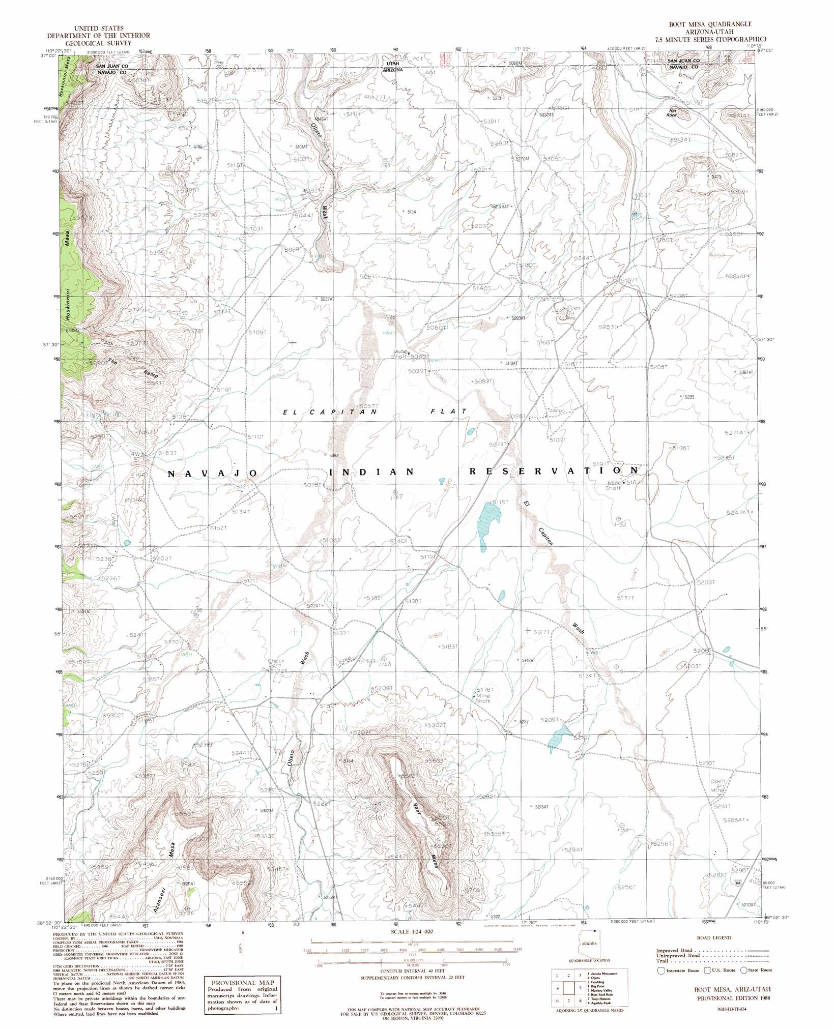
USGS Topo Quad 36110h3 - 1:24,000 scale
| Topo Map Name: | Boot Mesa |
| USGS Topo Quad ID: | 36110h3 |
| Print Size: | ca. 21 1/4" wide x 27" high |
| Southeast Coordinates: | 36.875° N latitude / 110.25° W longitude |
| Map Center Coordinates: | 36.9375° N latitude / 110.3125° W longitude |
| U.S. States: | AZ, UT |
| Filename: | o36110h3.jpg |
| Download Map JPG Image: | Boot Mesa topo map 1:24,000 scale |
| Map Type: | Topographic |
| Topo Series: | 7.5´ |
| Map Scale: | 1:24,000 |
| Source of Map Images: | United States Geological Survey (USGS) |
| Alternate Map Versions: |
Agathla Peak 2 NE AZ 1952, updated 1954 Download PDF Buy paper map Boot Mesa AZ 1988, updated 1988 Download PDF Buy paper map Boot Mesa AZ 2011 Download PDF Buy paper map Boot Mesa AZ 2011 Download PDF Buy paper map Boot Mesa AZ 2014 Download PDF Buy paper map |
1:24,000 Topo Quads surrounding Boot Mesa
No Mans Mesa North |
Monitor Butte |
Oljeto Ne |
Goulding Nw |
Goulding Ne |
No Mans Mesa South |
Jacobs Monument |
Oljeto |
Goulding |
Monument Pass |
Cattle Canyon |
Big Point |
Boot Mesa |
Mystery Valley |
Mitten Buttes |
Tall Mountain |
Keet Seel Ruin |
Tseyi-Hatsosi |
Agathla Peak |
Baby Rocks |
Betatakin Ruin |
Marsh Pass |
Kayenta West |
Kayenta East |
Church Rock |
> Back to 36110e1 at 1:100,000 scale
> Back to 36110a1 at 1:250,000 scale
> Back to U.S. Topo Maps home
Boot Mesa topo map: Gazetteer
Boot Mesa: Arroyos
Narrow Canyon Wash elevation 1531m 5022′Boot Mesa: Cliffs
The Ramp elevation 1697m 5567′Boot Mesa: Flats
El Capitan Flat elevation 1552m 5091′Boot Mesa: Streams
El Capitan Wash elevation 1531m 5022′Boot Mesa: Summits
Azansosi Mesa elevation 2019m 6624′Boot Mesa elevation 1906m 6253′
Hat Rock elevation 1615m 5298′
Boot Mesa digital topo map on disk
Buy this Boot Mesa topo map showing relief, roads, GPS coordinates and other geographical features, as a high-resolution digital map file on DVD: