Willow Springs Topo Map Arizona
To zoom in, hover over the map of Willow Springs
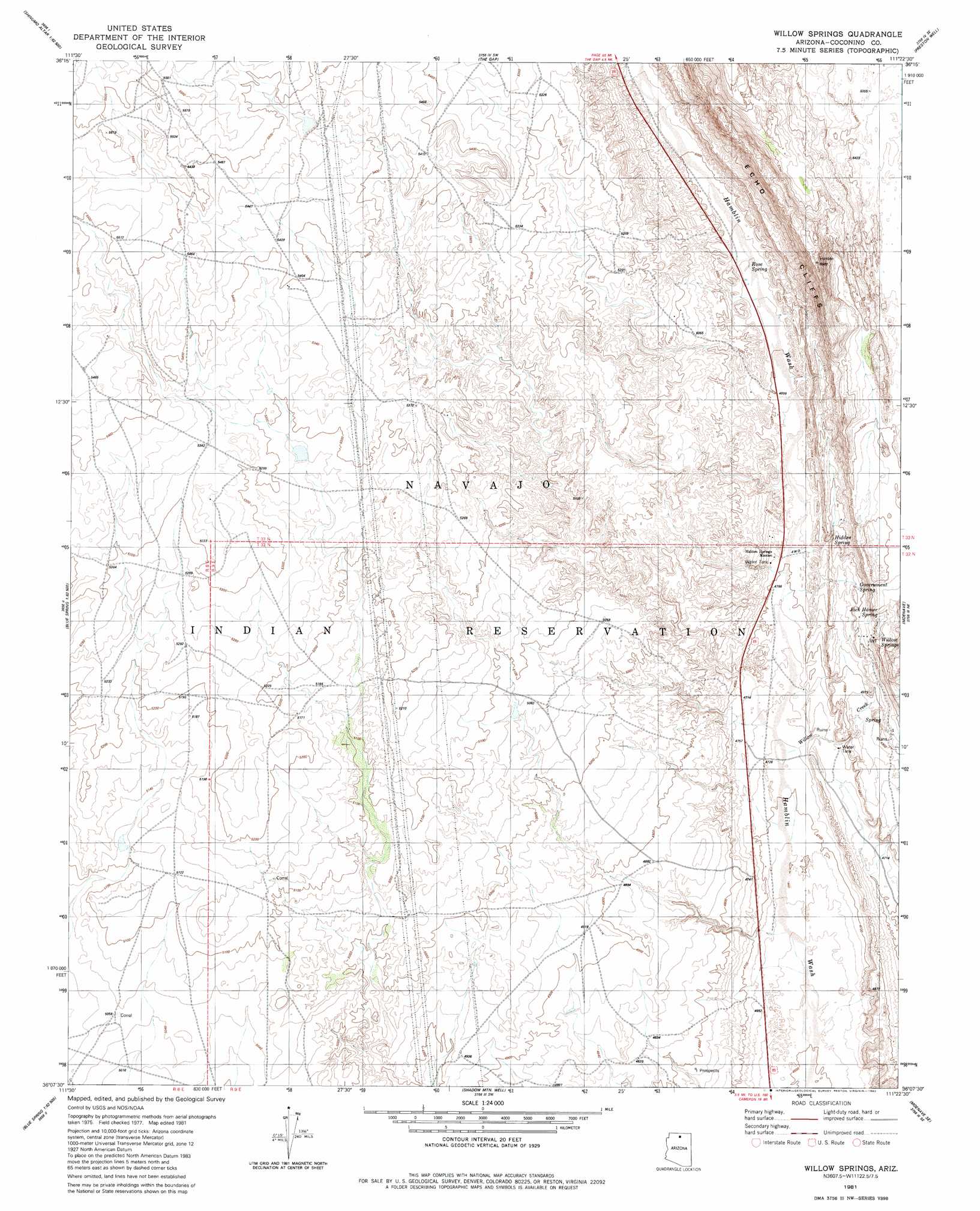
USGS Topo Quad 36111b4 - 1:24,000 scale
| Topo Map Name: | Willow Springs |
| USGS Topo Quad ID: | 36111b4 |
| Print Size: | ca. 21 1/4" wide x 27" high |
| Southeast Coordinates: | 36.125° N latitude / 111.375° W longitude |
| Map Center Coordinates: | 36.1875° N latitude / 111.4375° W longitude |
| U.S. State: | AZ |
| Filename: | o36111b4.jpg |
| Download Map JPG Image: | Willow Springs topo map 1:24,000 scale |
| Map Type: | Topographic |
| Topo Series: | 7.5´ |
| Map Scale: | 1:24,000 |
| Source of Map Images: | United States Geological Survey (USGS) |
| Alternate Map Versions: |
Moa Ave NW AZ 1955, updated 1957 Download PDF Buy paper map Willow Springs AZ 1981, updated 1982 Download PDF Buy paper map Willow Springs AZ 2011 Download PDF Buy paper map Willow Springs AZ 2014 Download PDF Buy paper map |
1:24,000 Topo Quads surrounding Willow Springs
Shinumo Altar |
Cedar Ridge |
Toh Bih Nosteny |
Sitting Coyote Hill |
Preston Mesa North |
Blue Moon Reservoir |
Bodaway Mesa |
The Gap |
Preston Well |
Preston Mesa South |
Salt Trail Canyon |
Pillow Mountain |
Willow Springs |
Moenave |
Tuba City |
Blue Spring |
Blue Spring Se |
Shadow Mountain Well |
Moenave Se |
Moenkopi |
Hellhole Bend |
Coconino Point |
Cameron North |
Cameron Ne |
Goldtooth |
> Back to 36111a1 at 1:100,000 scale
> Back to 36110a1 at 1:250,000 scale
> Back to U.S. Topo Maps home
Willow Springs topo map: Gazetteer
Willow Springs: Populated Places
Hidden Springs Mission elevation 1469m 4819′Willow Springs elevation 1470m 4822′
Willow Springs: Springs
Government Spring elevation 1518m 4980′Hidden Spring elevation 1498m 4914′
Jack Homer Spring elevation 1571m 5154′
Rose Spring elevation 1506m 4940′
Willow Springs elevation 1586m 5203′
Willow Springs: Streams
Willow Creek elevation 1437m 4714′Willow Springs digital topo map on disk
Buy this Willow Springs topo map showing relief, roads, GPS coordinates and other geographical features, as a high-resolution digital map file on DVD: