Blue Moon Reservoir Topo Map Arizona
To zoom in, hover over the map of Blue Moon Reservoir
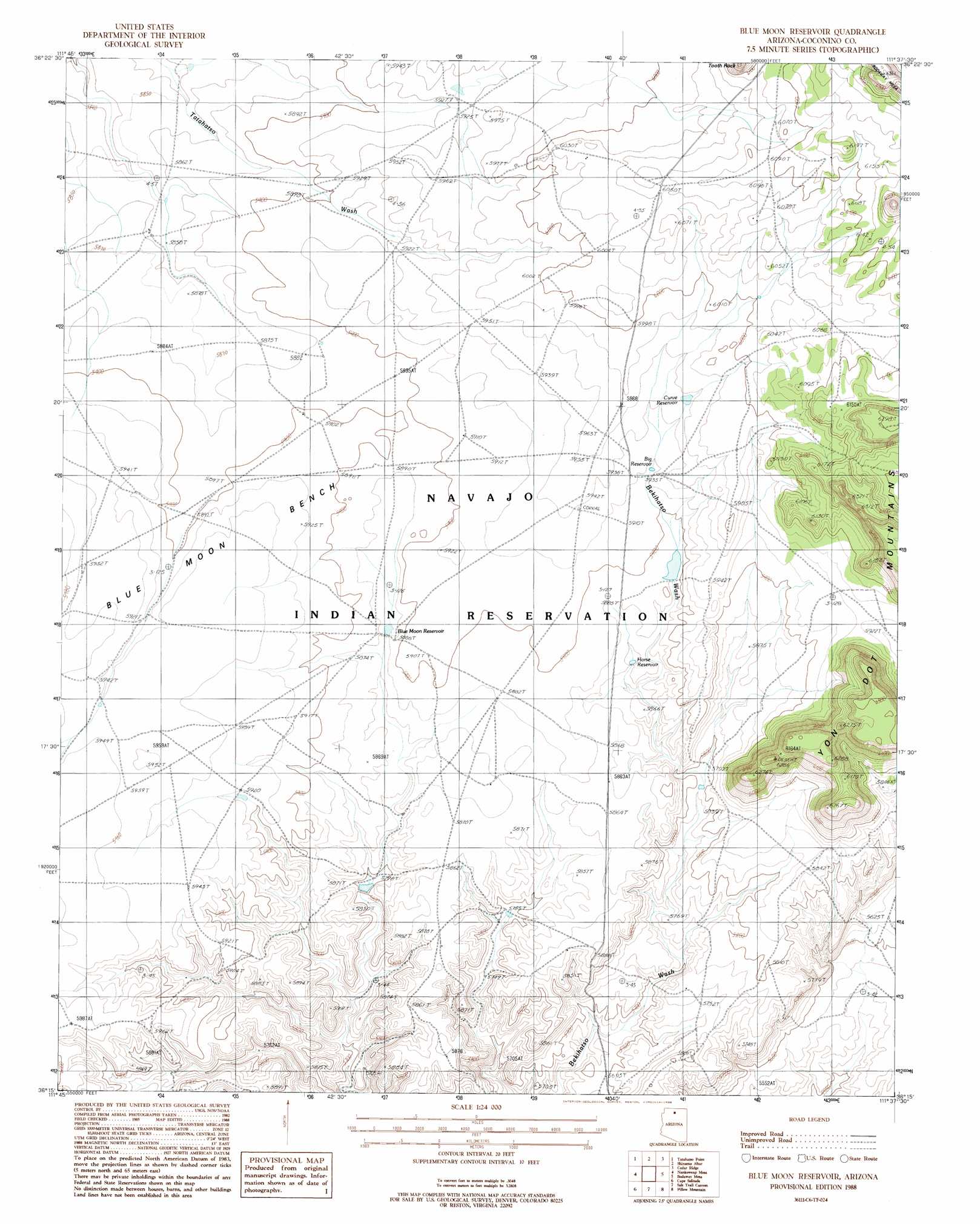
USGS Topo Quad 36111c6 - 1:24,000 scale
| Topo Map Name: | Blue Moon Reservoir |
| USGS Topo Quad ID: | 36111c6 |
| Print Size: | ca. 21 1/4" wide x 27" high |
| Southeast Coordinates: | 36.25° N latitude / 111.625° W longitude |
| Map Center Coordinates: | 36.3125° N latitude / 111.6875° W longitude |
| U.S. State: | AZ |
| Filename: | o36111c6.jpg |
| Download Map JPG Image: | Blue Moon Reservoir topo map 1:24,000 scale |
| Map Type: | Topographic |
| Topo Series: | 7.5´ |
| Map Scale: | 1:24,000 |
| Source of Map Images: | United States Geological Survey (USGS) |
| Alternate Map Versions: |
Blue Moon Reservoir AZ 1988, updated 1988 Download PDF Buy paper map Blue Moon Reservoir AZ 2011 Download PDF Buy paper map Blue Moon Reservoir AZ 2014 Download PDF Buy paper map |
1:24,000 Topo Quads surrounding Blue Moon Reservoir
Buffalo Tanks |
North Canyon Point |
Tanner Well |
Cedar Tree Hills |
Dove Spring |
Buffalo Ranch |
Tatahatso Point |
Shinumo Altar |
Cedar Ridge |
Toh Bih Nosteny |
Point Imperial |
Nankoweap Mesa |
Blue Moon Reservoir |
Bodaway Mesa |
The Gap |
Walhalla Plateau |
Cape Solitude |
Salt Trail Canyon |
Pillow Mountain |
Willow Springs |
Cape Royal |
Desert View |
Blue Spring |
Blue Spring Se |
Shadow Mountain Well |
> Back to 36111a1 at 1:100,000 scale
> Back to 36110a1 at 1:250,000 scale
> Back to U.S. Topo Maps home
Blue Moon Reservoir topo map: Gazetteer
Blue Moon Reservoir: Benches
Blue Moon Bench elevation 1818m 5964′Blue Moon Reservoir: Reservoirs
Big Reservoir elevation 1805m 5921′Blue Moon Reservoir elevation 1793m 5882′
Curve Reservoir elevation 1816m 5958′
Horse Reservoir elevation 1787m 5862′
Blue Moon Reservoir digital topo map on disk
Buy this Blue Moon Reservoir topo map showing relief, roads, GPS coordinates and other geographical features, as a high-resolution digital map file on DVD: