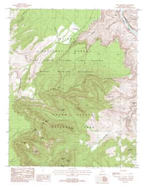
Point Imperial Topo Map Arizona
To zoom in, hover over the map of Point Imperial
USGS Topo Quad 36111c8 - 1:24,000 scale
| Topo Map Name: | Point Imperial |
| USGS Topo Quad ID: | 36111c8 |
| Print Size: | ca. 21 1/4" wide x 27" high |
| Southeast Coordinates: | 36.25° N latitude / 111.875° W longitude |
| Map Center Coordinates: | 36.3125° N latitude / 111.9375° W longitude |
| U.S. State: | AZ |
| Filename: | o36111c8.jpg |
| Download Map JPG Image: | Point Imperial topo map 1:24,000 scale |
| Map Type: | Topographic |
| Topo Series: | 7.5´ |
| Map Scale: | 1:24,000 |
| Source of Map Images: | United States Geological Survey (USGS) |
| Alternate Map Versions: |
Point Imperial AZ 1988, updated 1988 Download PDF Buy paper map Point Imperial AZ 1988, updated 1988 Download PDF Buy paper map Point Imperial AZ 2012 Download PDF Buy paper map Point Imperial AZ 2014 Download PDF Buy paper map |
| FStopo: | US Forest Service topo Point Imperial is available: Download FStopo PDF Download FStopo TIF |
1:24,000 Topo Quads surrounding Point Imperial
> Back to 36111a1 at 1:100,000 scale
> Back to 36110a1 at 1:250,000 scale
> Back to U.S. Topo Maps home
Point Imperial topo map: Gazetteer
Point Imperial: Arches
Kolb Arch elevation 2131m 6991′Point Imperial: Capes
Marion Point elevation 1839m 6033′Point Imperial: Cliffs
Bourke Point elevation 1876m 6154′Ehrenberg Point elevation 2051m 6729′
Point Imperial elevation 2628m 8622′
Seiber Point elevation 0m 0′
Woolsey Point elevation 2585m 8480′
Point Imperial: Reservoirs
Buck Farm Tank elevation 1940m 6364′Saddle Canyon Tank elevation 1891m 6204′
Point Imperial: Ridges
Boundary Ridge elevation 2208m 7244′Point Imperial: Summits
Alsap Butte elevation 2281m 7483′Barbenceta Butte elevation 1395m 4576′
Hancock Butte elevation 2334m 7657′
Mount Hayden elevation 2450m 8038′
Nankoweap Butte elevation 1604m 5262′
Novinger Butte elevation 2111m 6925′
Saddle Mountain elevation 0m 0′
Sullivan Peak elevation 2469m 8100′
Tilted Mesa elevation 1612m 5288′
Woolsey Butte elevation 2208m 7244′
Point Imperial: Valleys
Saddle Canyon elevation 0m 0′Point Imperial digital topo map on disk
Buy this Point Imperial topo map showing relief, roads, GPS coordinates and other geographical features, as a high-resolution digital map file on DVD:


