Sitting Coyote Hill Topo Map Arizona
To zoom in, hover over the map of Sitting Coyote Hill
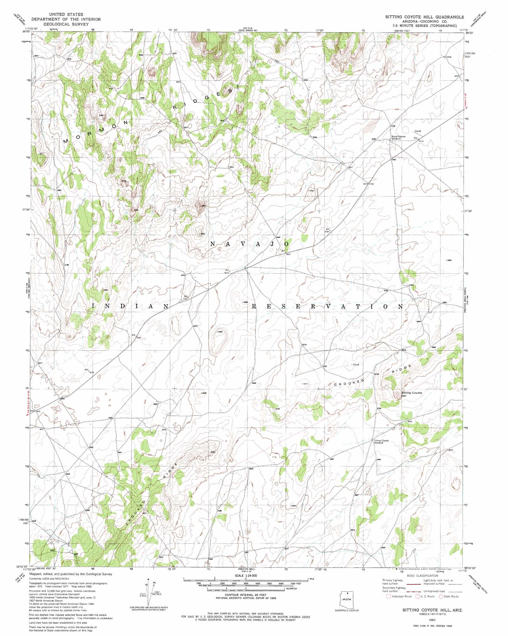
USGS Topo Quad 36111d3 - 1:24,000 scale
| Topo Map Name: | Sitting Coyote Hill |
| USGS Topo Quad ID: | 36111d3 |
| Print Size: | ca. 21 1/4" wide x 27" high |
| Southeast Coordinates: | 36.375° N latitude / 111.25° W longitude |
| Map Center Coordinates: | 36.4375° N latitude / 111.3125° W longitude |
| U.S. State: | AZ |
| Filename: | o36111d3.jpg |
| Download Map JPG Image: | Sitting Coyote Hill topo map 1:24,000 scale |
| Map Type: | Topographic |
| Topo Series: | 7.5´ |
| Map Scale: | 1:24,000 |
| Source of Map Images: | United States Geological Survey (USGS) |
| Alternate Map Versions: |
Sitting Coyote Hill AZ 1982, updated 1982 Download PDF Buy paper map Sitting Coyote Hill AZ 2011 Download PDF Buy paper map Sitting Coyote Hill AZ 2014 Download PDF Buy paper map |
1:24,000 Topo Quads surrounding Sitting Coyote Hill
Explosive Rock |
Dead Monkey Ridge |
Many Ghosts Hill |
Horsethief Mesa |
White Hill |
Cedar Tree Hills |
Dove Spring |
Dove Spring Se |
Arrowhead Mesa |
Kaibito |
Cedar Ridge |
Toh Bih Nosteny |
Sitting Coyote Hill |
Preston Mesa North |
Big Whisker Well |
Bodaway Mesa |
The Gap |
Preston Well |
Preston Mesa South |
Gopher Spring |
Pillow Mountain |
Willow Springs |
Moenave |
Tuba City |
Middle Mesa |
> Back to 36111a1 at 1:100,000 scale
> Back to 36110a1 at 1:250,000 scale
> Back to U.S. Topo Maps home
Sitting Coyote Hill topo map: Gazetteer
Sitting Coyote Hill: Plains
Kaibito Plateau elevation 1748m 5734′Sitting Coyote Hill: Summits
Sitting Coyote Hill elevation 1795m 5889′Sitting Coyote Hill: Wells
Buck Pasture Windmill elevation 1757m 5764′Sitting Coyote Windmill elevation 1729m 5672′
Sitting Coyote Hill digital topo map on disk
Buy this Sitting Coyote Hill topo map showing relief, roads, GPS coordinates and other geographical features, as a high-resolution digital map file on DVD: