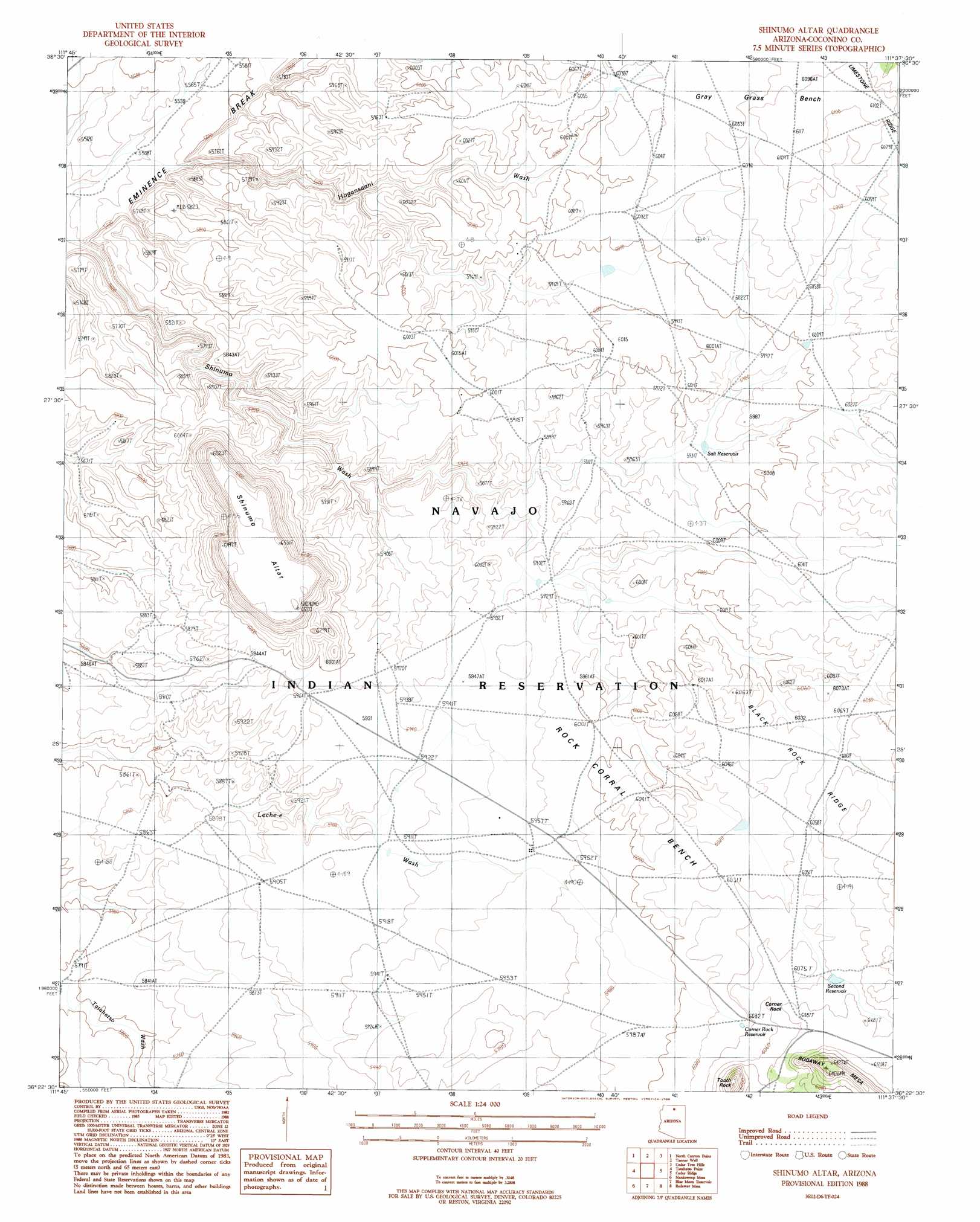
Shinumo Altar Topo Map Arizona
To zoom in, hover over the map of Shinumo Altar
USGS Topo Quad 36111d6 - 1:24,000 scale
| Topo Map Name: | Shinumo Altar |
| USGS Topo Quad ID: | 36111d6 |
| Print Size: | ca. 21 1/4" wide x 27" high |
| Southeast Coordinates: | 36.375° N latitude / 111.625° W longitude |
| Map Center Coordinates: | 36.4375° N latitude / 111.6875° W longitude |
| U.S. State: | AZ |
| Filename: | o36111d6.jpg |
| Download Map JPG Image: | Shinumo Altar topo map 1:24,000 scale |
| Map Type: | Topographic |
| Topo Series: | 7.5´ |
| Map Scale: | 1:24,000 |
| Source of Map Images: | United States Geological Survey (USGS) |
| Alternate Map Versions: |
Shinumo Altar AZ 1988, updated 1988 Download PDF Buy paper map Shinumo Altar AZ 2011 Download PDF Buy paper map Shinumo Altar AZ 2014 Download PDF Buy paper map |
1:24,000 Topo Quads surrounding Shinumo Altar
Emmett Hill |
Emmett Wash |
Bitter Springs |
Explosive Rock |
Dead Monkey Ridge |
Buffalo Tanks |
North Canyon Point |
Tanner Well |
Cedar Tree Hills |
Dove Spring |
Buffalo Ranch |
Tatahatso Point |
Shinumo Altar |
Cedar Ridge |
Toh Bih Nosteny |
Point Imperial |
Nankoweap Mesa |
Blue Moon Reservoir |
Bodaway Mesa |
The Gap |
Walhalla Plateau |
Cape Solitude |
Salt Trail Canyon |
Pillow Mountain |
Willow Springs |
> Back to 36111a1 at 1:100,000 scale
> Back to 36110a1 at 1:250,000 scale
> Back to U.S. Topo Maps home
Shinumo Altar topo map: Gazetteer
Shinumo Altar: Benches
Rock Corral Bench elevation 1838m 6030′Shinumo Altar: Cliffs
Eminence Break elevation 1737m 5698′Shinumo Altar: Pillars
Corner Rock elevation 1854m 6082′Tooth Rock elevation 1952m 6404′
Shinumo Altar: Reservoirs
Corner Rock Reservoir elevation 1841m 6040′Salt Reservoir elevation 0m 0′
Second Reservoir elevation 0m 0′
Weed Reservoir elevation 1810m 5938′
Shinumo Altar: Ridges
Black Rock Ridge elevation 1862m 6108′Limestone Ridge elevation 1842m 6043′
Shinumo Altar: Summits
Shinumo Altar elevation 0m 0′Shinumo Altar digital topo map on disk
Buy this Shinumo Altar topo map showing relief, roads, GPS coordinates and other geographical features, as a high-resolution digital map file on DVD: