Cedar Tree Hills Topo Map Arizona
To zoom in, hover over the map of Cedar Tree Hills
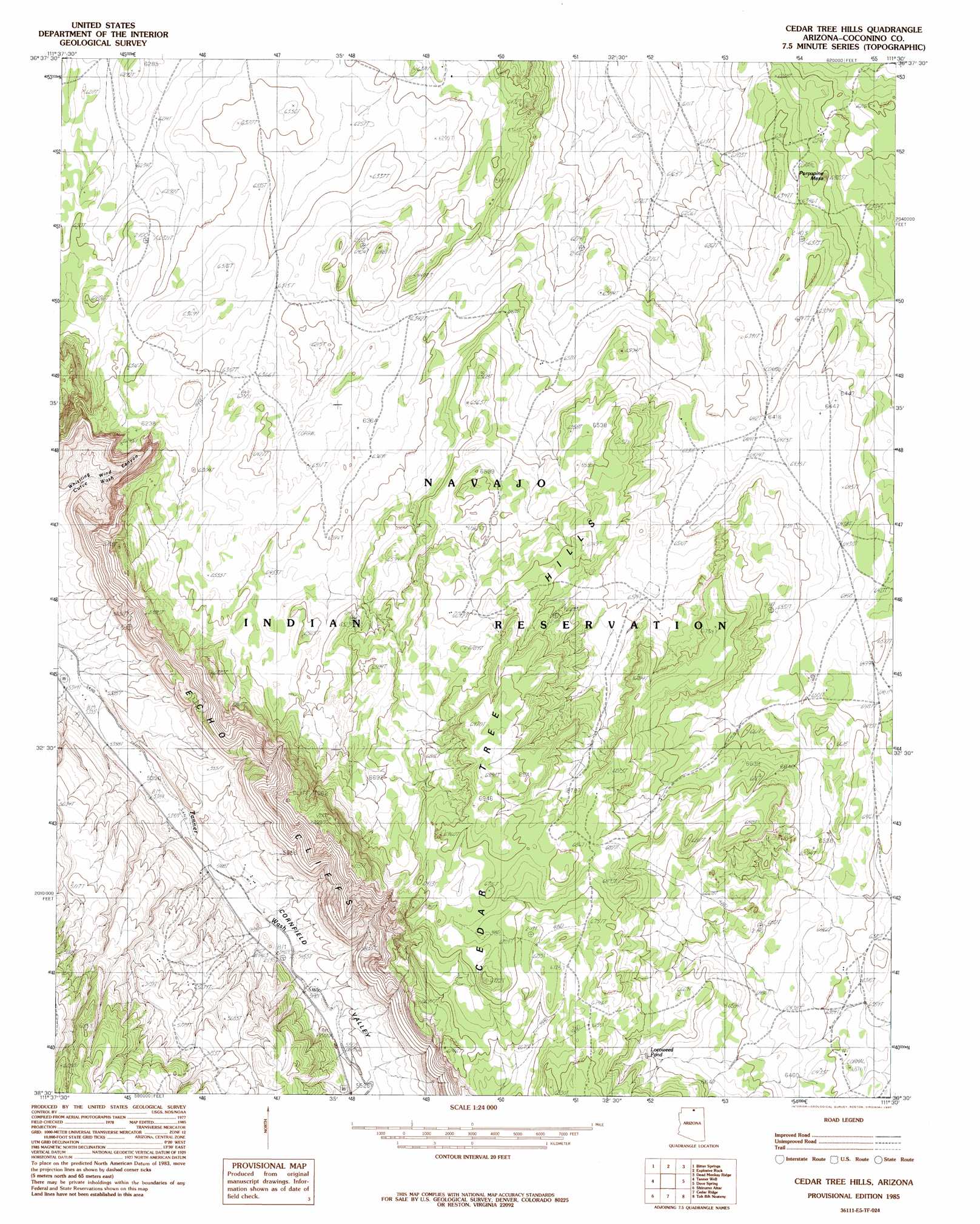
USGS Topo Quad 36111e5 - 1:24,000 scale
| Topo Map Name: | Cedar Tree Hills |
| USGS Topo Quad ID: | 36111e5 |
| Print Size: | ca. 21 1/4" wide x 27" high |
| Southeast Coordinates: | 36.5° N latitude / 111.5° W longitude |
| Map Center Coordinates: | 36.5625° N latitude / 111.5625° W longitude |
| U.S. State: | AZ |
| Filename: | o36111e5.jpg |
| Download Map JPG Image: | Cedar Tree Hills topo map 1:24,000 scale |
| Map Type: | Topographic |
| Topo Series: | 7.5´ |
| Map Scale: | 1:24,000 |
| Source of Map Images: | United States Geological Survey (USGS) |
| Alternate Map Versions: |
Cedar Tree Hills AZ 1985, updated 1985 Download PDF Buy paper map Cedar Tree Hills AZ 2011 Download PDF Buy paper map Cedar Tree Hills AZ 2014 Download PDF Buy paper map |
1:24,000 Topo Quads surrounding Cedar Tree Hills
The Big Knoll |
Navajo Bridge |
Lees Ferry |
White Dome |
Leche-E Rock |
Emmett Wash |
Bitter Springs |
Explosive Rock |
Dead Monkey Ridge |
Many Ghosts Hill |
North Canyon Point |
Tanner Well |
Cedar Tree Hills |
Dove Spring |
Dove Spring Se |
Tatahatso Point |
Shinumo Altar |
Cedar Ridge |
Toh Bih Nosteny |
Sitting Coyote Hill |
Nankoweap Mesa |
Blue Moon Reservoir |
Bodaway Mesa |
The Gap |
Preston Well |
> Back to 36111e1 at 1:100,000 scale
> Back to 36110a1 at 1:250,000 scale
> Back to U.S. Topo Maps home
Cedar Tree Hills topo map: Gazetteer
Cedar Tree Hills: Summits
Cedar Tree Hills elevation 2102m 6896′North Red Hill elevation 1660m 5446′
Cedar Tree Hills: Valleys
Cornfield Valley elevation 1628m 5341′Cedar Tree Hills digital topo map on disk
Buy this Cedar Tree Hills topo map showing relief, roads, GPS coordinates and other geographical features, as a high-resolution digital map file on DVD: