West Canyon Creek Topo Map Arizona
To zoom in, hover over the map of West Canyon Creek
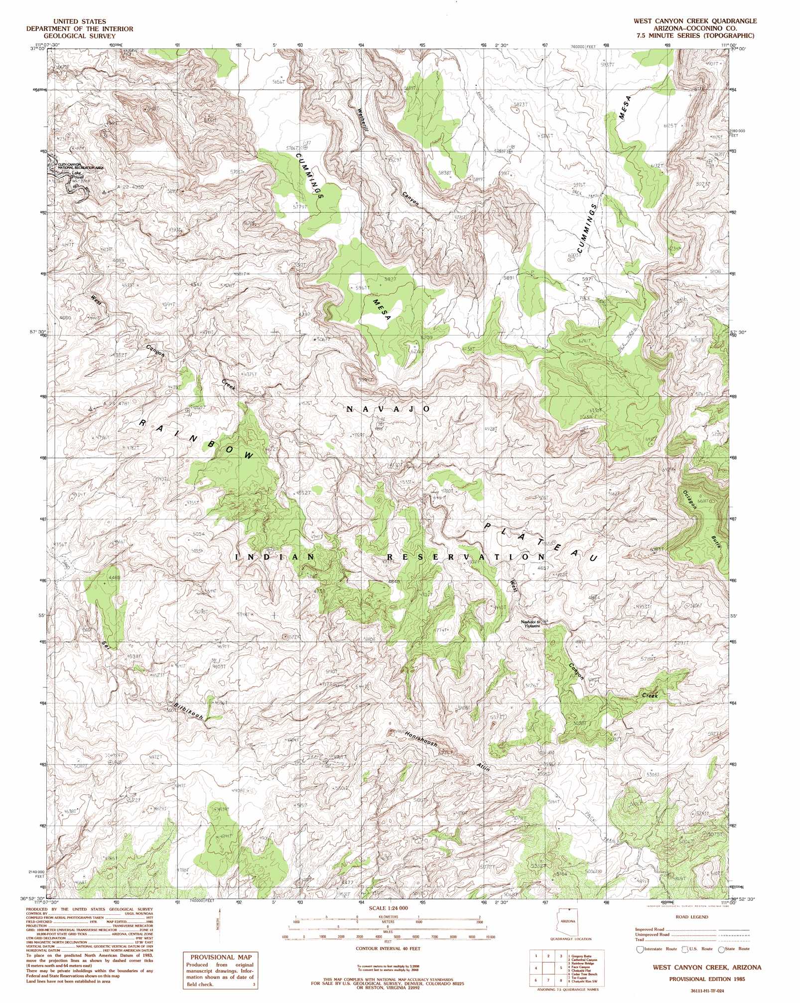
USGS Topo Quad 36111h1 - 1:24,000 scale
| Topo Map Name: | West Canyon Creek |
| USGS Topo Quad ID: | 36111h1 |
| Print Size: | ca. 21 1/4" wide x 27" high |
| Southeast Coordinates: | 36.875° N latitude / 111° W longitude |
| Map Center Coordinates: | 36.9375° N latitude / 111.0625° W longitude |
| U.S. State: | AZ |
| Filename: | o36111h1.jpg |
| Download Map JPG Image: | West Canyon Creek topo map 1:24,000 scale |
| Map Type: | Topographic |
| Topo Series: | 7.5´ |
| Map Scale: | 1:24,000 |
| Source of Map Images: | United States Geological Survey (USGS) |
| Alternate Map Versions: |
West Canyon Creek AZ 1985, updated 1985 Download PDF Buy paper map West Canyon Creek AZ 2011 Download PDF Buy paper map West Canyon Creek AZ 2011 Download PDF Buy paper map West Canyon Creek AZ 2014 Download PDF Buy paper map |
1:24,000 Topo Quads surrounding West Canyon Creek
Sit Down Bench |
Mazuki Point |
Navajo Point |
Nasja Mesa |
Wilson Creek |
Gunsight Butte |
Gregory Butte |
Cathedral Canyon |
Rainbow Bridge |
Navajo Begay |
Wild Horse Mesa |
Face Canyon |
West Canyon Creek |
Chaiyahi Flat |
Chaiyahi Rim Ne |
Leche-E Rock |
Cedar Tree Bench |
Tse Esgizii |
Chaiyahi Rim Sw |
Chaiyahi Rim Se |
Many Ghosts Hill |
Horsethief Mesa |
White Hill |
Two Red Mesas |
Inscription House Ruin |
> Back to 36111e1 at 1:100,000 scale
> Back to 36110a1 at 1:250,000 scale
> Back to U.S. Topo Maps home
West Canyon Creek topo map: Gazetteer
West Canyon Creek: Summits
Octagon Butte elevation 2036m 6679′West Canyon Creek digital topo map on disk
Buy this West Canyon Creek topo map showing relief, roads, GPS coordinates and other geographical features, as a high-resolution digital map file on DVD: