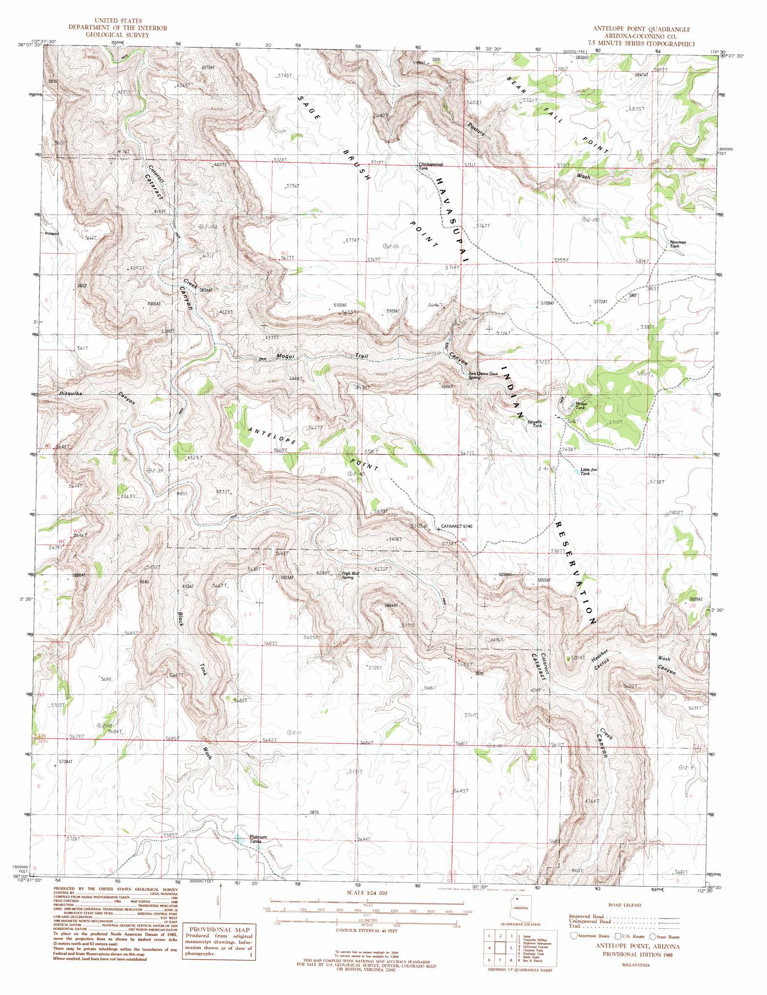
Antelope Point Topo Map Arizona
To zoom in, hover over the map of Antelope Point
USGS Topo Quad 36112a5 - 1:24,000 scale
| Topo Map Name: | Antelope Point |
| USGS Topo Quad ID: | 36112a5 |
| Print Size: | ca. 21 1/4" wide x 27" high |
| Southeast Coordinates: | 36° N latitude / 112.5° W longitude |
| Map Center Coordinates: | 36.0625° N latitude / 112.5625° W longitude |
| U.S. State: | AZ |
| Filename: | o36112a5.jpg |
| Download Map JPG Image: | Antelope Point topo map 1:24,000 scale |
| Map Type: | Topographic |
| Topo Series: | 7.5´ |
| Map Scale: | 1:24,000 |
| Source of Map Images: | United States Geological Survey (USGS) |
| Alternate Map Versions: |
Antelope Point AZ 1988, updated 1988 Download PDF Buy paper map Antelope Point AZ 2011 Download PDF Buy paper map Antelope Point AZ 2014 Download PDF Buy paper map |
1:24,000 Topo Quads surrounding Antelope Point
S B Point |
Havasu Falls |
Fossil Bay |
Powell Plateau |
King Arthur Castle |
Yunosi Point |
Supai |
Topocoba Hilltop |
Explorers Monument |
Havasupai Point |
Higgins Tank |
Driftwood Canyon |
Antelope Point |
Chamisa Tank |
Piute Point |
Supai Camp |
Hualapai Tank |
Baldy Basin |
Box K Ranch |
Metzger Tank |
Supai Camp Se |
Hazen Hole Tank |
Rosebud Tank |
Little Harpo Canyon |
Howard Hill |
> Back to 36112a1 at 1:100,000 scale
> Back to 36112a1 at 1:250,000 scale
> Back to U.S. Topo Maps home
Antelope Point topo map: Gazetteer
Antelope Point: Cliffs
Antelope Point elevation 1700m 5577′Antelope Point: Reservoirs
Chickapanagi Tank elevation 1728m 5669′Little Jim Tank elevation 1732m 5682′
Moqui Tank elevation 1709m 5606′
Newman Tank elevation 1768m 5800′
Platinum Tanks elevation 1708m 5603′
Sinyala Tank elevation 1714m 5623′
Antelope Point: Springs
High Wall Spring elevation 1285m 4215′Jwa Qwaw Gwa Spring elevation 1391m 4563′
Antelope Point: Streams
Black Tank Wash elevation 1225m 4019′Heather Wash elevation 1272m 4173′
Antelope Point: Valleys
Cactus Canyon elevation 1268m 4160′Disquiba Canyon elevation 1194m 3917′
Moqui Trail Canyon elevation 1188m 3897′
Antelope Point digital topo map on disk
Buy this Antelope Point topo map showing relief, roads, GPS coordinates and other geographical features, as a high-resolution digital map file on DVD: