Fossil Bay Topo Map Arizona
To zoom in, hover over the map of Fossil Bay
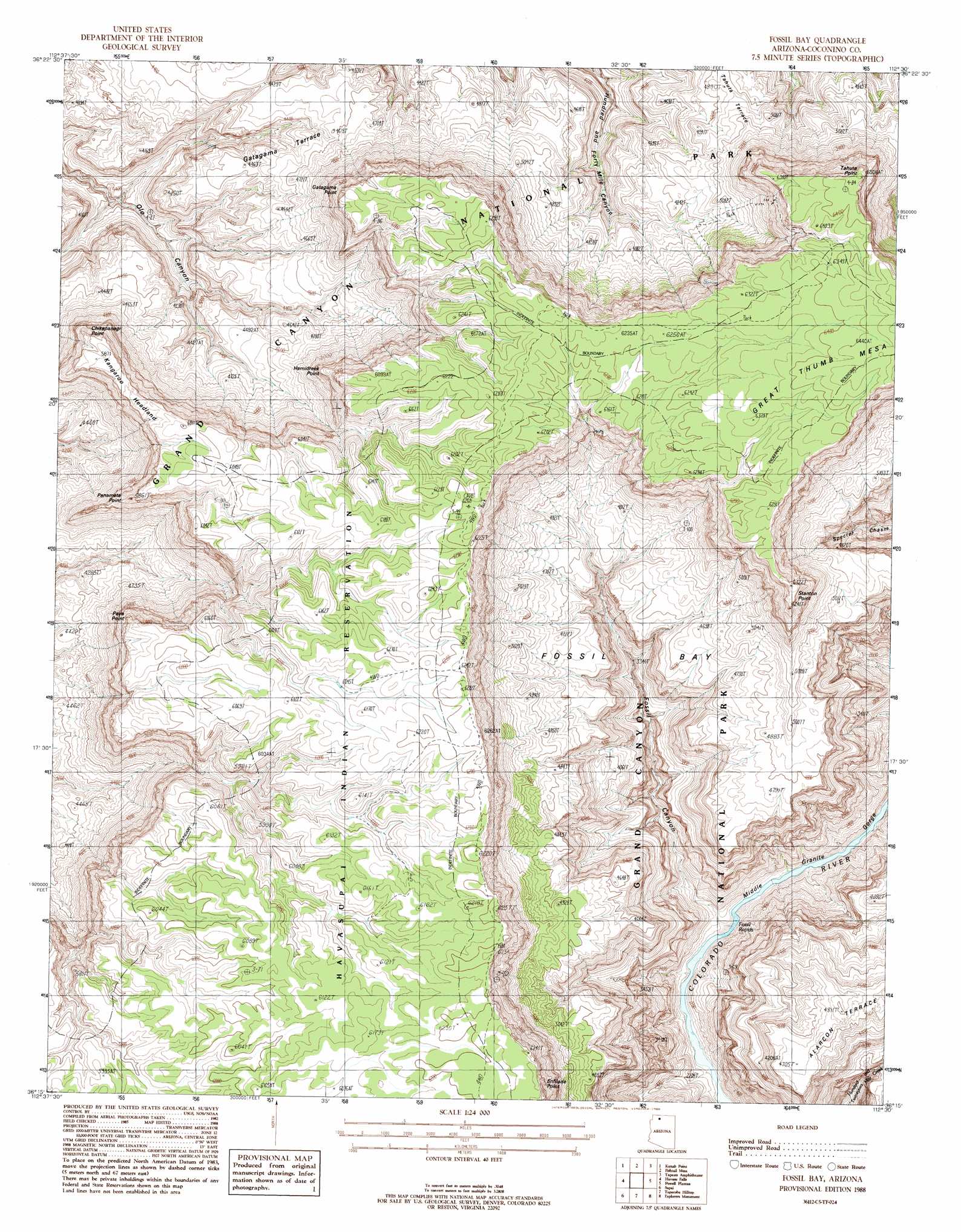
USGS Topo Quad 36112c5 - 1:24,000 scale
| Topo Map Name: | Fossil Bay |
| USGS Topo Quad ID: | 36112c5 |
| Print Size: | ca. 21 1/4" wide x 27" high |
| Southeast Coordinates: | 36.25° N latitude / 112.5° W longitude |
| Map Center Coordinates: | 36.3125° N latitude / 112.5625° W longitude |
| U.S. State: | AZ |
| Filename: | o36112c5.jpg |
| Download Map JPG Image: | Fossil Bay topo map 1:24,000 scale |
| Map Type: | Topographic |
| Topo Series: | 7.5´ |
| Map Scale: | 1:24,000 |
| Source of Map Images: | United States Geological Survey (USGS) |
| Alternate Map Versions: |
Fossil Bay AZ 1988, updated 1988 Download PDF Buy paper map Fossil Bay AZ 2011 Download PDF Buy paper map Fossil Bay AZ 2014 Download PDF Buy paper map |
1:24,000 Topo Quads surrounding Fossil Bay
Robinson Canyon |
Grama Spring |
Jumpup Point |
Sowats Spring |
Big Springs |
Hitson Tank |
Kanab Point |
Fishtail Mesa |
Tapeats Amphitheater |
Timp Point |
S B Point |
Havasu Falls |
Fossil Bay |
Powell Plateau |
King Arthur Castle |
Yunosi Point |
Supai |
Topocoba Hilltop |
Explorers Monument |
Havasupai Point |
Higgins Tank |
Driftwood Canyon |
Antelope Point |
Chamisa Tank |
Piute Point |
> Back to 36112a1 at 1:100,000 scale
> Back to 36112a1 at 1:250,000 scale
> Back to U.S. Topo Maps home
Fossil Bay topo map: Gazetteer
Fossil Bay: Basins
Fossil Bay elevation 906m 2972′Fossil Bay: Benches
Gatagama Terrace elevation 1366m 4481′Fossil Bay: Cliffs
Bear Headland elevation 1805m 5921′Chikapanagi Point elevation 1680m 5511′
Enfilade Point elevation 1814m 5951′
Gatagama Point elevation 1858m 6095′
Hamidreek Point elevation 1759m 5770′
Kangaroo Headland elevation 1814m 5951′
Panameta Point elevation 1657m 5436′
Paya Point elevation 1819m 5967′
Stanton Point elevation 1902m 6240′
Tahuta Point elevation 1979m 6492′
Fossil Bay: Parks
Grand Canyon Natural Game Preserve elevation 1943m 6374′Fossil Bay: Rapids
Fossil Rapids elevation 648m 2125′Fossil Bay: Summits
Great Thumb Mesa elevation 1948m 6391′Fossil Bay: Valleys
Fossil Canyon elevation 650m 2132′Fossil Bay digital topo map on disk
Buy this Fossil Bay topo map showing relief, roads, GPS coordinates and other geographical features, as a high-resolution digital map file on DVD: