Toothpick Ridge Topo Map Arizona
To zoom in, hover over the map of Toothpick Ridge
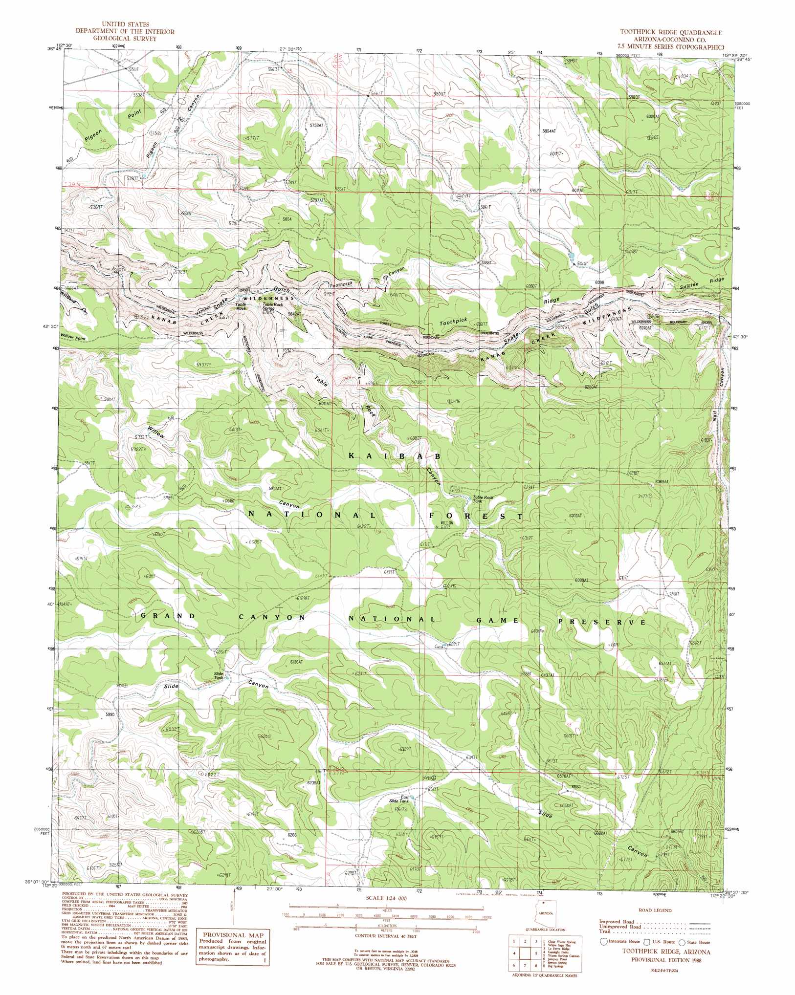
USGS Topo Quad 36112f4 - 1:24,000 scale
| Topo Map Name: | Toothpick Ridge |
| USGS Topo Quad ID: | 36112f4 |
| Print Size: | ca. 21 1/4" wide x 27" high |
| Southeast Coordinates: | 36.625° N latitude / 112.375° W longitude |
| Map Center Coordinates: | 36.6875° N latitude / 112.4375° W longitude |
| U.S. State: | AZ |
| Filename: | o36112f4.jpg |
| Download Map JPG Image: | Toothpick Ridge topo map 1:24,000 scale |
| Map Type: | Topographic |
| Topo Series: | 7.5´ |
| Map Scale: | 1:24,000 |
| Source of Map Images: | United States Geological Survey (USGS) |
| Alternate Map Versions: |
Toothpick Ridge AZ 1988, updated 1988 Download PDF Buy paper map Toothpick Ridge AZ 2012 Download PDF Buy paper map Toothpick Ridge AZ 2014 Download PDF Buy paper map |
| FStopo: | US Forest Service topo Toothpick Ridge is available: Download FStopo PDF Download FStopo TIF |
1:24,000 Topo Quads surrounding Toothpick Ridge
Kaibab |
Fredonia |
Shinarump Point |
Muggins Flat |
Buck Pasture Canyon |
Pipe Spring |
Clear Water Spring |
White Sage Flat |
Le Fevre Ridge |
Cooper Ridge |
Findlay Tank |
Gunsight Point |
Toothpick Ridge |
Warm Springs Canyon |
Jacob Lake |
Grama Spring |
Jumpup Point |
Sowats Spring |
Big Springs |
Telephone Hill |
Kanab Point |
Fishtail Mesa |
Tapeats Amphitheater |
Timp Point |
De Motte Park |
> Back to 36112e1 at 1:100,000 scale
> Back to 36112a1 at 1:250,000 scale
> Back to U.S. Topo Maps home
Toothpick Ridge topo map: Gazetteer
Toothpick Ridge: Pillars
Table Rock elevation 1676m 5498′Toothpick Ridge: Reservoirs
East Side Apron elevation 2110m 6922′East Side Tank elevation 1917m 6289′
East Slide Tank elevation 1920m 6299′
Pigeon Tank elevation 1644m 5393′
Slide Tank elevation 1825m 5987′
Table Rock Tank elevation 1851m 6072′
Toothpick Ridge: Ridges
Toothpick Ridge elevation 1855m 6085′Toothpick Ridge: Springs
Table Rock Spring elevation 1616m 5301′Toothpick Ridge: Valleys
Naile Canyon elevation 1767m 5797′Table Rock Canyon elevation 1591m 5219′
Toothpick Canyon elevation 1615m 5298′
Warm Springs Canyon elevation 1782m 5846′
Toothpick Ridge digital topo map on disk
Buy this Toothpick Ridge topo map showing relief, roads, GPS coordinates and other geographical features, as a high-resolution digital map file on DVD: