Cooper Ridge Topo Map Arizona
To zoom in, hover over the map of Cooper Ridge
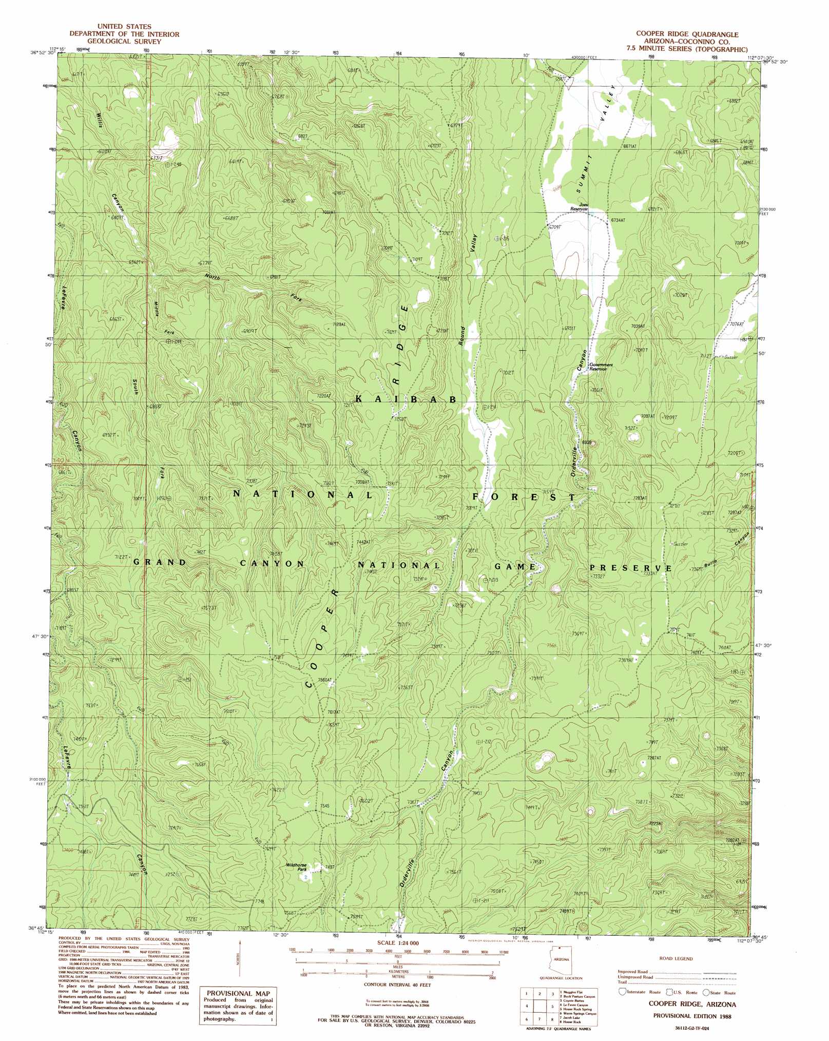
USGS Topo Quad 36112g2 - 1:24,000 scale
| Topo Map Name: | Cooper Ridge |
| USGS Topo Quad ID: | 36112g2 |
| Print Size: | ca. 21 1/4" wide x 27" high |
| Southeast Coordinates: | 36.75° N latitude / 112.125° W longitude |
| Map Center Coordinates: | 36.8125° N latitude / 112.1875° W longitude |
| U.S. State: | AZ |
| Filename: | o36112g2.jpg |
| Download Map JPG Image: | Cooper Ridge topo map 1:24,000 scale |
| Map Type: | Topographic |
| Topo Series: | 7.5´ |
| Map Scale: | 1:24,000 |
| Source of Map Images: | United States Geological Survey (USGS) |
| Alternate Map Versions: |
House Rock Spring SW AZ 1957, updated 1958 Download PDF Buy paper map Cooper Ridge AZ 1988, updated 1998 Download PDF Buy paper map Cooper Ridge AZ 2012 Download PDF Buy paper map Cooper Ridge AZ 2014 Download PDF Buy paper map |
| FStopo: | US Forest Service topo Cooper Ridge is available: Download FStopo PDF Download FStopo TIF |
1:24,000 Topo Quads surrounding Cooper Ridge
Thompson Point |
Johnson Lakes |
Petrified Hollow |
Pine Hollow Canyon |
West Clark Bench |
Shinarump Point |
Muggins Flat |
Buck Pasture Canyon |
Coyote Buttes |
Poverty Flat |
White Sage Flat |
Le Fevre Ridge |
Cooper Ridge |
House Rock Spring |
One Toe Ridge |
Toothpick Ridge |
Warm Springs Canyon |
Jacob Lake |
House Rock |
Emmett Hill |
Sowats Spring |
Big Springs |
Telephone Hill |
Cane |
Buffalo Tanks |
> Back to 36112e1 at 1:100,000 scale
> Back to 36112a1 at 1:250,000 scale
> Back to U.S. Topo Maps home
Cooper Ridge topo map: Gazetteer
Cooper Ridge: Flats
Wildhorse Park elevation 2289m 7509′Cooper Ridge: Lakes
Government Reservoir elevation 2095m 6873′Cooper Ridge: Reservoirs
Basin Tank elevation 2198m 7211′Burro Apron elevation 2168m 7112′
Burro Apron elevation 2168m 7112′
Cooper Ridge Tank elevation 2247m 7372′
Cooper Trick Tank elevation 2163m 7096′
Joes Reservoir elevation 2047m 6715′
Le Fevre Tank elevation 2230m 7316′
Lobo Tank elevation 2286m 7500′
Orderville Tank elevation 2229m 7312′
Orderville Trick Tank elevation 2235m 7332′
Ponderosa Trick Tank elevation 2221m 7286′
Round Valley Tank elevation 2083m 6833′
Stipa Tank elevation 2183m 7162′
Summit Tank elevation 2198m 7211′
Summit Trick Tank elevation 2014m 6607′
Wet Weather Seep elevation 2241m 7352′
Cooper Ridge: Ridges
Cooper Ridge elevation 2267m 7437′Cooper Ridge: Valleys
Middle Fork Willis Canyon elevation 1965m 6446′North Fork Willis Canyon elevation 1965m 6446′
South Fork Willis Canyon elevation 1961m 6433′
Cooper Ridge digital topo map on disk
Buy this Cooper Ridge topo map showing relief, roads, GPS coordinates and other geographical features, as a high-resolution digital map file on DVD: