Whitmore Point Sw Topo Map Arizona
To zoom in, hover over the map of Whitmore Point Sw
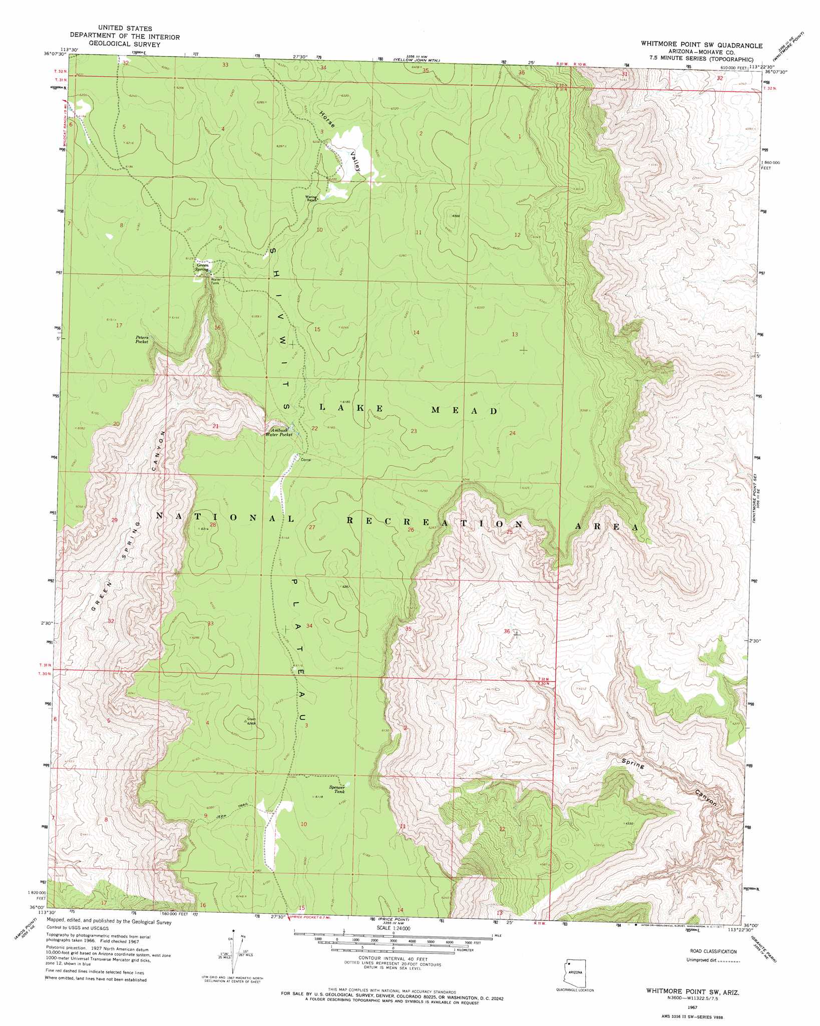
USGS Topo Quad 36113a4 - 1:24,000 scale
| Topo Map Name: | Whitmore Point Sw |
| USGS Topo Quad ID: | 36113a4 |
| Print Size: | ca. 21 1/4" wide x 27" high |
| Southeast Coordinates: | 36° N latitude / 113.375° W longitude |
| Map Center Coordinates: | 36.0625° N latitude / 113.4375° W longitude |
| U.S. State: | AZ |
| Filename: | o36113a4.jpg |
| Download Map JPG Image: | Whitmore Point Sw topo map 1:24,000 scale |
| Map Type: | Topographic |
| Topo Series: | 7.5´ |
| Map Scale: | 1:24,000 |
| Source of Map Images: | United States Geological Survey (USGS) |
| Alternate Map Versions: |
Whitmore Point SW AZ 1967, updated 1971 Download PDF Buy paper map Whitmore Point SW AZ 2011 Download PDF Buy paper map Whitmore Point SW AZ 2014 Download PDF Buy paper map |
1:24,000 Topo Quads surrounding Whitmore Point Sw
Mustang Point |
Wildcat Ranch |
Grassy Mountain |
Cold Spring |
Mount Logan |
Snap Draw |
Castle Peak |
Yellow John Mountain |
Whitmore Point |
Whitmore Rapids |
Tincanebitts Point |
Mount Dellenbaugh |
Whitmore Point Sw |
Whitmore Point Se |
Vulcans Throne Sw |
Devils Slide Rapids |
Amos Point |
Price Point |
Granite Park |
Hockey Puck Spring |
Spencer Canyon |
Separation Canyon |
Travertine Rapids |
Diamond Peak |
Frazier Wells Sw |
> Back to 36113a1 at 1:100,000 scale
> Back to 36112a1 at 1:250,000 scale
> Back to U.S. Topo Maps home
Whitmore Point Sw topo map: Gazetteer
Whitmore Point Sw: Lakes
Peters Pocket elevation 1854m 6082′Whitmore Point Sw: Reservoirs
Ambush Water Pocket elevation 1840m 6036′Pen Pocket elevation 1852m 6076′
Spencer Tank elevation 1862m 6108′
Whitmore Point Sw: Springs
Green Spring elevation 1845m 6053′Whitmore Point Sw: Valleys
Pine Valley elevation 1886m 6187′Whitmore Point Sw digital topo map on disk
Buy this Whitmore Point Sw topo map showing relief, roads, GPS coordinates and other geographical features, as a high-resolution digital map file on DVD: