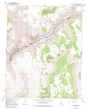
Vulcans Throne Topo Map Arizona
To zoom in, hover over the map of Vulcans Throne
USGS Topo Quad 36113b1 - 1:24,000 scale
| Topo Map Name: | Vulcans Throne |
| USGS Topo Quad ID: | 36113b1 |
| Print Size: | ca. 21 1/4" wide x 27" high |
| Southeast Coordinates: | 36.125° N latitude / 113° W longitude |
| Map Center Coordinates: | 36.1875° N latitude / 113.0625° W longitude |
| U.S. State: | AZ |
| Filename: | o36113b1.jpg |
| Download Map JPG Image: | Vulcans Throne topo map 1:24,000 scale |
| Map Type: | Topographic |
| Topo Series: | 7.5´ |
| Map Scale: | 1:24,000 |
| Source of Map Images: | United States Geological Survey (USGS) |
| Alternate Map Versions: |
Vulcans Throne AZ 1967, updated 1970 Download PDF Buy paper map Vulcans Throne AZ 1967, updated 1982 Download PDF Buy paper map Vulcans Throne AZ 1967, updated 1992 Download PDF Buy paper map Vulcans Throne AZ 2011 Download PDF Buy paper map Vulcans Throne AZ 2014 Download PDF Buy paper map |
1:24,000 Topo Quads surrounding Vulcans Throne
> Back to 36113a1 at 1:100,000 scale
> Back to 36112a1 at 1:250,000 scale
> Back to U.S. Topo Maps home
Vulcans Throne topo map: Gazetteer
Vulcans Throne: Airports
Lava Falls Airport elevation 1081m 3546′Lava Falls Heliport elevation 882m 2893′
Vulcans Throne: Benches
Esplanade Bench elevation 757m 2483′Vulcans Throne: Cliffs
Lava Falls elevation 861m 2824′Toroweap Point elevation 1888m 6194′
Vulcans Throne: Flats
Toroweap Lake elevation 1374m 4507′Vulcans Throne: Pillars
Lava Pinnacle elevation 518m 1699′Vulcans Throne: Rapids
Lava Falls Rapids elevation 507m 1663′Vulcans Throne: Reservoirs
Cougar Tank elevation 1961m 6433′Elk Tank elevation 1962m 6437′
Mustang Tank elevation 1952m 6404′
Vulcans Throne: Springs
Cement Tank Spring elevation 1448m 4750′Hogan Spring elevation 1230m 4035′
Honga Springs elevation 1210m 3969′
Saddle Horse Spring elevation 0m 0′
Warm Springs elevation 515m 1689′
Vulcans Throne: Summits
McKee Point elevation 1917m 6289′Vulcans Throne elevation 1554m 5098′
Vulcans Throne: Valleys
Cove Canyon elevation 531m 1742′Hells Hollow elevation 525m 1722′
Prospect Canyon elevation 514m 1686′
Prospect Valley elevation 1170m 3838′
Saddle Horse Canyon elevation 0m 0′
Toroweap Valley elevation 1229m 4032′
Vulcans Throne digital topo map on disk
Buy this Vulcans Throne topo map showing relief, roads, GPS coordinates and other geographical features, as a high-resolution digital map file on DVD:


