Whitmore Rapids Topo Map Arizona
To zoom in, hover over the map of Whitmore Rapids
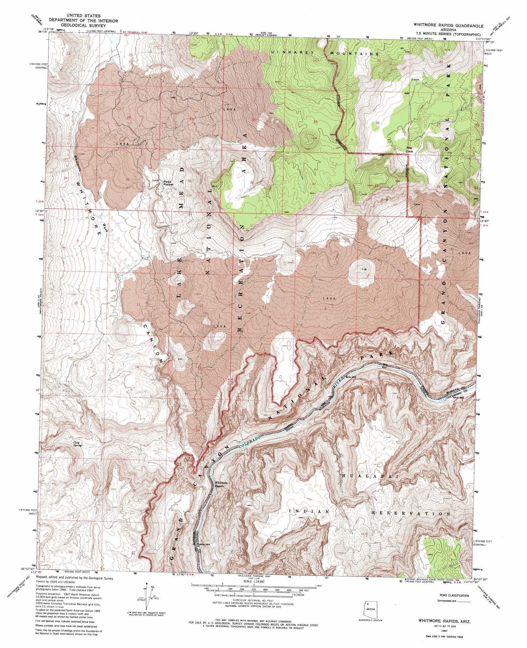
USGS Topo Quad 36113b2 - 1:24,000 scale
| Topo Map Name: | Whitmore Rapids |
| USGS Topo Quad ID: | 36113b2 |
| Print Size: | ca. 21 1/4" wide x 27" high |
| Southeast Coordinates: | 36.125° N latitude / 113.125° W longitude |
| Map Center Coordinates: | 36.1875° N latitude / 113.1875° W longitude |
| U.S. State: | AZ |
| Filename: | o36113b2.jpg |
| Download Map JPG Image: | Whitmore Rapids topo map 1:24,000 scale |
| Map Type: | Topographic |
| Topo Series: | 7.5´ |
| Map Scale: | 1:24,000 |
| Source of Map Images: | United States Geological Survey (USGS) |
| Alternate Map Versions: |
Whitmore Rapids AZ 1967, updated 1970 Download PDF Buy paper map Whitmore Rapids AZ 1967, updated 1986 Download PDF Buy paper map Whitmore Rapids AZ 2011 Download PDF Buy paper map Whitmore Rapids AZ 2014 Download PDF Buy paper map |
1:24,000 Topo Quads surrounding Whitmore Rapids
Poverty Knoll |
Jones Hill |
Mount Trumbull |
Mount Trumbull Ne |
Hancock Knolls |
Grassy Mountain |
Cold Spring |
Mount Logan |
Mount Trumbull Se |
Fern Glen Canyon |
Yellow John Mountain |
Whitmore Point |
Whitmore Rapids |
Vulcans Throne |
Gateway Rapids |
Whitmore Point Sw |
Whitmore Point Se |
Vulcans Throne Sw |
Vulcans Throne Se |
National Canyon Sw |
Price Point |
Granite Park |
Hockey Puck Spring |
Prospect Point |
National Tank |
> Back to 36113a1 at 1:100,000 scale
> Back to 36112a1 at 1:250,000 scale
> Back to U.S. Topo Maps home
Whitmore Rapids topo map: Gazetteer
Whitmore Rapids: Basins
Paws Pocket elevation 1234m 4048′Whitmore Rapids: Falls
Whitmore Rapids elevation 489m 1604′Whitmore Rapids: Reservoirs
Sage Flat Reservoir elevation 1526m 5006′Whitmore Rapids: Springs
Cane Spring elevation 894m 2933′Whitmore Rapids: Streams
Whitmore Wash elevation 489m 1604′Whitmore Rapids: Valleys
The Cove elevation 1606m 5269′Whitmore Canyon elevation 489m 1604′
Whitmore Rapids digital topo map on disk
Buy this Whitmore Rapids topo map showing relief, roads, GPS coordinates and other geographical features, as a high-resolution digital map file on DVD: