Snap Canyon East Topo Map Arizona
To zoom in, hover over the map of Snap Canyon East
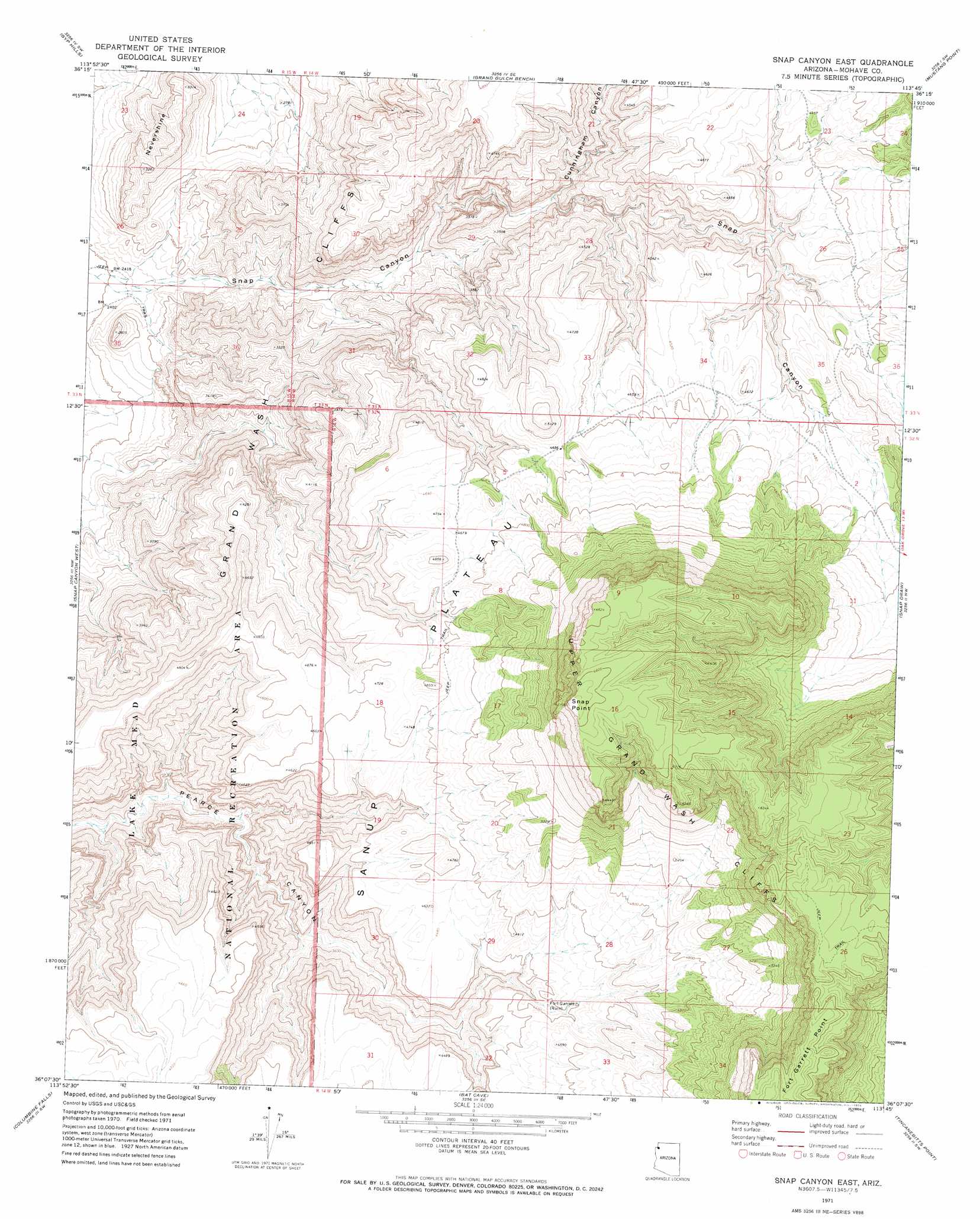
USGS Topo Quad 36113b7 - 1:24,000 scale
| Topo Map Name: | Snap Canyon East |
| USGS Topo Quad ID: | 36113b7 |
| Print Size: | ca. 21 1/4" wide x 27" high |
| Southeast Coordinates: | 36.125° N latitude / 113.75° W longitude |
| Map Center Coordinates: | 36.1875° N latitude / 113.8125° W longitude |
| U.S. State: | AZ |
| Filename: | o36113b7.jpg |
| Download Map JPG Image: | Snap Canyon East topo map 1:24,000 scale |
| Map Type: | Topographic |
| Topo Series: | 7.5´ |
| Map Scale: | 1:24,000 |
| Source of Map Images: | United States Geological Survey (USGS) |
| Alternate Map Versions: |
Snap Canyon East AZ 1971, updated 1974 Download PDF Buy paper map Snap Canyon East AZ 2011 Download PDF Buy paper map Snap Canyon East AZ 2014 Download PDF Buy paper map |
1:24,000 Topo Quads surrounding Snap Canyon East
Saint Thomas Gap |
Pakoon Springs |
Olaf Knolls |
Last Chance Canyon |
Poverty Spring |
Azure Ridge |
Gyp Hills |
Grand Gulch Bench |
Mustang Point |
Wildcat Ranch |
Iceberg Canyon |
Snap Canyon West |
Snap Canyon East |
Snap Draw |
Castle Peak |
Meadview North |
Columbine Falls |
Bat Cave |
Tincanebitts Point |
Mount Dellenbaugh |
Meadview South |
Grapevine Canyon |
Quartermaster Canyon |
Devils Slide Rapids |
Amos Point |
> Back to 36113a1 at 1:100,000 scale
> Back to 36112a1 at 1:250,000 scale
> Back to U.S. Topo Maps home
Snap Canyon East topo map: Gazetteer
Snap Canyon East: Cliffs
Snap Point elevation 2043m 6702′Snap Canyon East: Reservoirs
Water Pockets Tank elevation 969m 3179′Snap Canyon East: Summits
Nevershine elevation 916m 3005′Snap Canyon East: Valleys
Cunningham Canyon elevation 1030m 3379′Snap Canyon East digital topo map on disk
Buy this Snap Canyon East topo map showing relief, roads, GPS coordinates and other geographical features, as a high-resolution digital map file on DVD: