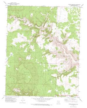
Grassy Mountain Topo Map Arizona
To zoom in, hover over the map of Grassy Mountain
USGS Topo Quad 36113c4 - 1:24,000 scale
| Topo Map Name: | Grassy Mountain |
| USGS Topo Quad ID: | 36113c4 |
| Print Size: | ca. 21 1/4" wide x 27" high |
| Southeast Coordinates: | 36.25° N latitude / 113.375° W longitude |
| Map Center Coordinates: | 36.3125° N latitude / 113.4375° W longitude |
| U.S. State: | AZ |
| Filename: | o36113c4.jpg |
| Download Map JPG Image: | Grassy Mountain topo map 1:24,000 scale |
| Map Type: | Topographic |
| Topo Series: | 7.5´ |
| Map Scale: | 1:24,000 |
| Source of Map Images: | United States Geological Survey (USGS) |
| Alternate Map Versions: |
Grassy Mountain AZ 1971, updated 1973 Download PDF Buy paper map Grassy Mountain AZ 2011 Download PDF Buy paper map Grassy Mountain AZ 2014 Download PDF Buy paper map |
1:24,000 Topo Quads surrounding Grassy Mountain
> Back to 36113a1 at 1:100,000 scale
> Back to 36112a1 at 1:250,000 scale
> Back to U.S. Topo Maps home
Grassy Mountain topo map: Gazetteer
Grassy Mountain: Lakes
Agway Pond elevation 1679m 5508′Cedar Pond elevation 1683m 5521′
Pine Pond elevation 1672m 5485′
Pymn Canyon Pond elevation 1690m 5544′
Grassy Mountain: Reservoirs
Cedar Pocket Reservoir elevation 1696m 5564′Grassy Mountain: Springs
Grassy Spring elevation 1763m 5784′Schultz Spring elevation 0m 0′
Grassy Mountain: Streams
Ivanpatch Wash elevation 1459m 4786′Grassy Mountain: Summits
Grassy Mountain elevation 2008m 6587′Grassy Mountain: Valleys
Agway Valley elevation 1681m 5515′Agway Wash elevation 1452m 4763′
Pymn Canyon elevation 1266m 4153′
Grassy Mountain digital topo map on disk
Buy this Grassy Mountain topo map showing relief, roads, GPS coordinates and other geographical features, as a high-resolution digital map file on DVD:


