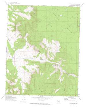
Mustang Point Topo Map Arizona
To zoom in, hover over the map of Mustang Point
USGS Topo Quad 36113c6 - 1:24,000 scale
| Topo Map Name: | Mustang Point |
| USGS Topo Quad ID: | 36113c6 |
| Print Size: | ca. 21 1/4" wide x 27" high |
| Southeast Coordinates: | 36.25° N latitude / 113.625° W longitude |
| Map Center Coordinates: | 36.3125° N latitude / 113.6875° W longitude |
| U.S. State: | AZ |
| Filename: | o36113c6.jpg |
| Download Map JPG Image: | Mustang Point topo map 1:24,000 scale |
| Map Type: | Topographic |
| Topo Series: | 7.5´ |
| Map Scale: | 1:24,000 |
| Source of Map Images: | United States Geological Survey (USGS) |
| Alternate Map Versions: |
Mustang Point AZ 1971, updated 1973 Download PDF Buy paper map Mustang Point AZ 2011 Download PDF Buy paper map Mustang Point AZ 2014 Download PDF Buy paper map |
1:24,000 Topo Quads surrounding Mustang Point
> Back to 36113a1 at 1:100,000 scale
> Back to 36112a1 at 1:250,000 scale
> Back to U.S. Topo Maps home
Mustang Point topo map: Gazetteer
Mustang Point: Cliffs
Mustang Point elevation 1809m 5935′Mustang Point: Lakes
Hidden Lake elevation 1860m 6102′Lundgren Pond elevation 1796m 5892′
Overnight Pond elevation 1797m 5895′
Mustang Point: Ranges
Hidden Hills elevation 1892m 6207′Mustang Point: Springs
Coyote Spring elevation 1555m 5101′Lower Pigeon Spring elevation 1466m 4809′
Upper Pigeon Spring elevation 1569m 5147′
Mustang Point: Valleys
Coyote Canyon elevation 1425m 4675′Gardner Canyon elevation 1573m 5160′
Mustang Point digital topo map on disk
Buy this Mustang Point topo map showing relief, roads, GPS coordinates and other geographical features, as a high-resolution digital map file on DVD:


