Poverty Spring Topo Map Arizona
To zoom in, hover over the map of Poverty Spring
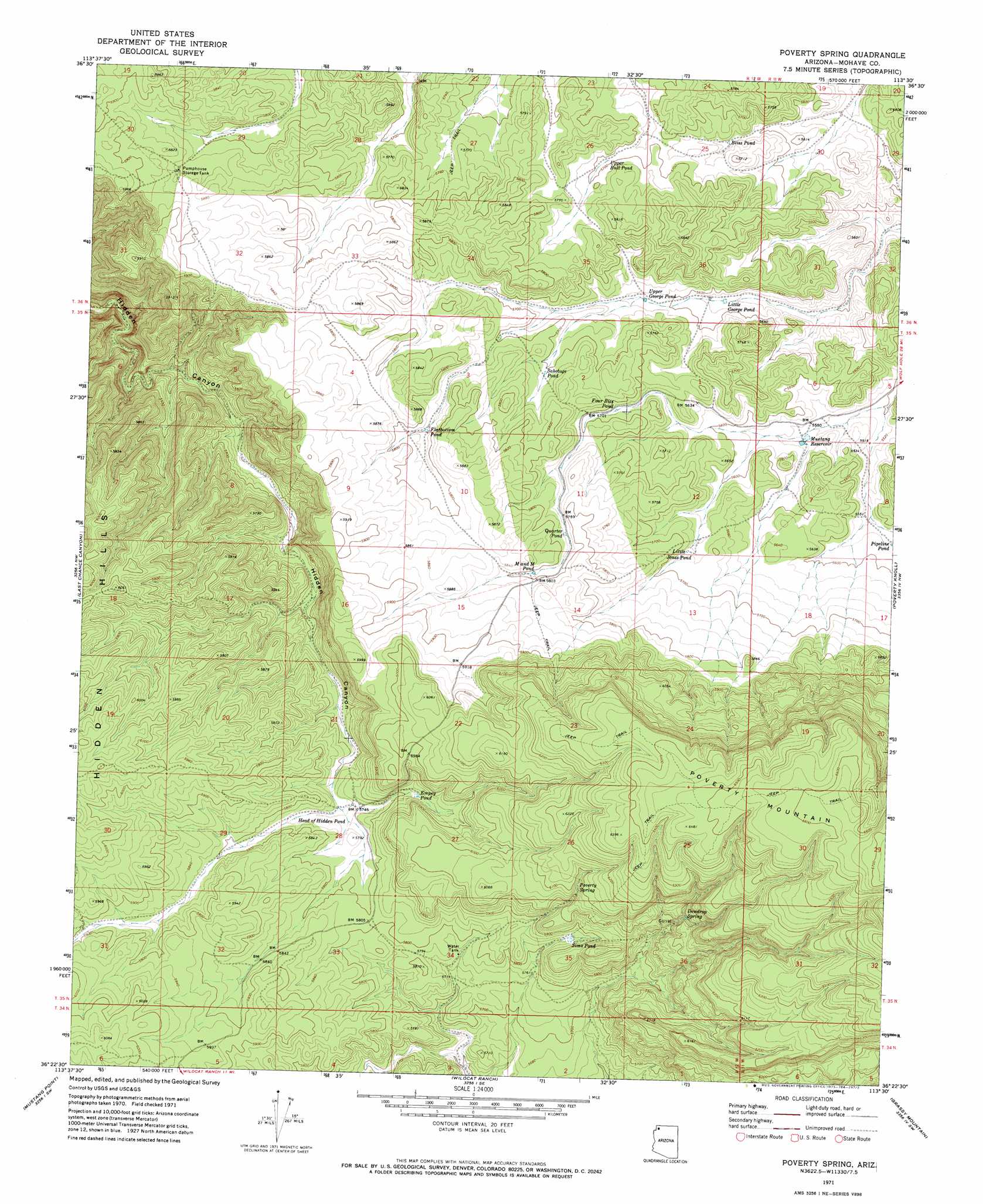
USGS Topo Quad 36113d5 - 1:24,000 scale
| Topo Map Name: | Poverty Spring |
| USGS Topo Quad ID: | 36113d5 |
| Print Size: | ca. 21 1/4" wide x 27" high |
| Southeast Coordinates: | 36.375° N latitude / 113.5° W longitude |
| Map Center Coordinates: | 36.4375° N latitude / 113.5625° W longitude |
| U.S. State: | AZ |
| Filename: | o36113d5.jpg |
| Download Map JPG Image: | Poverty Spring topo map 1:24,000 scale |
| Map Type: | Topographic |
| Topo Series: | 7.5´ |
| Map Scale: | 1:24,000 |
| Source of Map Images: | United States Geological Survey (USGS) |
| Alternate Map Versions: |
Poverty Spring AZ 1971, updated 1973 Download PDF Buy paper map Poverty Spring AZ 2011 Download PDF Buy paper map Poverty Spring AZ 2014 Download PDF Buy paper map |
1:24,000 Topo Quads surrounding Poverty Spring
Cane Springs |
Mustang Knoll |
Sullivan Draw North |
Dutchman Draw |
The Grandstand |
Cane Springs Se |
Saint George Canyon |
Sullivan Draw South |
Little Tanks |
Russell Spring |
Olaf Knolls |
Last Chance Canyon |
Poverty Spring |
Poverty Knoll |
Jones Hill |
Grand Gulch Bench |
Mustang Point |
Wildcat Ranch |
Grassy Mountain |
Cold Spring |
Snap Canyon East |
Snap Draw |
Castle Peak |
Yellow John Mountain |
Whitmore Point |
> Back to 36113a1 at 1:100,000 scale
> Back to 36112a1 at 1:250,000 scale
> Back to U.S. Topo Maps home
Poverty Spring topo map: Gazetteer
Poverty Spring: Lakes
Bliss Pond elevation 1718m 5636′Empey Pond elevation 1777m 5830′
Flatbottom Pond elevation 1760m 5774′
Four Bits Pond elevation 1731m 5679′
Head of Hidden Pond elevation 1754m 5754′
Little George Pond elevation 1698m 5570′
Little Jones Pond elevation 1730m 5675′
M and M Pond elevation 1767m 5797′
Pipeline Pond elevation 1702m 5583′
Quarter Pond elevation 1762m 5780′
Sabotage Pond elevation 0m 0′
Sims Pond elevation 1784m 5853′
Upper Bull Pond elevation 1737m 5698′
Upper George Pond elevation 1711m 5613′
Poverty Spring: Plains
Shivwits Plateau elevation 0m 0′Poverty Spring: Reservoirs
Middle Trough Tank elevation 1679m 5508′Mustang Reservoir elevation 1694m 5557′
Poverty Spring: Springs
Dewdrop Spring elevation 1817m 5961′Poverty Spring elevation 1837m 6026′
Poverty Spring digital topo map on disk
Buy this Poverty Spring topo map showing relief, roads, GPS coordinates and other geographical features, as a high-resolution digital map file on DVD: