Littlefield Topo Map Arizona
To zoom in, hover over the map of Littlefield
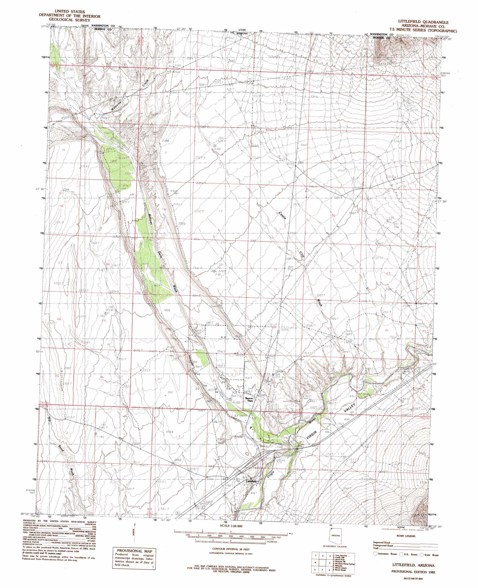
USGS Topo Quad 36113h8 - 1:24,000 scale
| Topo Map Name: | Littlefield |
| USGS Topo Quad ID: | 36113h8 |
| Print Size: | ca. 21 1/4" wide x 27" high |
| Southeast Coordinates: | 36.875° N latitude / 113.875° W longitude |
| Map Center Coordinates: | 36.9375° N latitude / 113.9375° W longitude |
| U.S. State: | AZ |
| Filename: | o36113h8.jpg |
| Download Map JPG Image: | Littlefield topo map 1:24,000 scale |
| Map Type: | Topographic |
| Topo Series: | 7.5´ |
| Map Scale: | 1:24,000 |
| Source of Map Images: | United States Geological Survey (USGS) |
| Alternate Map Versions: |
Littlefield AZ 1985, updated 1985 Download PDF Buy paper map Littlefield AZ 1985, updated 1985 Download PDF Buy paper map Littlefield AZ 2011 Download PDF Buy paper map Littlefield AZ 2011 Download PDF Buy paper map Littlefield AZ 2014 Download PDF Buy paper map |
1:24,000 Topo Quads surrounding Littlefield
Lime Mountain |
Scarecrow Peak |
West Mountain Peak |
Shivwits |
Santa Clara |
Tule Spring |
Terry Benches |
Castle Cliff |
Jarvis Peak |
White Hills |
Mesquite Nw |
Mesquite Ne |
Littlefield |
Mountain Sheep Spring |
Purgatory Canyon |
Flat Top Mesa |
Mesquite |
Elbow Canyon |
Mount Bangs |
Wolf Hole Mountain West |
Riverside |
Hen Spring |
Jacobs Well |
Cane Springs |
Mustang Knoll |
> Back to 36113e1 at 1:100,000 scale
> Back to 36112a1 at 1:250,000 scale
> Back to U.S. Topo Maps home
Littlefield topo map: Gazetteer
Littlefield: Populated Places
Littlefield elevation 565m 1853′Littlefield: Streams
Beaver Dam Wash elevation 543m 1781′Welcome Creek elevation 635m 2083′
Littlefield: Valleys
Beaver Dam Wash elevation 543m 1781′Beaver Dam Wash elevation 543m 1781′
Castle Cliff Wash elevation 610m 2001′
Figure Four Canyon elevation 561m 1840′
Littlefield: Wells
Mormon Well elevation 651m 2135′Littlefield digital topo map on disk
Buy this Littlefield topo map showing relief, roads, GPS coordinates and other geographical features, as a high-resolution digital map file on DVD: