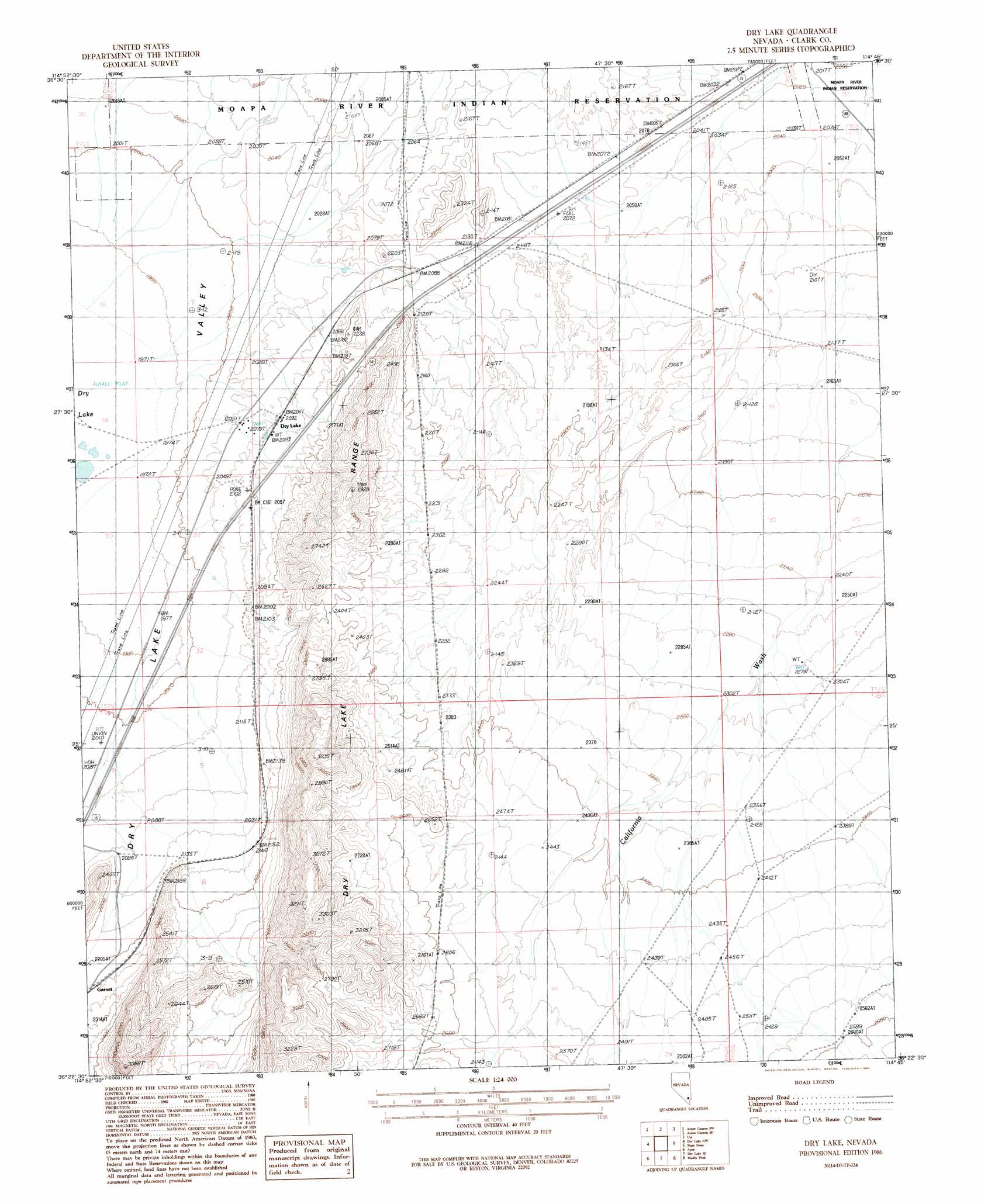
Dry Lake Topo Map Nevada
To zoom in, hover over the map of Dry Lake
USGS Topo Quad 36114d7 - 1:24,000 scale
| Topo Map Name: | Dry Lake |
| USGS Topo Quad ID: | 36114d7 |
| Print Size: | ca. 21 1/4" wide x 27" high |
| Southeast Coordinates: | 36.375° N latitude / 114.75° W longitude |
| Map Center Coordinates: | 36.4375° N latitude / 114.8125° W longitude |
| U.S. State: | NV |
| Filename: | o36114d7.jpg |
| Download Map JPG Image: | Dry Lake topo map 1:24,000 scale |
| Map Type: | Topographic |
| Topo Series: | 7.5´ |
| Map Scale: | 1:24,000 |
| Source of Map Images: | United States Geological Survey (USGS) |
| Alternate Map Versions: |
Dry Lake NV 1986, updated 1986 Download PDF Buy paper map Dry Lake NV 2012 Download PDF Buy paper map Dry Lake NV 2014 Download PDF Buy paper map |
1:24,000 Topo Quads surrounding Dry Lake
Mormon Well |
Arrow Canyon Nw |
Arrow Canyon |
Moapa West |
Moapa East |
Hayford Peak Se |
Arrow Canyon Sw |
Arrow Canyon Se |
Ute |
Weiser Ridge |
Gass Peak Ne |
Dry Lake Nw |
Dry Lake |
Piute Point |
Valley Of Fire West |
Valley |
Apex |
Dry Lake Se |
Muddy Peak |
Bitter Spring |
Las Vegas Ne |
Frenchman Mountain |
Government Wash |
Callville Bay |
Boulder Canyon |
> Back to 36114a1 at 1:100,000 scale
> Back to 36114a1 at 1:250,000 scale
> Back to U.S. Topo Maps home
Dry Lake topo map: Gazetteer
Dry Lake: Basins
Dry Lake Valley elevation 600m 1968′Dry Lake: Populated Places
Dry Lake elevation 639m 2096′Garnet elevation 679m 2227′
Dry Lake: Post Offices
Dry Lake Post Office (historical) elevation 639m 2096′Dry Lake: Ranges
Dry Lake Range elevation 938m 3077′Dry Lake digital topo map on disk
Buy this Dry Lake topo map showing relief, roads, GPS coordinates and other geographical features, as a high-resolution digital map file on DVD:
Southern Sierra Nevada, California & Southern Nevada
Buy digital topo maps: Southern Sierra Nevada, California & Southern Nevada