Ute Topo Map Nevada
To zoom in, hover over the map of Ute
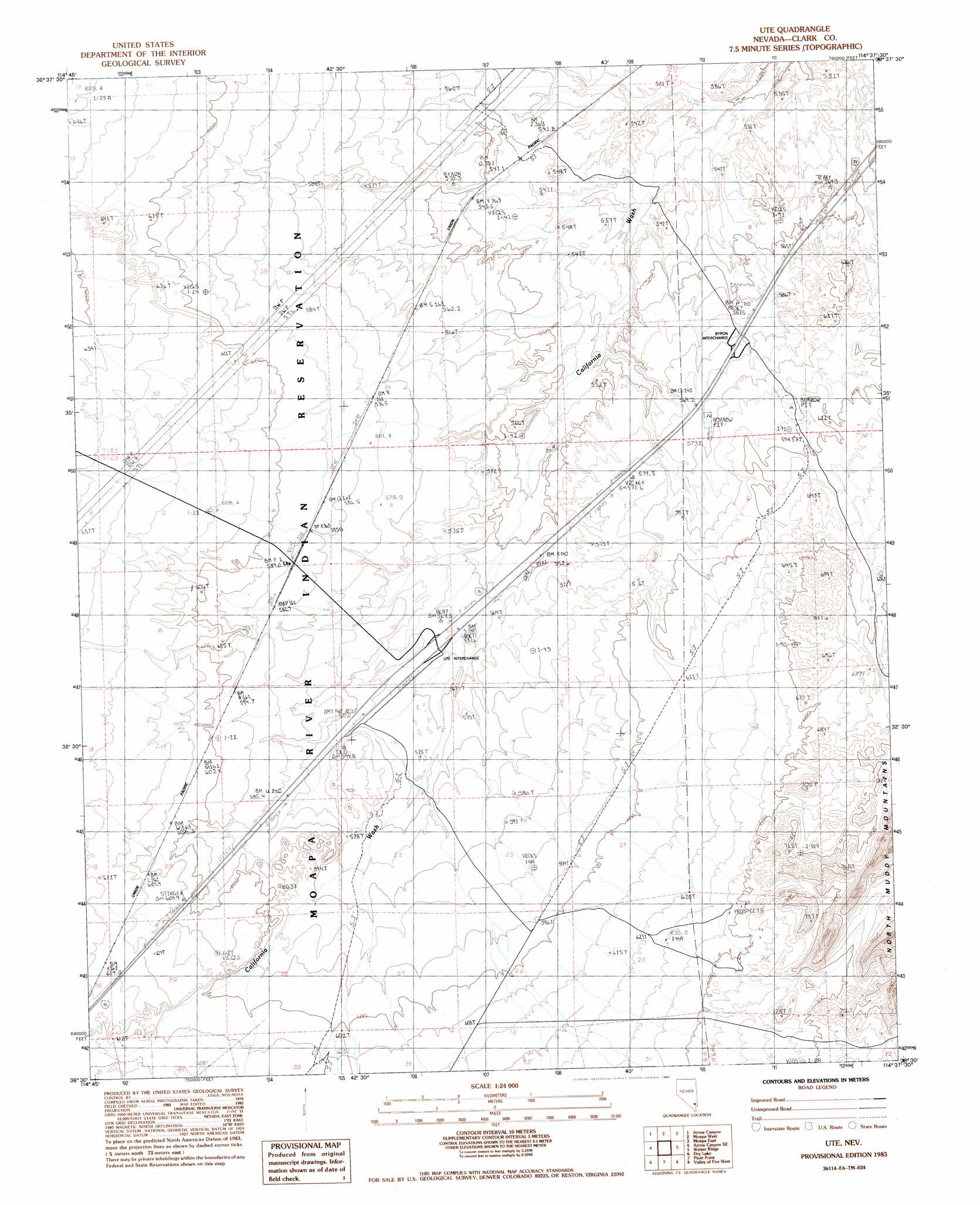
USGS Topo Quad 36114e6 - 1:24,000 scale
| Topo Map Name: | Ute |
| USGS Topo Quad ID: | 36114e6 |
| Print Size: | ca. 21 1/4" wide x 27" high |
| Southeast Coordinates: | 36.5° N latitude / 114.625° W longitude |
| Map Center Coordinates: | 36.5625° N latitude / 114.6875° W longitude |
| U.S. State: | NV |
| Filename: | o36114e6.jpg |
| Download Map JPG Image: | Ute topo map 1:24,000 scale |
| Map Type: | Topographic |
| Topo Series: | 7.5´ |
| Map Scale: | 1:24,000 |
| Source of Map Images: | United States Geological Survey (USGS) |
| Alternate Map Versions: |
Ute NV 1983, updated 1984 Download PDF Buy paper map Ute NV 2012 Download PDF Buy paper map Ute NV 2014 Download PDF Buy paper map |
1:24,000 Topo Quads surrounding Ute
Wildcat Wash Sw |
Wildcat Wash Se |
Farrier |
Rox Se |
Moapa Peak |
Arrow Canyon Nw |
Arrow Canyon |
Moapa West |
Moapa East |
Overton Nw |
Arrow Canyon Sw |
Arrow Canyon Se |
Ute |
Weiser Ridge |
Overton |
Dry Lake Nw |
Dry Lake |
Piute Point |
Valley Of Fire West |
Valley Of Fire East |
Apex |
Dry Lake Se |
Muddy Peak |
Bitter Spring |
Echo Bay |
> Back to 36114e1 at 1:100,000 scale
> Back to 36114a1 at 1:250,000 scale
> Back to U.S. Topo Maps home
Ute topo map: Gazetteer
Ute: Crossings
Byron Interchange elevation 565m 1853′Ute Interchange elevation 563m 1847′
Ute: Populated Places
Ute elevation 589m 1932′Ute: Reservoirs
California Wash Reservoir elevation 566m 1856′Ute: Springs
Crystal Springs elevation 566m 1856′Livingston Number Two Spring elevation 595m 1952′
Ute digital topo map on disk
Buy this Ute topo map showing relief, roads, GPS coordinates and other geographical features, as a high-resolution digital map file on DVD:
Southern Sierra Nevada, California & Southern Nevada
Buy digital topo maps: Southern Sierra Nevada, California & Southern Nevada