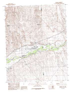
Mesquite Topo Map Nevada
To zoom in, hover over the map of Mesquite
USGS Topo Quad 36114g1 - 1:24,000 scale
| Topo Map Name: | Mesquite |
| USGS Topo Quad ID: | 36114g1 |
| Print Size: | ca. 21 1/4" wide x 27" high |
| Southeast Coordinates: | 36.75° N latitude / 114° W longitude |
| Map Center Coordinates: | 36.8125° N latitude / 114.0625° W longitude |
| U.S. States: | NV, AZ |
| Filename: | o36114g1.jpg |
| Download Map JPG Image: | Mesquite topo map 1:24,000 scale |
| Map Type: | Topographic |
| Topo Series: | 7.5´ |
| Map Scale: | 1:24,000 |
| Source of Map Images: | United States Geological Survey (USGS) |
| Alternate Map Versions: |
Mesquite NV 1985, updated 1985 Download PDF Buy paper map Mesquite NV 2012 Download PDF Buy paper map Mesquite NV 2014 Download PDF Buy paper map |
1:24,000 Topo Quads surrounding Mesquite
> Back to 36114e1 at 1:100,000 scale
> Back to 36114a1 at 1:250,000 scale
> Back to U.S. Topo Maps home
Mesquite topo map: Gazetteer
Mesquite: Airports
Bronze Boot Airport elevation 539m 1768′Mesquite Airport elevation 538m 1765′
Mesquite: Canals
Bunkerville Ditch elevation 472m 1548′Mesquite Ditch elevation 491m 1610′
Mesquite: Parks
Elementary Park elevation 489m 1604′Hafen Lane Park elevation 478m 1568′
Jensen Park elevation 482m 1581′
Library Park elevation 486m 1594′
Marilyn Redd Park elevation 523m 1715′
Mesquite Rodeo Grounds elevation 505m 1656′
Pioneer Park elevation 499m 1637′
Pulsipher Park elevation 483m 1584′
Recreation Center Park elevation 490m 1607′
Trailside Park elevation 474m 1555′
Virgin Valley Middle School and High School Park elevation 537m 1761′
Virgin Valley School Park elevation 489m 1604′
Mesquite: Populated Places
Mesquite elevation 488m 1601′Mesquite: Post Offices
Mesquite Post Office elevation 486m 1594′Mesquite: Streams
Abbott Wash elevation 471m 1545′Pulsipher Wash elevation 468m 1535′
Town Wash elevation 476m 1561′
Mesquite: Summits
Flat Top Mesa elevation 789m 2588′Mesquite digital topo map on disk
Buy this Mesquite topo map showing relief, roads, GPS coordinates and other geographical features, as a high-resolution digital map file on DVD:
Southern Sierra Nevada, California & Southern Nevada
Buy digital topo maps: Southern Sierra Nevada, California & Southern Nevada


