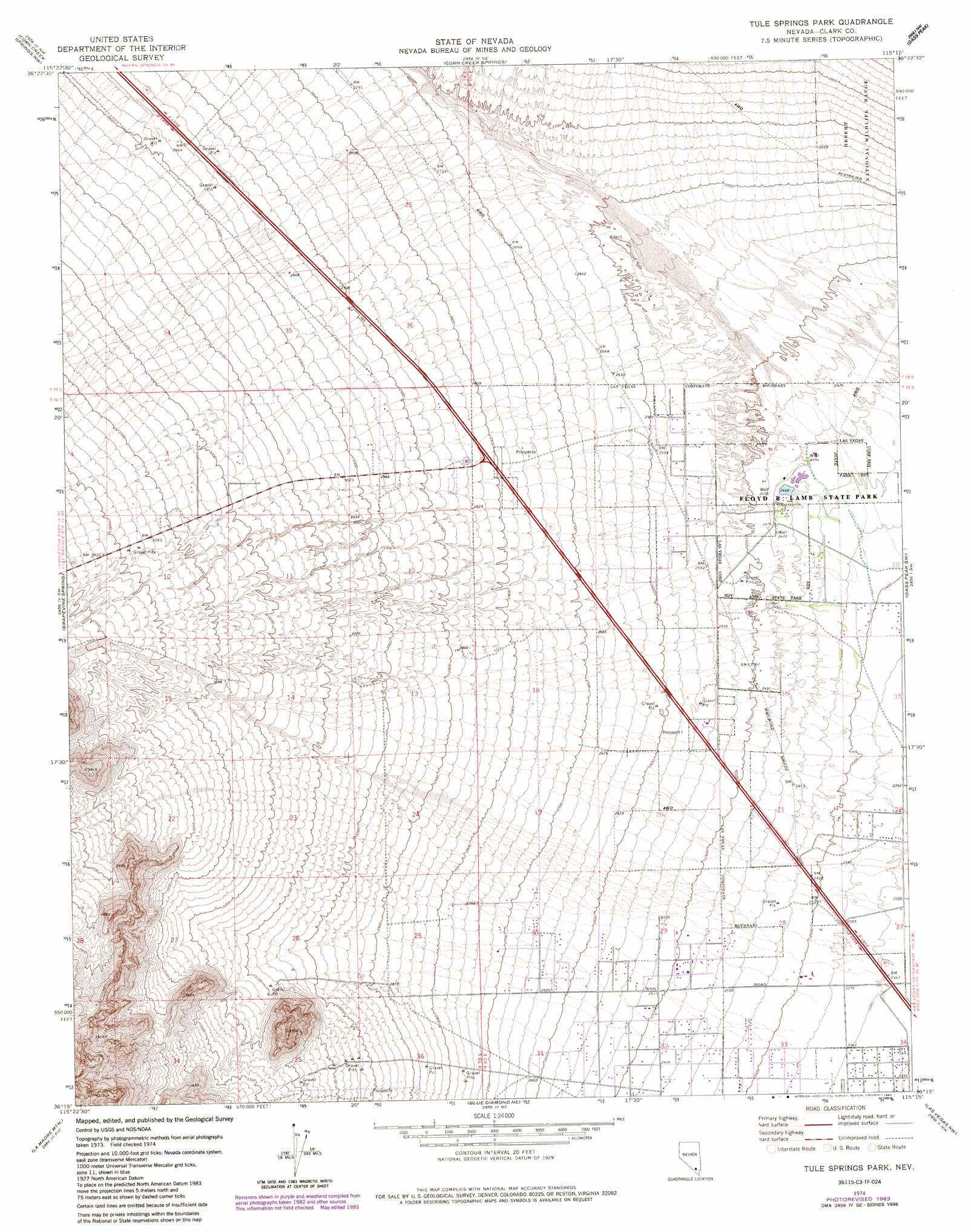
Tule Springs Park Topo Map Nevada
To zoom in, hover over the map of Tule Springs Park
USGS Topo Quad 36115c3 - 1:24,000 scale
| Topo Map Name: | Tule Springs Park |
| USGS Topo Quad ID: | 36115c3 |
| Print Size: | ca. 21 1/4" wide x 27" high |
| Southeast Coordinates: | 36.25° N latitude / 115.25° W longitude |
| Map Center Coordinates: | 36.3125° N latitude / 115.3125° W longitude |
| U.S. State: | NV |
| Filename: | o36115c3.jpg |
| Download Map JPG Image: | Tule Springs Park topo map 1:24,000 scale |
| Map Type: | Topographic |
| Topo Series: | 7.5´ |
| Map Scale: | 1:24,000 |
| Source of Map Images: | United States Geological Survey (USGS) |
| Alternate Map Versions: |
Tule Springs Park NV 1974, updated 1977 Download PDF Buy paper map Tule Springs Park NV 1974, updated 1984 Download PDF Buy paper map Tule Springs Park NV 1974, updated 1991 Download PDF Buy paper map |
1:24,000 Topo Quads surrounding Tule Springs Park
Indian Springs Se |
Black Hills Sw |
Black Hills |
Sheep Peak |
Hayford Peak Se |
Charleston Peak Ne |
Corn Creek Springs Nw |
Corn Creek Springs |
Gass Peak |
Gass Peak Ne |
Angel Peak |
Grapevine Spring |
Tule Springs Park |
Gass Peak Sw |
Valley |
La Madre Spring |
La Madre Mountain |
Blue Diamond Ne |
Las Vegas Nw |
Las Vegas Ne |
Mountain Springs |
Blue Diamond |
Blue Diamond Se |
Las Vegas Sw |
Las Vegas Se |
> Back to 36115a1 at 1:100,000 scale
> Back to 36114a1 at 1:250,000 scale
> Back to U.S. Topo Maps home
Tule Springs Park topo map: Gazetteer
Tule Springs Park: Lakes
Cottonwood Lake elevation 751m 2463′Desert Willow Lake elevation 751m 2463′
Mulberry Lake elevation 750m 2460′
Tule Springs Lake elevation 752m 2467′
Tule Springs Park: Parks
Cimarron Rose Park elevation 735m 2411′Floyd R Lamb State Park elevation 750m 2460′
Tule Springs Park: Springs
Stillwell Spring elevation 752m 2467′Tule Spring elevation 753m 2470′
Tule Springs Park digital topo map on disk
Buy this Tule Springs Park topo map showing relief, roads, GPS coordinates and other geographical features, as a high-resolution digital map file on DVD:
Southern Sierra Nevada, California & Southern Nevada
Buy digital topo maps: Southern Sierra Nevada, California & Southern Nevada