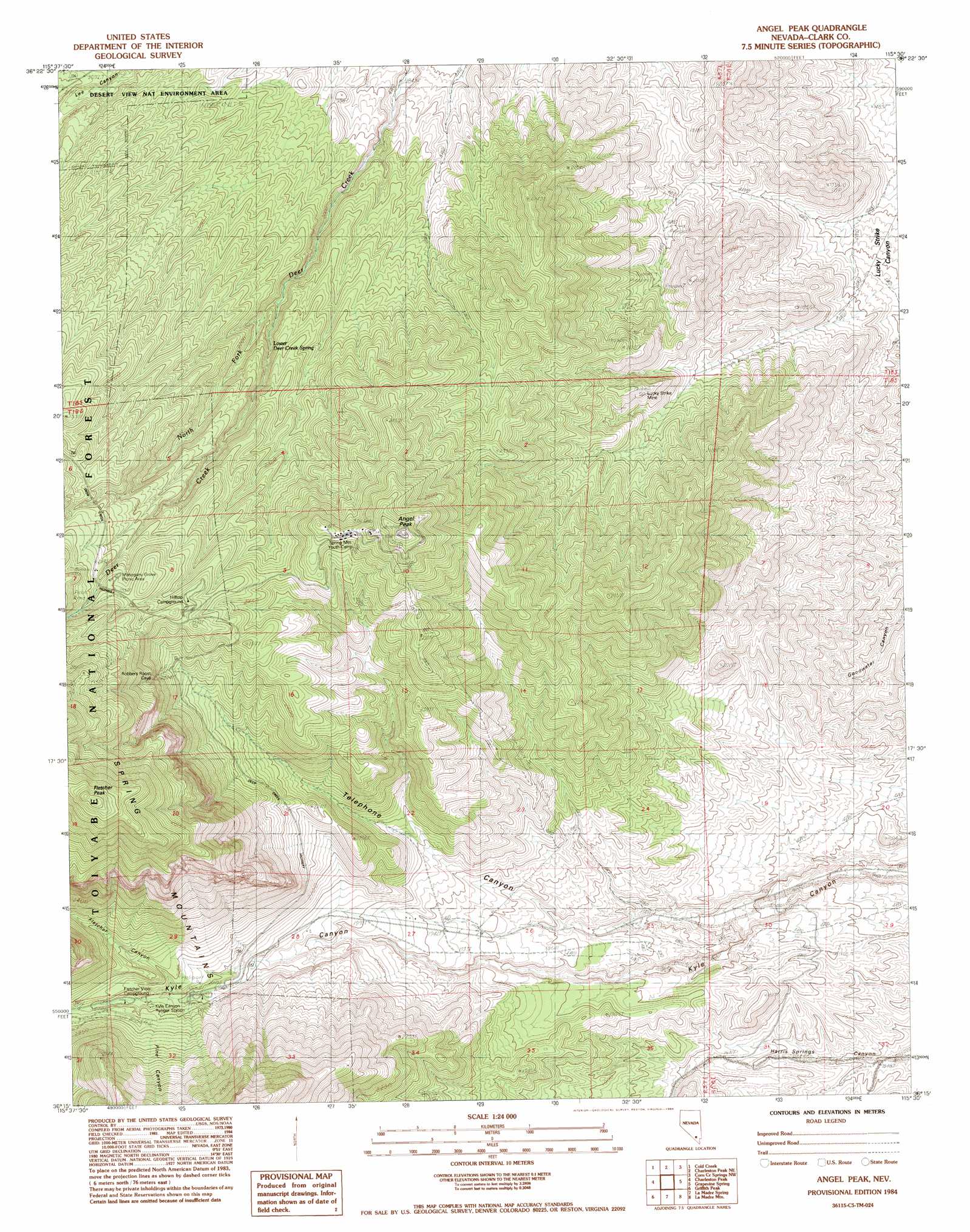
Angel Peak Topo Map Nevada
To zoom in, hover over the map of Angel Peak
USGS Topo Quad 36115c5 - 1:24,000 scale
| Topo Map Name: | Angel Peak |
| USGS Topo Quad ID: | 36115c5 |
| Print Size: | ca. 21 1/4" wide x 27" high |
| Southeast Coordinates: | 36.25° N latitude / 115.5° W longitude |
| Map Center Coordinates: | 36.3125° N latitude / 115.5625° W longitude |
| U.S. State: | NV |
| Filename: | o36115c5.jpg |
| Download Map JPG Image: | Angel Peak topo map 1:24,000 scale |
| Map Type: | Topographic |
| Topo Series: | 7.5´ |
| Map Scale: | 1:24,000 |
| Source of Map Images: | United States Geological Survey (USGS) |
| Alternate Map Versions: |
Angel Peak NV 1984, updated 1984 Download PDF Buy paper map Angel Peak NV 2012 Download PDF Buy paper map Angel Peak NV 2014 Download PDF Buy paper map |
| FStopo: | US Forest Service topo Angel Peak is available: Download FStopo PDF Download FStopo TIF |
1:24,000 Topo Quads surrounding Angel Peak
Mercury Se |
Indian Springs |
Indian Springs Se |
Black Hills Sw |
Black Hills |
Willow Peak |
Cold Creek |
Charleston Peak Ne |
Corn Creek Springs Nw |
Corn Creek Springs |
Wheeler Well |
Charleston Peak |
Angel Peak |
Grapevine Spring |
Tule Springs Park |
Pahrump Ne |
Griffith Peak |
La Madre Spring |
La Madre Mountain |
Blue Diamond Ne |
Hidden Hills Ranch |
Lost Cabin Spring |
Mountain Springs |
Blue Diamond |
Blue Diamond Se |
> Back to 36115a1 at 1:100,000 scale
> Back to 36114a1 at 1:250,000 scale
> Back to U.S. Topo Maps home
Angel Peak topo map: Gazetteer
Angel Peak: Basins
Pine Canyon elevation 2278m 7473′Angel Peak: Mines
Lucky Strike Mine elevation 2018m 6620′Angel Peak: Populated Places
Desert View Point elevation 2484m 8149′Angel Peak: Springs
Goodwater Spring elevation 1899m 6230′Lower Deer Creek Spring elevation 2138m 7014′
Sidehill Spring elevation 2182m 7158′
Two Spring elevation 2062m 6765′
Angel Peak: Streams
North Fork Deer Creek elevation 2082m 6830′Angel Peak: Summits
Angel Peak elevation 2682m 8799′Fletcher Peak elevation 3119m 10232′
Angel Peak: Valleys
Fletcher Canyon elevation 2146m 7040′Telephone Canyon elevation 1811m 5941′
Angel Peak digital topo map on disk
Buy this Angel Peak topo map showing relief, roads, GPS coordinates and other geographical features, as a high-resolution digital map file on DVD:
Southern Sierra Nevada, California & Southern Nevada
Buy digital topo maps: Southern Sierra Nevada, California & Southern Nevada