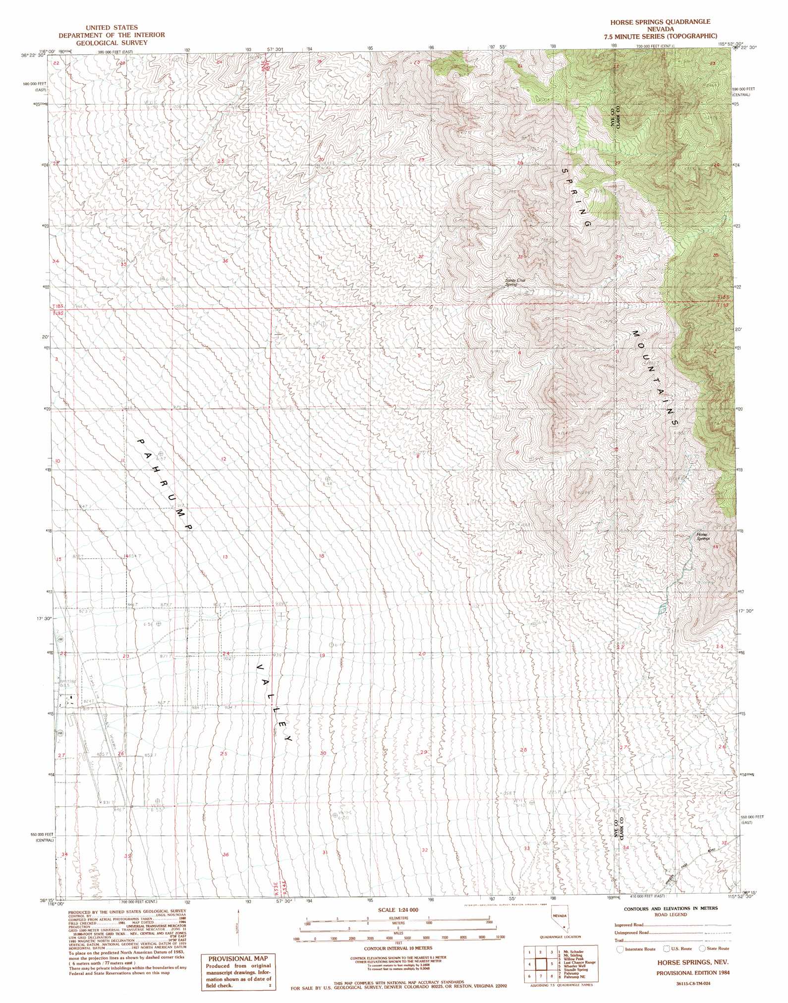
Horse Springs Topo Map Nevada
To zoom in, hover over the map of Horse Springs
USGS Topo Quad 36115c8 - 1:24,000 scale
| Topo Map Name: | Horse Springs |
| USGS Topo Quad ID: | 36115c8 |
| Print Size: | ca. 21 1/4" wide x 27" high |
| Southeast Coordinates: | 36.25° N latitude / 115.875° W longitude |
| Map Center Coordinates: | 36.3125° N latitude / 115.9375° W longitude |
| U.S. State: | NV |
| Filename: | o36115c8.jpg |
| Download Map JPG Image: | Horse Springs topo map 1:24,000 scale |
| Map Type: | Topographic |
| Topo Series: | 7.5´ |
| Map Scale: | 1:24,000 |
| Source of Map Images: | United States Geological Survey (USGS) |
| Alternate Map Versions: |
Horse Springs NV 1984, updated 1984 Download PDF Buy paper map Horse Springs NV 2012 Download PDF Buy paper map Horse Springs NV 2014 Download PDF Buy paper map |
| FStopo: | US Forest Service topo Horse Springs is available: Download FStopo PDF Download FStopo TIF |
1:24,000 Topo Quads surrounding Horse Springs
Specter Range Sw |
Point Of Rocks |
Niavi Wash |
Mercury Se |
Indian Springs |
Amargosa Flat |
Mount Schader |
Mount Stirling |
Willow Peak |
Cold Creek |
High Peak |
Last Chance Range |
Horse Springs |
Wheeler Well |
Charleston Peak |
Stewart Valley |
Sixmile Spring |
Pahrump |
Pahrump Ne |
Griffith Peak |
Twelve Mile Spring |
Nopah Peak |
Mound Spring |
Hidden Hills Ranch |
Lost Cabin Spring |
> Back to 36115a1 at 1:100,000 scale
> Back to 36114a1 at 1:250,000 scale
> Back to U.S. Topo Maps home
Horse Springs topo map: Gazetteer
Horse Springs: Airports
Calvada Meadows Airport elevation 822m 2696′Horse Springs: Springs
Horse Springs elevation 1584m 5196′Santa Cruz Spring elevation 1454m 4770′
Horse Springs: Valleys
Wood Canyon elevation 1093m 3585′Horse Springs digital topo map on disk
Buy this Horse Springs topo map showing relief, roads, GPS coordinates and other geographical features, as a high-resolution digital map file on DVD:
Southern Sierra Nevada, California & Southern Nevada
Buy digital topo maps: Southern Sierra Nevada, California & Southern Nevada