Eagle Mountain Topo Map California
To zoom in, hover over the map of Eagle Mountain
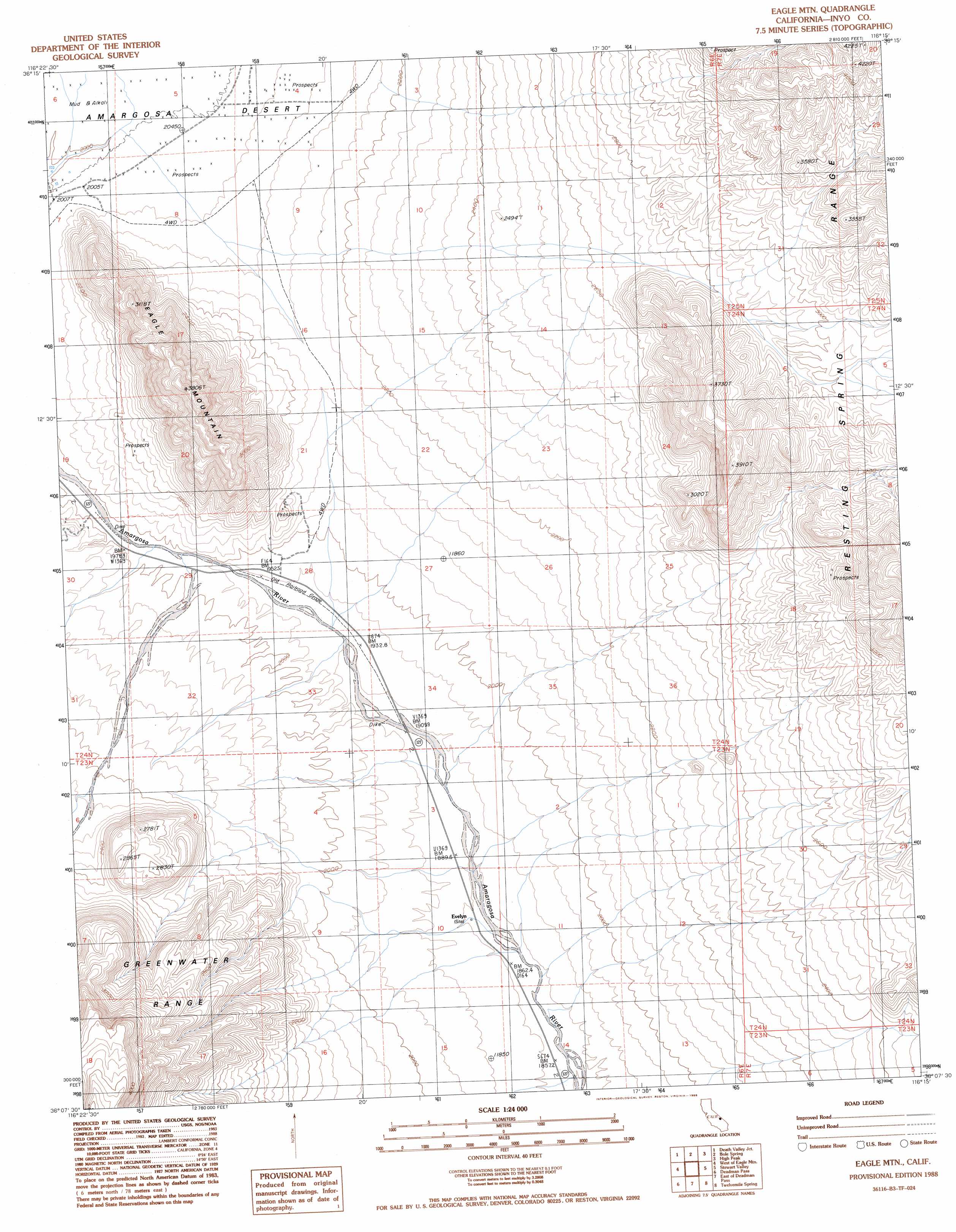
USGS Topo Quad 36116b3 - 1:24,000 scale
| Topo Map Name: | Eagle Mountain |
| USGS Topo Quad ID: | 36116b3 |
| Print Size: | ca. 21 1/4" wide x 27" high |
| Southeast Coordinates: | 36.125° N latitude / 116.25° W longitude |
| Map Center Coordinates: | 36.1875° N latitude / 116.3125° W longitude |
| U.S. State: | CA |
| Filename: | o36116b3.jpg |
| Download Map JPG Image: | Eagle Mountain topo map 1:24,000 scale |
| Map Type: | Topographic |
| Topo Series: | 7.5´ |
| Map Scale: | 1:24,000 |
| Source of Map Images: | United States Geological Survey (USGS) |
| Alternate Map Versions: |
Eagle Mtn. CA 1988, updated 1988 Download PDF Buy paper map Eagle Mountain CA 2012 Download PDF Buy paper map Eagle Mountain CA 2015 Download PDF Buy paper map |
1:24,000 Topo Quads surrounding Eagle Mountain
East Of Echo Canyon |
Franklin Well |
Devils Hole |
Amargosa Flat |
Mount Schader |
East Of Ryan |
Death Valley Junction |
Bole Spring |
High Peak |
Last Chance Range |
Greenwater Canyon |
West Of Eagle Mountain |
Eagle Mountain |
Stewart Valley |
Sixmile Spring |
Funeral Peak |
Deadman Pass |
East Of Deadman Pass |
Twelve Mile Spring |
Nopah Peak |
Epaulet Peak |
Salsberry Peak |
Shoshone |
Resting Spring |
North Of Tecopa Pass |
> Back to 36116a1 at 1:100,000 scale
> Back to 36116a1 at 1:250,000 scale
> Back to U.S. Topo Maps home
Eagle Mountain topo map: Gazetteer
Eagle Mountain: Populated Places
Evelyn elevation 573m 1879′Eagle Mountain: Summits
Eagle Mountain elevation 1134m 3720′Eagle Mountain digital topo map on disk
Buy this Eagle Mountain topo map showing relief, roads, GPS coordinates and other geographical features, as a high-resolution digital map file on DVD:
Southern Sierra Nevada, California & Southern Nevada
Buy digital topo maps: Southern Sierra Nevada, California & Southern Nevada