Devils Golf Course Topo Map California
To zoom in, hover over the map of Devils Golf Course
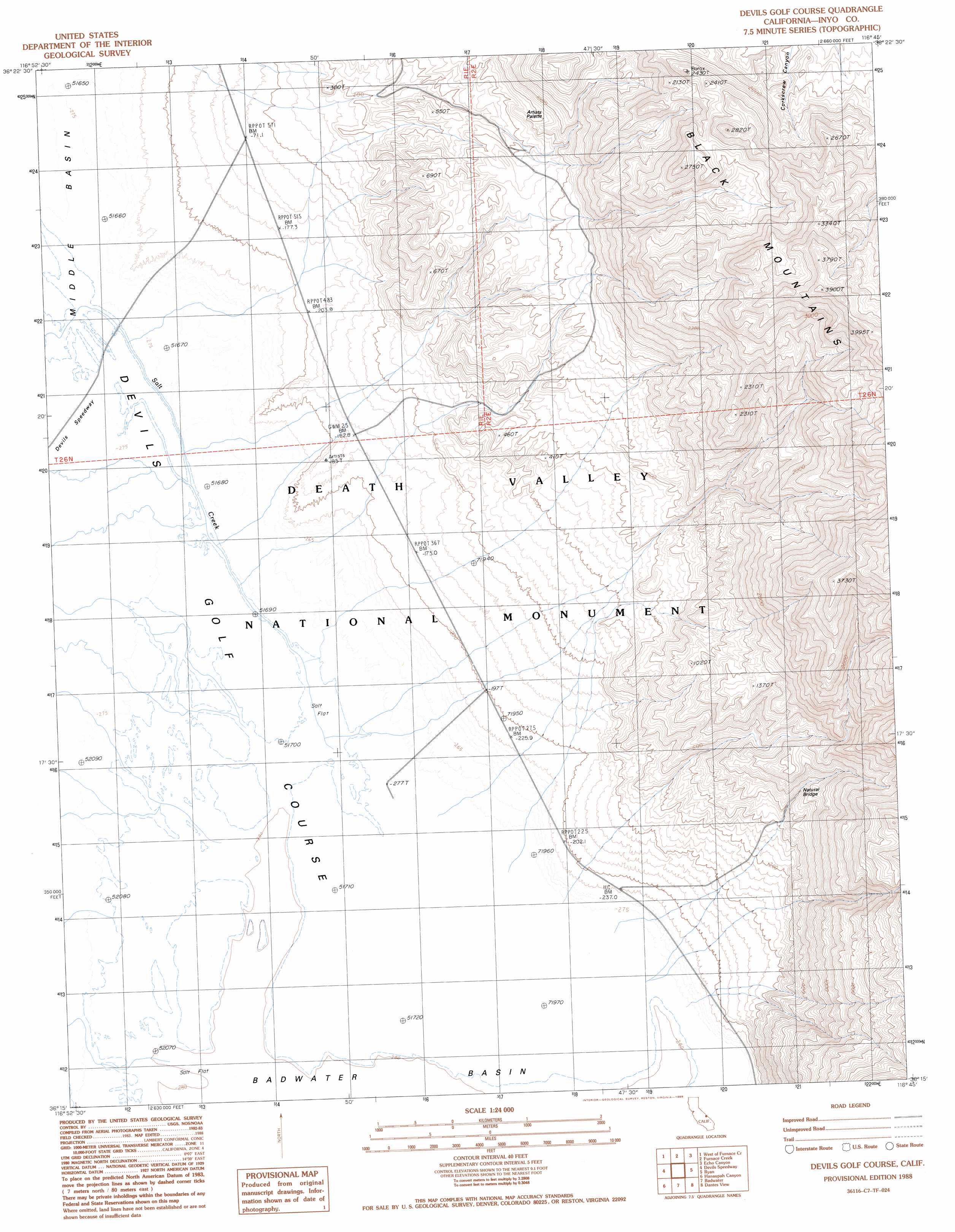
USGS Topo Quad 36116c7 - 1:24,000 scale
| Topo Map Name: | Devils Golf Course |
| USGS Topo Quad ID: | 36116c7 |
| Print Size: | ca. 21 1/4" wide x 27" high |
| Southeast Coordinates: | 36.25° N latitude / 116.75° W longitude |
| Map Center Coordinates: | 36.3125° N latitude / 116.8125° W longitude |
| U.S. State: | CA |
| Filename: | o36116c7.jpg |
| Download Map JPG Image: | Devils Golf Course topo map 1:24,000 scale |
| Map Type: | Topographic |
| Topo Series: | 7.5´ |
| Map Scale: | 1:24,000 |
| Source of Map Images: | United States Geological Survey (USGS) |
| Alternate Map Versions: |
Devils Golf Course CA 1988, updated 1988 Download PDF Buy paper map Devils Golf Course CA 2012 Download PDF Buy paper map Devils Golf Course CA 2015 Download PDF Buy paper map |
1:24,000 Topo Quads surrounding Devils Golf Course
Grotto Canyon |
Beatty Junction |
Nevares Peak |
Lees Camp |
Leeland |
Tucki Wash |
East Of Furnace Creek |
Furnace Creek |
Echo Canyon |
East Of Echo Canyon |
Wildrose Peak |
Devils Speedway |
Devils Golf Course |
Ryan |
East Of Ryan |
Telescope Peak |
Hanaupah Canyon |
Badwater |
Dantes View |
Greenwater Canyon |
Panamint |
Galena Canyon |
Mormon Point |
Gold Valley |
Funeral Peak |
> Back to 36116a1 at 1:100,000 scale
> Back to 36116a1 at 1:250,000 scale
> Back to U.S. Topo Maps home
Devils Golf Course topo map: Gazetteer
Devils Golf Course: Arches
Death Valley Natural Bridge elevation 189m 620′Devils Golf Course: Areas
Devils Golf Course elevation -83m -273′Devils Golf Course: Basins
Badwater Basin elevation -85m -279′Devils Golf Course: Mines
Corkscrew Mine elevation 612m 2007′Devils Golf Course: Streams
Salt Creek elevation -85m -279′Devils Golf Course: Summits
Artists Palette elevation 238m 780′Devils Golf Course digital topo map on disk
Buy this Devils Golf Course topo map showing relief, roads, GPS coordinates and other geographical features, as a high-resolution digital map file on DVD:
Southern Sierra Nevada, California & Southern Nevada
Buy digital topo maps: Southern Sierra Nevada, California & Southern Nevada