Point Of Rocks Topo Map Nevada
To zoom in, hover over the map of Point Of Rocks
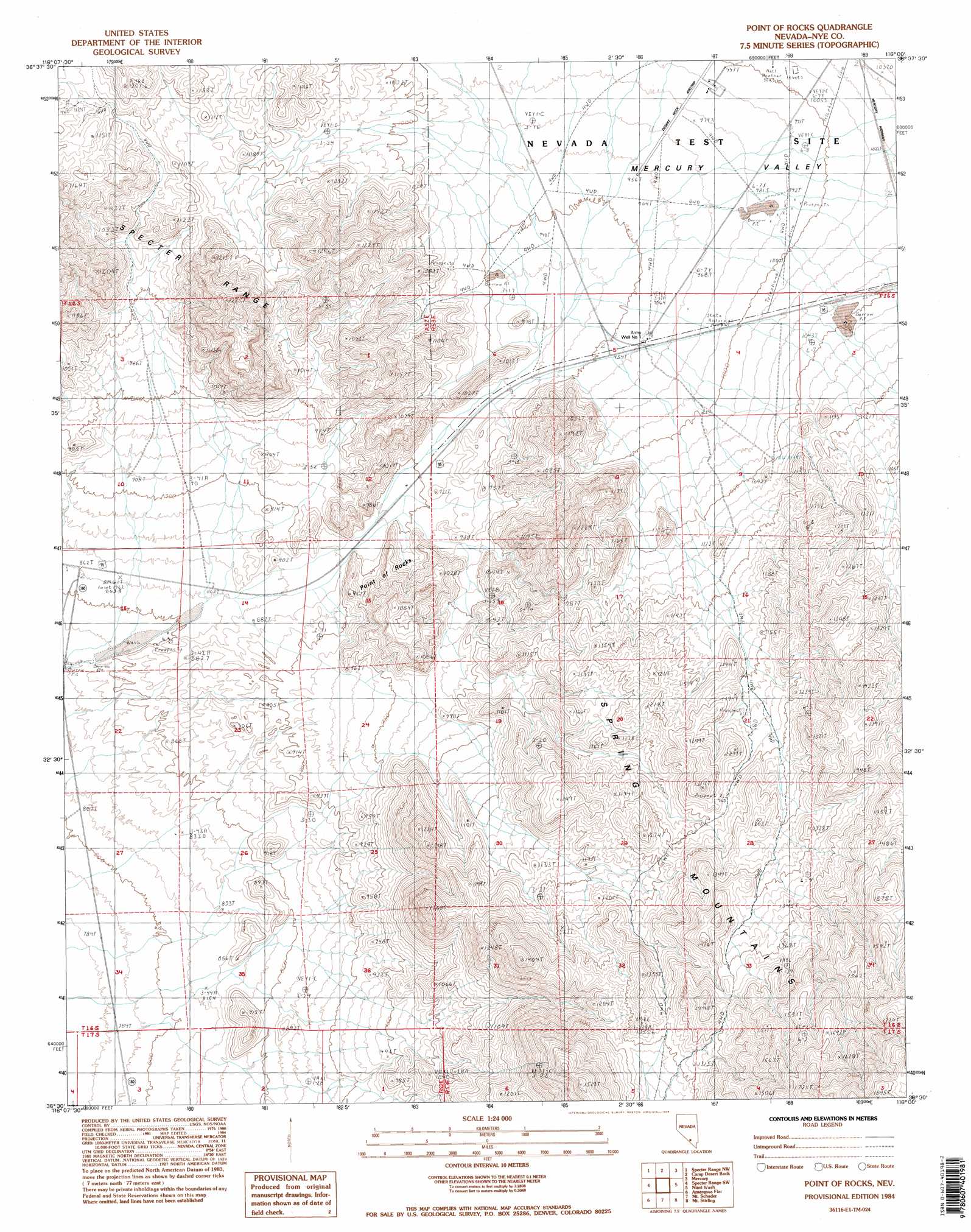
USGS Topo Quad 36116e1 - 1:24,000 scale
| Topo Map Name: | Point Of Rocks |
| USGS Topo Quad ID: | 36116e1 |
| Print Size: | ca. 21 1/4" wide x 27" high |
| Southeast Coordinates: | 36.5° N latitude / 116° W longitude |
| Map Center Coordinates: | 36.5625° N latitude / 116.0625° W longitude |
| U.S. State: | NV |
| Filename: | o36116e1.jpg |
| Download Map JPG Image: | Point Of Rocks topo map 1:24,000 scale |
| Map Type: | Topographic |
| Topo Series: | 7.5´ |
| Map Scale: | 1:24,000 |
| Source of Map Images: | United States Geological Survey (USGS) |
| Alternate Map Versions: |
Point of Rocks NV 1984, updated 1984 Download PDF Buy paper map Point of Rocks NV 2012 Download PDF Buy paper map Point of Rocks NV 2015 Download PDF Buy paper map |
| FStopo: | US Forest Service topo Point of Rocks is available: Download FStopo PDF Download FStopo TIF |
1:24,000 Topo Quads surrounding Point Of Rocks
Jackass Flats |
Skull Mountain |
Cane Spring |
Frenchman Lake |
Frenchman Lake Se |
Striped Hills |
Specter Range Nw |
Camp Desert Rock |
Mercury |
Mercury Ne |
Skeleton Hills |
Specter Range Sw |
Point Of Rocks |
Niavi Wash |
Mercury Se |
Devils Hole |
Amargosa Flat |
Mount Schader |
Mount Stirling |
Willow Peak |
Bole Spring |
High Peak |
Last Chance Range |
Horse Springs |
Wheeler Well |
> Back to 36116e1 at 1:100,000 scale
> Back to 36116a1 at 1:250,000 scale
> Back to U.S. Topo Maps home
Point Of Rocks topo map: Gazetteer
Point Of Rocks: Airports
Desert Rock Airstrip elevation 981m 3218′Point Of Rocks: Basins
Mercury Valley elevation 990m 3248′Point Of Rocks: Gaps
Strawberry Valley elevation 905m 2969′Point Of Rocks: Pillars
Point of Rocks elevation 940m 3083′Point Of Rocks: Wells
Army Well Number 1 elevation 959m 3146′Point Of Rocks digital topo map on disk
Buy this Point Of Rocks topo map showing relief, roads, GPS coordinates and other geographical features, as a high-resolution digital map file on DVD:
Southern Sierra Nevada, California & Southern Nevada
Buy digital topo maps: Southern Sierra Nevada, California & Southern Nevada