Cane Spring Topo Map Nevada
To zoom in, hover over the map of Cane Spring
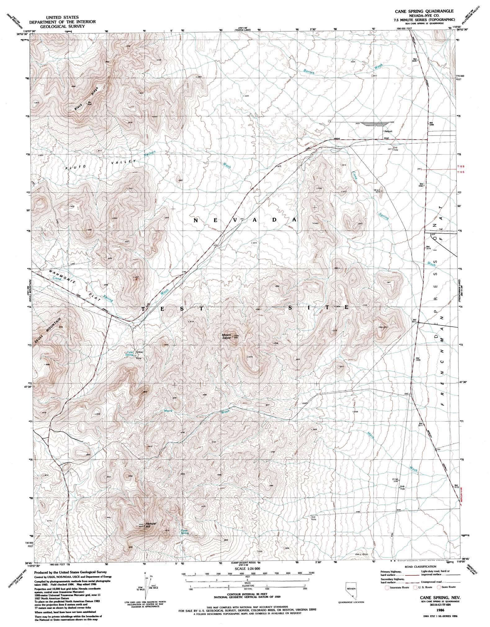
USGS Topo Quad 36116g1 - 1:24,000 scale
| Topo Map Name: | Cane Spring |
| USGS Topo Quad ID: | 36116g1 |
| Print Size: | ca. 21 1/4" wide x 27" high |
| Southeast Coordinates: | 36.75° N latitude / 116° W longitude |
| Map Center Coordinates: | 36.8125° N latitude / 116.0625° W longitude |
| U.S. State: | NV |
| Filename: | o36116g1.jpg |
| Download Map JPG Image: | Cane Spring topo map 1:24,000 scale |
| Map Type: | Topographic |
| Topo Series: | 7.5´ |
| Map Scale: | 1:24,000 |
| Source of Map Images: | United States Geological Survey (USGS) |
| Alternate Map Versions: |
Cane Spring NV 1961, updated 1962 Download PDF Buy paper map Cane Spring NV 1961, updated 1975 Download PDF Buy paper map Cane Spring NV 1961, updated 1984 Download PDF Buy paper map Cane Spring NV 1986, updated 1987 Download PDF Buy paper map |
1:24,000 Topo Quads surrounding Cane Spring
Buckboard Mesa |
Tippipah Spring |
Yucca Flat |
Paiute Ridge |
Papoose Lake |
Topopah Spring |
Mine Mountain |
Yucca Lake |
Plutonium Valley |
Aysees Peak |
Jackass Flats |
Skull Mountain |
Cane Spring |
Frenchman Lake |
Frenchman Lake Se |
Striped Hills |
Specter Range Nw |
Camp Desert Rock |
Mercury |
Mercury Ne |
Skeleton Hills |
Specter Range Sw |
Point Of Rocks |
Niavi Wash |
Mercury Se |
> Back to 36116e1 at 1:100,000 scale
> Back to 36116a1 at 1:250,000 scale
> Back to U.S. Topo Maps home
Cane Spring topo map: Gazetteer
Cane Spring: Basins
Pluto Valley elevation 1252m 4107′Cane Spring: Ridges
Black Ridge elevation 1537m 5042′Cane Spring: Springs
Cane Spring elevation 1238m 4061′Pavits Spring elevation 1202m 3943′
Cane Spring: Streams
Mara Wash elevation 976m 3202′Neilson Wash elevation 1099m 3605′
Cane Spring: Summits
Hampel Hill elevation 1506m 4940′Mount Salyer elevation 1389m 4557′
Cane Spring: Wells
Well G elevation 987m 3238′Cane Spring digital topo map on disk
Buy this Cane Spring topo map showing relief, roads, GPS coordinates and other geographical features, as a high-resolution digital map file on DVD:
Southern Sierra Nevada, California & Southern Nevada
Buy digital topo maps: Southern Sierra Nevada, California & Southern Nevada