Skull Mountain Topo Map Nevada
To zoom in, hover over the map of Skull Mountain
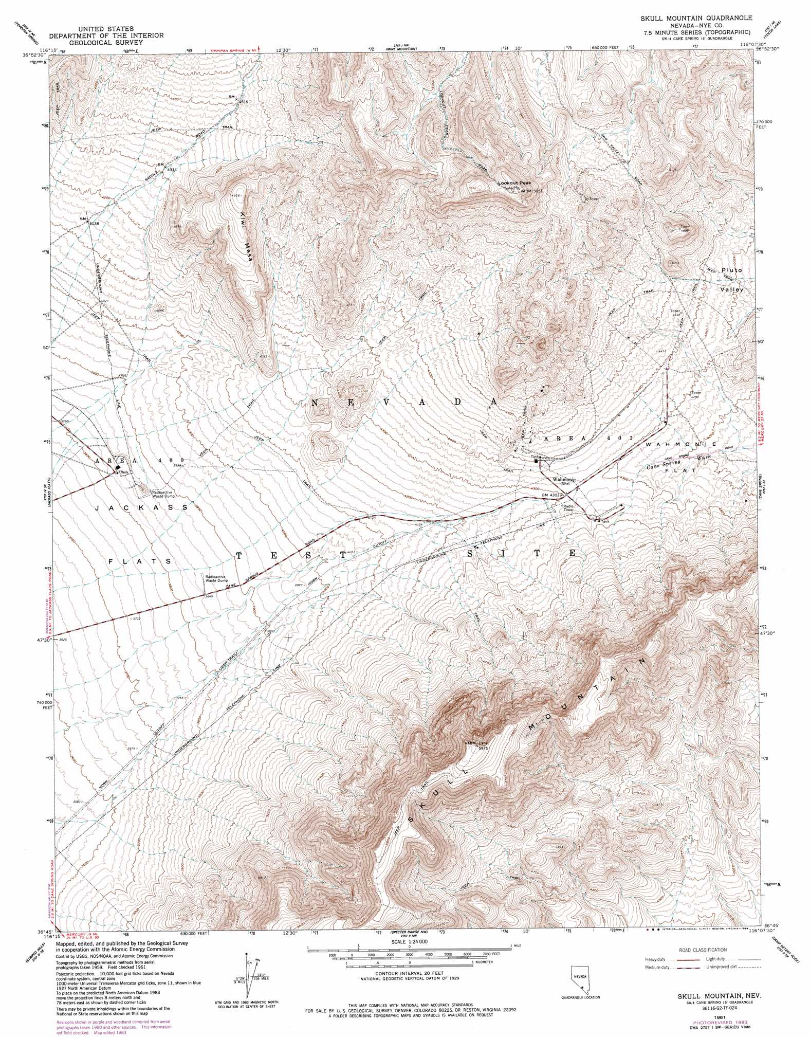
USGS Topo Quad 36116g2 - 1:24,000 scale
| Topo Map Name: | Skull Mountain |
| USGS Topo Quad ID: | 36116g2 |
| Print Size: | ca. 21 1/4" wide x 27" high |
| Southeast Coordinates: | 36.75° N latitude / 116.125° W longitude |
| Map Center Coordinates: | 36.8125° N latitude / 116.1875° W longitude |
| U.S. State: | NV |
| Filename: | o36116g2.jpg |
| Download Map JPG Image: | Skull Mountain topo map 1:24,000 scale |
| Map Type: | Topographic |
| Topo Series: | 7.5´ |
| Map Scale: | 1:24,000 |
| Source of Map Images: | United States Geological Survey (USGS) |
| Alternate Map Versions: |
Skull Mountain NV 1961, updated 1962 Download PDF Buy paper map Skull Mountain NV 1961, updated 1979 Download PDF Buy paper map Skull Mountain NV 1961, updated 1983 Download PDF Buy paper map Skull Mountain NV 1961, updated 1984 Download PDF Buy paper map |
1:24,000 Topo Quads surrounding Skull Mountain
Timber Mountain |
Buckboard Mesa |
Tippipah Spring |
Yucca Flat |
Paiute Ridge |
Topopah Springs Nw |
Topopah Spring |
Mine Mountain |
Yucca Lake |
Plutonium Valley |
Busted Butte |
Jackass Flats |
Skull Mountain |
Cane Spring |
Frenchman Lake |
Lathrop Wells |
Striped Hills |
Specter Range Nw |
Camp Desert Rock |
Mercury |
South Of Amargosa Valley |
Skeleton Hills |
Specter Range Sw |
Point Of Rocks |
Niavi Wash |
> Back to 36116e1 at 1:100,000 scale
> Back to 36116a1 at 1:250,000 scale
> Back to U.S. Topo Maps home
Skull Mountain topo map: Gazetteer
Skull Mountain: Flats
Wahmonie Flat elevation 1360m 4461′Skull Mountain: Mines
Horn Silver Mine elevation 1459m 4786′Skull Mountain: Populated Places
Wahmonie (historical) elevation 1313m 4307′Skull Mountain: Post Offices
Wahmonie Post Office (historical) elevation 1315m 4314′Skull Mountain: Summits
Kiwi Mesa elevation 1508m 4947′Lookout Peak elevation 1721m 5646′
Skull Mountain elevation 1817m 5961′
Skull Mountain digital topo map on disk
Buy this Skull Mountain topo map showing relief, roads, GPS coordinates and other geographical features, as a high-resolution digital map file on DVD:
Southern Sierra Nevada, California & Southern Nevada
Buy digital topo maps: Southern Sierra Nevada, California & Southern Nevada