Wildrose Peak Topo Map California
To zoom in, hover over the map of Wildrose Peak
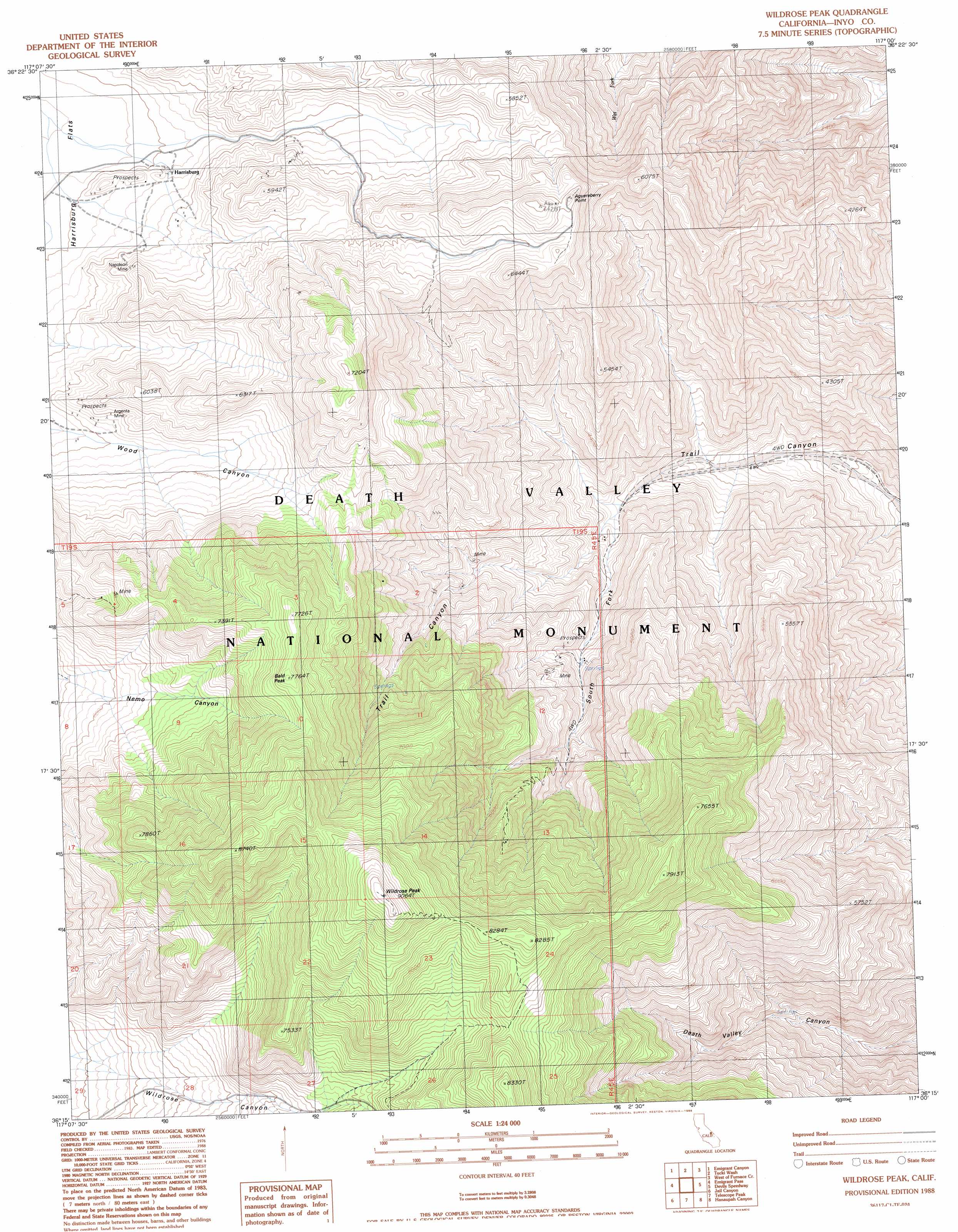
USGS Topo Quad 36117c1 - 1:24,000 scale
| Topo Map Name: | Wildrose Peak |
| USGS Topo Quad ID: | 36117c1 |
| Print Size: | ca. 21 1/4" wide x 27" high |
| Southeast Coordinates: | 36.25° N latitude / 117° W longitude |
| Map Center Coordinates: | 36.3125° N latitude / 117.0625° W longitude |
| U.S. State: | CA |
| Filename: | o36117c1.jpg |
| Download Map JPG Image: | Wildrose Peak topo map 1:24,000 scale |
| Map Type: | Topographic |
| Topo Series: | 7.5´ |
| Map Scale: | 1:24,000 |
| Source of Map Images: | United States Geological Survey (USGS) |
| Alternate Map Versions: |
Wildrose Peak CA 1988, updated 1988 Download PDF Buy paper map Wildrose Peak CA 1988, updated 1988 Download PDF Buy paper map Wildrose Peak CA 2012 Download PDF Buy paper map Wildrose Peak CA 2015 Download PDF Buy paper map |
1:24,000 Topo Quads surrounding Wildrose Peak
Cottonwood Canyon |
Stovepipe Wells Village |
Grotto Canyon |
Beatty Junction |
Nevares Peak |
Panamint Butte |
Emigrant Canyon |
Tucki Wash |
East Of Furnace Creek |
Furnace Creek |
Nova Canyon |
Emigrant Pass |
Wildrose Peak |
Devils Speedway |
Devils Golf Course |
Maturango Peak Ne |
Jail Canyon |
Telescope Peak |
Hanaupah Canyon |
Badwater |
Maturango Peak Se |
Ballarat |
Panamint |
Galena Canyon |
Mormon Point |
> Back to 36117a1 at 1:100,000 scale
> Back to 36116a1 at 1:250,000 scale
> Back to U.S. Topo Maps home
Wildrose Peak topo map: Gazetteer
Wildrose Peak: Mines
Argenta Mine elevation 1686m 5531′Napoleon Mine elevation 1604m 5262′
Wildrose Peak: Populated Places
Harrisburg elevation 1520m 4986′Wildrose Peak: Summits
Aguereberry Point elevation 1916m 6286′Bald Peak elevation 2367m 7765′
Wildrose Peak elevation 2762m 9061′
Wildrose Peak: Valleys
South Fork Trail Canyon elevation 1060m 3477′Wildrose Peak digital topo map on disk
Buy this Wildrose Peak topo map showing relief, roads, GPS coordinates and other geographical features, as a high-resolution digital map file on DVD:
Southern Sierra Nevada, California & Southern Nevada
Buy digital topo maps: Southern Sierra Nevada, California & Southern Nevada