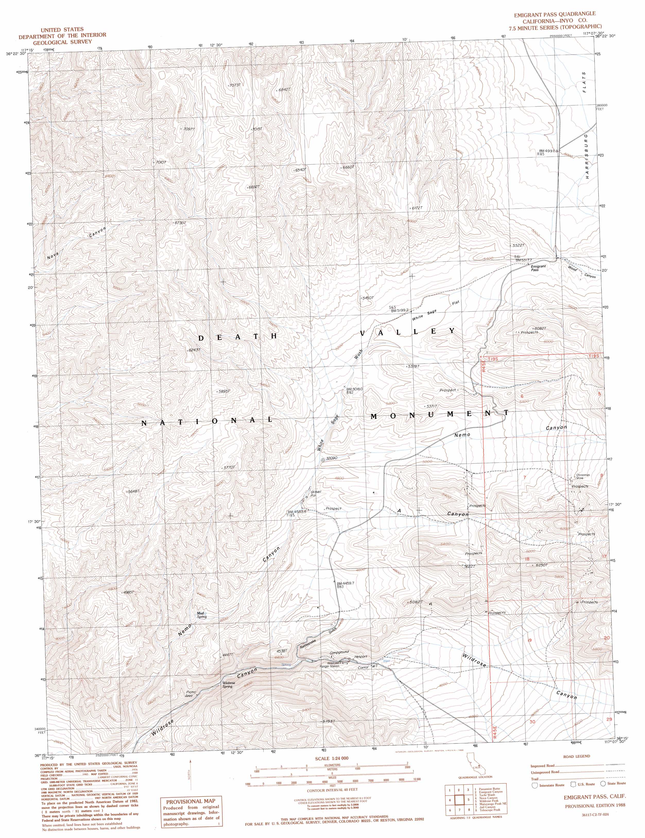
Emigrant Pass Topo Map California
To zoom in, hover over the map of Emigrant Pass
USGS Topo Quad 36117c2 - 1:24,000 scale
| Topo Map Name: | Emigrant Pass |
| USGS Topo Quad ID: | 36117c2 |
| Print Size: | ca. 21 1/4" wide x 27" high |
| Southeast Coordinates: | 36.25° N latitude / 117.125° W longitude |
| Map Center Coordinates: | 36.3125° N latitude / 117.1875° W longitude |
| U.S. State: | CA |
| Filename: | o36117c2.jpg |
| Download Map JPG Image: | Emigrant Pass topo map 1:24,000 scale |
| Map Type: | Topographic |
| Topo Series: | 7.5´ |
| Map Scale: | 1:24,000 |
| Source of Map Images: | United States Geological Survey (USGS) |
| Alternate Map Versions: |
Emigrant Pass CA 1988, updated 1988 Download PDF Buy paper map Emigrant Pass CA 2012 Download PDF Buy paper map Emigrant Pass CA 2015 Download PDF Buy paper map |
1:24,000 Topo Quads surrounding Emigrant Pass
Harris Hill |
Cottonwood Canyon |
Stovepipe Wells Village |
Grotto Canyon |
Beatty Junction |
The Dunes |
Panamint Butte |
Emigrant Canyon |
Tucki Wash |
East Of Furnace Creek |
Panamint Springs |
Nova Canyon |
Emigrant Pass |
Wildrose Peak |
Devils Speedway |
Revenue Canyon |
Maturango Peak Ne |
Jail Canyon |
Telescope Peak |
Hanaupah Canyon |
Maturango Peak |
Maturango Peak Se |
Ballarat |
Panamint |
Galena Canyon |
> Back to 36117a1 at 1:100,000 scale
> Back to 36116a1 at 1:250,000 scale
> Back to U.S. Topo Maps home
Emigrant Pass topo map: Gazetteer
Emigrant Pass: Flats
White Sage Flat elevation 1582m 5190′Emigrant Pass: Gaps
Emigrant Pass elevation 1622m 5321′Emigrant Pass: Mines
Christmas Mine elevation 1706m 5597′Emigrant Pass: Springs
Mud Spring elevation 1245m 4084′Wildrose Spring elevation 1144m 3753′
Emigrant Pass: Streams
White Sage Wash elevation 1400m 4593′Emigrant Pass: Valleys
A Canyon elevation 1469m 4819′Jayhawker Canyon elevation 2032m 6666′
Nemo Canyon elevation 987m 3238′
Rattlesnake Gulch elevation 1226m 4022′
Wood Canyon elevation 1610m 5282′
Emigrant Pass digital topo map on disk
Buy this Emigrant Pass topo map showing relief, roads, GPS coordinates and other geographical features, as a high-resolution digital map file on DVD:
Southern Sierra Nevada, California & Southern Nevada
Buy digital topo maps: Southern Sierra Nevada, California & Southern Nevada