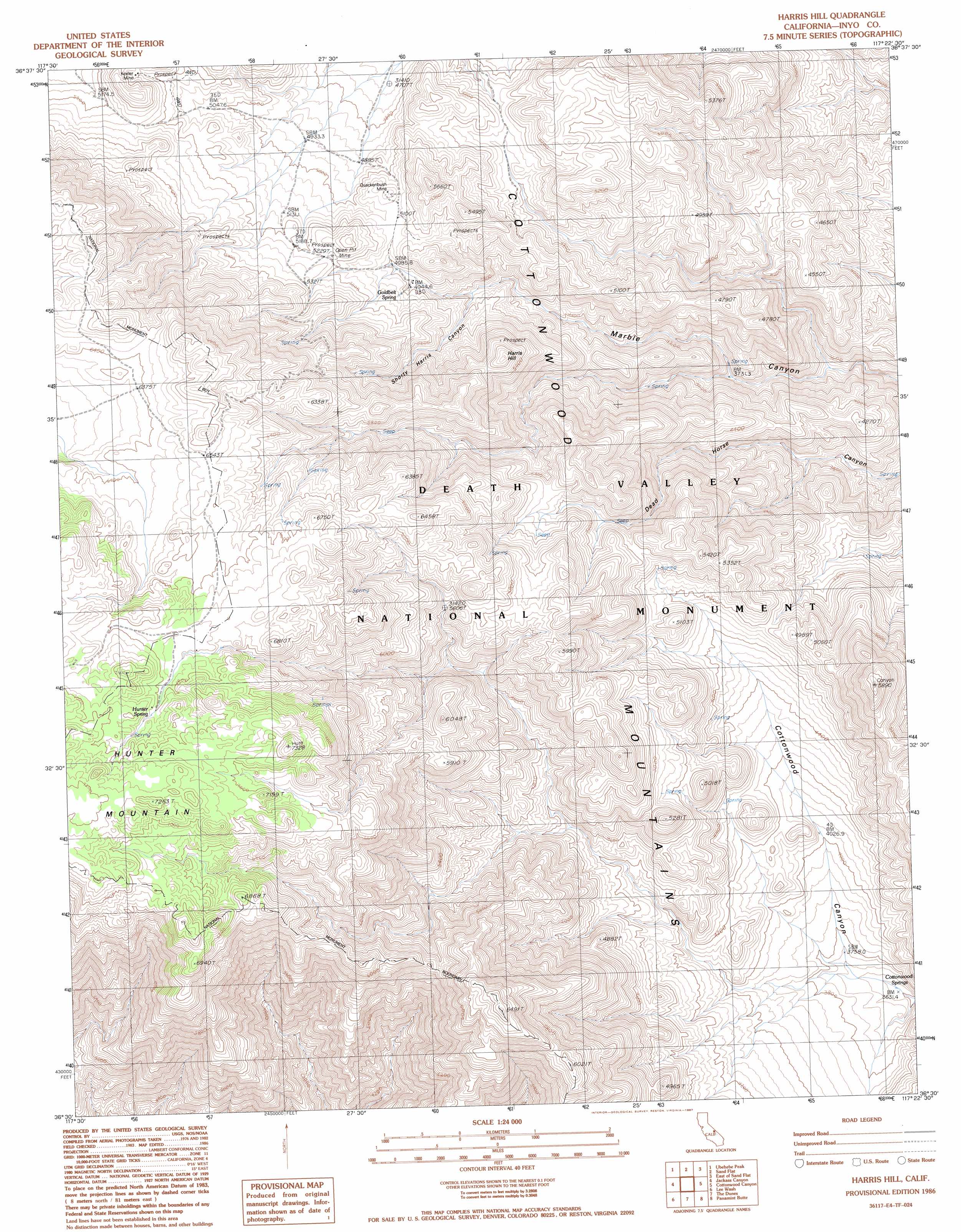
Harris Hill Topo Map California
To zoom in, hover over the map of Harris Hill
USGS Topo Quad 36117e4 - 1:24,000 scale
| Topo Map Name: | Harris Hill |
| USGS Topo Quad ID: | 36117e4 |
| Print Size: | ca. 21 1/4" wide x 27" high |
| Southeast Coordinates: | 36.5° N latitude / 117.375° W longitude |
| Map Center Coordinates: | 36.5625° N latitude / 117.4375° W longitude |
| U.S. State: | CA |
| Filename: | o36117e4.jpg |
| Download Map JPG Image: | Harris Hill topo map 1:24,000 scale |
| Map Type: | Topographic |
| Topo Series: | 7.5´ |
| Map Scale: | 1:24,000 |
| Source of Map Images: | United States Geological Survey (USGS) |
| Alternate Map Versions: |
Harris Hill CA 1986, updated 1987 Download PDF Buy paper map Harris Hill CA 1986, updated 1987 Download PDF Buy paper map Harris Hill CA 2012 Download PDF Buy paper map Harris Hill CA 2015 Download PDF Buy paper map |
1:24,000 Topo Quads surrounding Harris Hill
West Of Teakettle Junction |
Teakettle Junction |
White Top Mountain |
Dry Bone Canyon |
Fall Canyon |
West Of Ubehebe Peak |
Ubehebe Peak |
Sand Flat |
East Of Sand Flat |
Mesquite Flat |
Nelson Range |
Jackass Canyon |
Harris Hill |
Cottonwood Canyon |
Stovepipe Wells Village |
Santa Rosa Flat |
Lee Wash |
The Dunes |
Panamint Butte |
Emigrant Canyon |
Talc City Hills |
Darwin |
Panamint Springs |
Nova Canyon |
Emigrant Pass |
> Back to 36117e1 at 1:100,000 scale
> Back to 36116a1 at 1:250,000 scale
> Back to U.S. Topo Maps home
Harris Hill topo map: Gazetteer
Harris Hill: Mines
Keeler Mine elevation 1614m 5295′Quackenbush Mine elevation 1576m 5170′
Harris Hill: Springs
Cottonwood Springs elevation 1106m 3628′Goldbelt Spring elevation 1514m 4967′
Hunter Spring elevation 2079m 6820′
Harris Hill: Summits
Harris Hill elevation 1743m 5718′Harris Hill: Valleys
Shorty Harris Canyon elevation 1432m 4698′Harris Hill digital topo map on disk
Buy this Harris Hill topo map showing relief, roads, GPS coordinates and other geographical features, as a high-resolution digital map file on DVD:
Southern Sierra Nevada, California & Southern Nevada
Buy digital topo maps: Southern Sierra Nevada, California & Southern Nevada