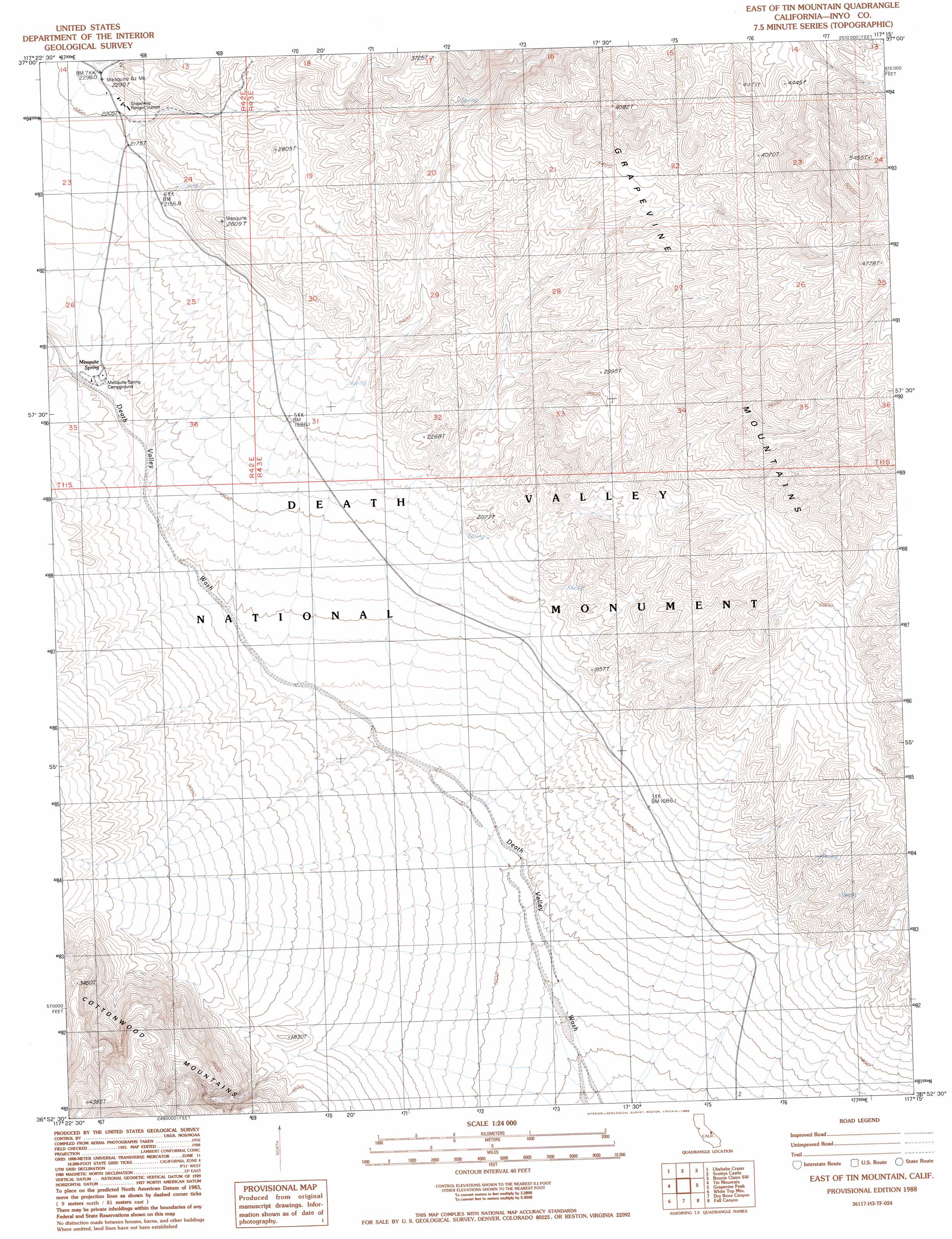
East Of Tin Mountain Topo Map California
To zoom in, hover over the map of East Of Tin Mountain
USGS Topo Quad 36117h3 - 1:24,000 scale
| Topo Map Name: | East Of Tin Mountain |
| USGS Topo Quad ID: | 36117h3 |
| Print Size: | ca. 21 1/4" wide x 27" high |
| Southeast Coordinates: | 36.875° N latitude / 117.25° W longitude |
| Map Center Coordinates: | 36.9375° N latitude / 117.3125° W longitude |
| U.S. State: | CA |
| Filename: | o36117h3.jpg |
| Download Map JPG Image: | East Of Tin Mountain topo map 1:24,000 scale |
| Map Type: | Topographic |
| Topo Series: | 7.5´ |
| Map Scale: | 1:24,000 |
| Source of Map Images: | United States Geological Survey (USGS) |
| Alternate Map Versions: |
East of Tin Mountain CA 1988, updated 1988 Download PDF Buy paper map East of Tin Mountain CA 2012 Download PDF Buy paper map East of Tin Mountain CA 2015 Download PDF Buy paper map |
1:24,000 Topo Quads surrounding East Of Tin Mountain
Sand Spring |
West Of Gold Mountain |
Gold Mountain |
Bonnie Claire Lake |
Bonnie Claire |
Last Chance Range Se |
Ubehebe Crater |
Scottys Castle |
Bonnie Claire Sw |
Bonnie Claire Se |
Dry Mountain |
Tin Mountain |
East Of Tin Mountain |
Grapevine Peak |
Wahguyhe Peak |
Teakettle Junction |
White Top Mountain |
Dry Bone Canyon |
Fall Canyon |
Thimble Peak |
Ubehebe Peak |
Sand Flat |
East Of Sand Flat |
Mesquite Flat |
Stovepipe Wells |
> Back to 36117e1 at 1:100,000 scale
> Back to 36116a1 at 1:250,000 scale
> Back to U.S. Topo Maps home
East Of Tin Mountain topo map: Gazetteer
East Of Tin Mountain: Springs
Mesquite Spring elevation 550m 1804′East Of Tin Mountain: Valleys
Bighorn Gorge elevation 451m 1479′Grapevine Canyon elevation 723m 2372′
East Of Tin Mountain digital topo map on disk
Buy this East Of Tin Mountain topo map showing relief, roads, GPS coordinates and other geographical features, as a high-resolution digital map file on DVD:
Southern Sierra Nevada, California & Southern Nevada
Buy digital topo maps: Southern Sierra Nevada, California & Southern Nevada