Dry Mountain Topo Map California
To zoom in, hover over the map of Dry Mountain
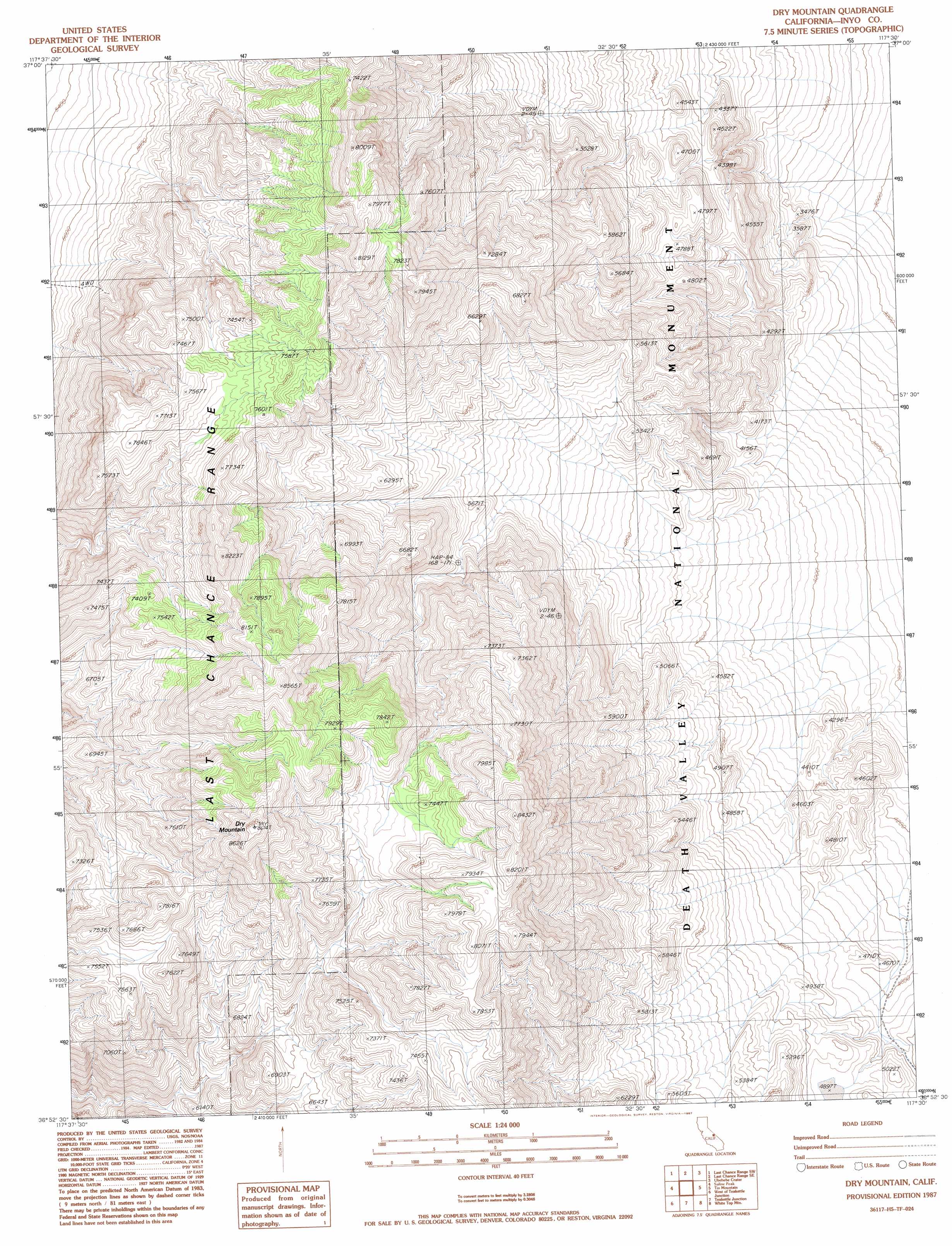
USGS Topo Quad 36117h5 - 1:24,000 scale
| Topo Map Name: | Dry Mountain |
| USGS Topo Quad ID: | 36117h5 |
| Print Size: | ca. 21 1/4" wide x 27" high |
| Southeast Coordinates: | 36.875° N latitude / 117.5° W longitude |
| Map Center Coordinates: | 36.9375° N latitude / 117.5625° W longitude |
| U.S. State: | CA |
| Filename: | o36117h5.jpg |
| Download Map JPG Image: | Dry Mountain topo map 1:24,000 scale |
| Map Type: | Topographic |
| Topo Series: | 7.5´ |
| Map Scale: | 1:24,000 |
| Source of Map Images: | United States Geological Survey (USGS) |
| Alternate Map Versions: |
Dry Mountain CA 1987, updated 1987 Download PDF Buy paper map Dry Mountain CA 2012 Download PDF Buy paper map Dry Mountain CA 2015 Download PDF Buy paper map |
1:24,000 Topo Quads surrounding Dry Mountain
East Of Joshua Flats |
Hanging Rock Canyon |
Sand Spring |
West Of Gold Mountain |
Gold Mountain |
East Of Waucoba Spring |
Last Chance Range Sw |
Last Chance Range Se |
Ubehebe Crater |
Scottys Castle |
East Of Waucoba Canyon |
Saline Mountain |
Dry Mountain |
Tin Mountain |
East Of Tin Mountain |
Lower Warm Springs |
West Of Teakettle Junction |
Teakettle Junction |
White Top Mountain |
Dry Bone Canyon |
Craig Canyon |
West Of Ubehebe Peak |
Ubehebe Peak |
Sand Flat |
East Of Sand Flat |
> Back to 36117e1 at 1:100,000 scale
> Back to 36116a1 at 1:250,000 scale
> Back to U.S. Topo Maps home
Dry Mountain topo map: Gazetteer
Dry Mountain: Ranges
Last Chance Range elevation 2645m 8677′Dry Mountain: Springs
Marble Bath elevation 1883m 6177′Dry Mountain: Summits
Dry Mountain elevation 2645m 8677′Dry Mountain digital topo map on disk
Buy this Dry Mountain topo map showing relief, roads, GPS coordinates and other geographical features, as a high-resolution digital map file on DVD:
Southern Sierra Nevada, California & Southern Nevada
Buy digital topo maps: Southern Sierra Nevada, California & Southern Nevada