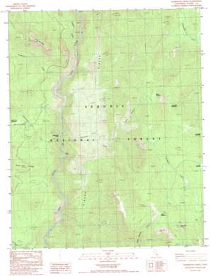
Durrwood Creek Topo Map California
To zoom in, hover over the map of Durrwood Creek
USGS Topo Quad 36118a4 - 1:24,000 scale
| Topo Map Name: | Durrwood Creek |
| USGS Topo Quad ID: | 36118a4 |
| Print Size: | ca. 21 1/4" wide x 27" high |
| Southeast Coordinates: | 36° N latitude / 118.375° W longitude |
| Map Center Coordinates: | 36.0625° N latitude / 118.4375° W longitude |
| U.S. State: | CA |
| Filename: | o36118a4.jpg |
| Download Map JPG Image: | Durrwood Creek topo map 1:24,000 scale |
| Map Type: | Topographic |
| Topo Series: | 7.5´ |
| Map Scale: | 1:24,000 |
| Source of Map Images: | United States Geological Survey (USGS) |
| Alternate Map Versions: |
Durrwood Creek CA 1987, updated 1987 Download PDF Buy paper map Durrwood Creek CA 1987, updated 1994 Download PDF Buy paper map Durrwood Creek CA 2012 Download PDF Buy paper map Durrwood Creek CA 2015 Download PDF Buy paper map |
| FStopo: | US Forest Service topo Durrwood Creek is available: Download FStopo PDF Download FStopo TIF |
1:24,000 Topo Quads surrounding Durrwood Creek
> Back to 36118a1 at 1:100,000 scale
> Back to 36118a1 at 1:250,000 scale
> Back to U.S. Topo Maps home
Durrwood Creek topo map: Gazetteer
Durrwood Creek: Flats
North Meadow elevation 2718m 8917′Peppermint Meadows elevation 1628m 5341′
Schaeffer Meadow elevation 2357m 7732′
Stony Meadow elevation 2542m 8339′
Durrwood Creek: Springs
Sam Spring elevation 2424m 7952′Durrwood Creek: Streams
Durrwood Creek elevation 1325m 4347′Freeman Creek elevation 1392m 4566′
Needlerock Creek elevation 1397m 4583′
Peppermint Creek elevation 1293m 4242′
Durrwood Creek: Summits
Lookout Mountain elevation 2944m 9658′Schaeffer Mountain elevation 2843m 9327′
Sherman Peak elevation 3000m 9842′
The Needles elevation 2500m 8202′
Durrwood Creek: Trails
Rincon Trail elevation 1577m 5173′Durrwood Creek: Valleys
Cedar Canyon elevation 1739m 5705′Durrwood Creek digital topo map on disk
Buy this Durrwood Creek topo map showing relief, roads, GPS coordinates and other geographical features, as a high-resolution digital map file on DVD:
Southern Sierra Nevada, California & Southern Nevada
Buy digital topo maps: Southern Sierra Nevada, California & Southern Nevada


