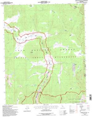
Templeton Mountain Topo Map California
To zoom in, hover over the map of Templeton Mountain
USGS Topo Quad 36118c2 - 1:24,000 scale
| Topo Map Name: | Templeton Mountain |
| USGS Topo Quad ID: | 36118c2 |
| Print Size: | ca. 21 1/4" wide x 27" high |
| Southeast Coordinates: | 36.25° N latitude / 118.125° W longitude |
| Map Center Coordinates: | 36.3125° N latitude / 118.1875° W longitude |
| U.S. State: | CA |
| Filename: | o36118c2.jpg |
| Download Map JPG Image: | Templeton Mountain topo map 1:24,000 scale |
| Map Type: | Topographic |
| Topo Series: | 7.5´ |
| Map Scale: | 1:24,000 |
| Source of Map Images: | United States Geological Survey (USGS) |
| Alternate Map Versions: |
Templeton Mtn CA 1988, updated 1988 Download PDF Buy paper map Templeton Mtn CA 1993, updated 1995 Download PDF Buy paper map Templeton Mtn CA 1994, updated 1997 Download PDF Buy paper map Templeton Mountain CA 2012 Download PDF Buy paper map Templeton Mountain CA 2015 Download PDF Buy paper map |
| FStopo: | US Forest Service topo Templeton Mountain is available: Download FStopo PDF Download FStopo TIF |
1:24,000 Topo Quads surrounding Templeton Mountain
> Back to 36118a1 at 1:100,000 scale
> Back to 36118a1 at 1:250,000 scale
> Back to U.S. Topo Maps home
Templeton Mountain topo map: Gazetteer
Templeton Mountain: Flats
Bell Camp Meadow elevation 2704m 8871′Big Dry Meadow elevation 2723m 8933′
Brown Meadow elevation 2634m 8641′
Brush Meadow elevation 2995m 9826′
Buck Meadow elevation 2854m 9363′
East Potholes elevation 2899m 9511′
Fat Cow Meadow elevation 2622m 8602′
Four Canyons elevation 2685m 8809′
Freckles Meadow elevation 2772m 9094′
Grouse Meadow elevation 2734m 8969′
Overholster Meadow elevation 2771m 9091′
Schaeffer Meadow elevation 2604m 8543′
Strawberry Meadows elevation 2586m 8484′
Templeton Meadows elevation 2618m 8589′
Templeton Mountain: Springs
Iron Spring elevation 2635m 8645′Templeton Mountain: Streams
Dry Creek elevation 2582m 8471′Lewis Stringer elevation 2619m 8592′
Long Stringer elevation 2719m 8920′
Movie Stringer elevation 2620m 8595′
Mulkey Creek elevation 2610m 8562′
Schaeffer Stringer elevation 2522m 8274′
Strawberry Creek elevation 2571m 8435′
Templeton Mountain: Summits
Brown Mountain elevation 3038m 9967′Templeton Mountain elevation 3031m 9944′
Templeton Mountain: Valleys
Death Canyon elevation 2727m 8946′Templeton Mountain digital topo map on disk
Buy this Templeton Mountain topo map showing relief, roads, GPS coordinates and other geographical features, as a high-resolution digital map file on DVD:
Southern Sierra Nevada, California & Southern Nevada
Buy digital topo maps: Southern Sierra Nevada, California & Southern Nevada


