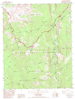
Kern Lake Topo Map California
To zoom in, hover over the map of Kern Lake
USGS Topo Quad 36118c4 - 1:24,000 scale
| Topo Map Name: | Kern Lake |
| USGS Topo Quad ID: | 36118c4 |
| Print Size: | ca. 21 1/4" wide x 27" high |
| Southeast Coordinates: | 36.25° N latitude / 118.375° W longitude |
| Map Center Coordinates: | 36.3125° N latitude / 118.4375° W longitude |
| U.S. State: | CA |
| Filename: | o36118c4.jpg |
| Download Map JPG Image: | Kern Lake topo map 1:24,000 scale |
| Map Type: | Topographic |
| Topo Series: | 7.5´ |
| Map Scale: | 1:24,000 |
| Source of Map Images: | United States Geological Survey (USGS) |
| Alternate Map Versions: |
Kern Lake CA 1988, updated 1988 Download PDF Buy paper map Kern Lake CA 1988, updated 1993 Download PDF Buy paper map Kern Lake CA 1988, updated 1994 Download PDF Buy paper map Kern Lake CA 2012 Download PDF Buy paper map Kern Lake CA 2015 Download PDF Buy paper map |
| FStopo: | US Forest Service topo Kern Lake is available: Download FStopo PDF Download FStopo TIF |
1:24,000 Topo Quads surrounding Kern Lake
> Back to 36118a1 at 1:100,000 scale
> Back to 36118a1 at 1:250,000 scale
> Back to U.S. Topo Maps home
Kern Lake topo map: Gazetteer
Kern Lake: Falls
Volcano Falls elevation 2088m 6850′Kern Lake: Flats
Grasshopper Flat elevation 1817m 5961′Lion Meadows elevation 2023m 6637′
Kern Lake: Gaps
Coyote Pass elevation 3092m 10144′Kern Lake: Lakes
Coyote Lakes elevation 3073m 10082′Kern Lake elevation 1901m 6236′
Little Kern Lake elevation 1899m 6230′
Kern Lake: Parks
Hansen Dam Park elevation 2421m 7942′Kern Lake: Ridges
Hell for Sure elevation 2227m 7306′Kern Lake: Springs
Soda Spring elevation 1940m 6364′Kern Lake: Streams
Angora Creek elevation 1753m 5751′BIg Kern Lake Creek elevation 1910m 6266′
Coyote Creek elevation 1923m 6309′
Golden Trout Creek elevation 1942m 6371′
Grasshopper Creek elevation 1780m 5839′
Hell for Sure Creek elevation 1770m 5807′
Leggett Creek elevation 1771m 5810′
Little Kern Lake Creek elevation 1936m 6351′
Malpais Creek elevation 2381m 7811′
Rough Creek elevation 1908m 6259′
Kern Lake: Summits
Angora Mountain elevation 3096m 10157′Coyote Peaks elevation 3276m 10748′
Tower Rock elevation 2590m 8497′
White Mountain elevation 2645m 8677′
Kern Lake: Valleys
Kern Canyon elevation 1874m 6148′Kern Lake digital topo map on disk
Buy this Kern Lake topo map showing relief, roads, GPS coordinates and other geographical features, as a high-resolution digital map file on DVD:
Southern Sierra Nevada, California & Southern Nevada
Buy digital topo maps: Southern Sierra Nevada, California & Southern Nevada


