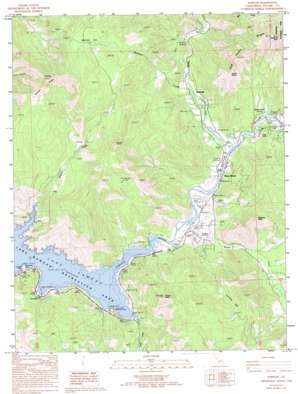
Kaweah Topo Map California
To zoom in, hover over the map of Kaweah
USGS Topo Quad 36118d8 - 1:24,000 scale
| Topo Map Name: | Kaweah |
| USGS Topo Quad ID: | 36118d8 |
| Print Size: | ca. 21 1/4" wide x 27" high |
| Southeast Coordinates: | 36.375° N latitude / 118.875° W longitude |
| Map Center Coordinates: | 36.4375° N latitude / 118.9375° W longitude |
| U.S. State: | CA |
| Filename: | o36118d8.jpg |
| Download Map JPG Image: | Kaweah topo map 1:24,000 scale |
| Map Type: | Topographic |
| Topo Series: | 7.5´ |
| Map Scale: | 1:24,000 |
| Source of Map Images: | United States Geological Survey (USGS) |
| Alternate Map Versions: |
Kaweah CA 1986, updated 1987 Download PDF Buy paper map Kaweah CA 1986, updated 1994 Download PDF Buy paper map Kaweah CA 2012 Download PDF Buy paper map Kaweah CA 2015 Download PDF Buy paper map |
1:24,000 Topo Quads surrounding Kaweah
> Back to 36118a1 at 1:100,000 scale
> Back to 36118a1 at 1:250,000 scale
> Back to U.S. Topo Maps home
Kaweah topo map: Gazetteer
Kaweah: Basins
Washburn Cove elevation 281m 921′Kaweah: Flats
Cherokee Flat elevation 612m 2007′Mankins Flat elevation 787m 2582′
Kaweah: Parks
Horse Creek Recreation Area elevation 220m 721′Kaweah Recreation Area elevation 229m 751′
Lake Kaweah Recreation Area elevation 212m 695′
Kaweah: Populated Places
Kaweah elevation 287m 941′Three Rivers elevation 257m 843′
Kaweah: Ridges
Sulphur Ridge elevation 1051m 3448′Kaweah: Streams
Greasy Creek elevation 220m 721′Horse Creek elevation 219m 718′
Mankins Creek elevation 263m 862′
North Fork Kaweah River elevation 246m 807′
South Fork Kaweah River elevation 231m 757′
Kaweah: Summits
Barton Mountain elevation 772m 2532′Blossom Peak elevation 749m 2457′
Comb Rocks elevation 889m 2916′
Lemon Hill elevation 242m 793′
Shepherd Peak elevation 1087m 3566′
Tharps Peak elevation 841m 2759′
Kaweah digital topo map on disk
Buy this Kaweah topo map showing relief, roads, GPS coordinates and other geographical features, as a high-resolution digital map file on DVD:
Southern Sierra Nevada, California & Southern Nevada
Buy digital topo maps: Southern Sierra Nevada, California & Southern Nevada


