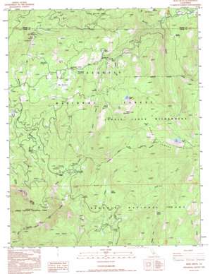
Muir Grove Topo Map California
To zoom in, hover over the map of Muir Grove
USGS Topo Quad 36118f7 - 1:24,000 scale
| Topo Map Name: | Muir Grove |
| USGS Topo Quad ID: | 36118f7 |
| Print Size: | ca. 21 1/4" wide x 27" high |
| Southeast Coordinates: | 36.625° N latitude / 118.75° W longitude |
| Map Center Coordinates: | 36.6875° N latitude / 118.8125° W longitude |
| U.S. State: | CA |
| Filename: | o36118f7.jpg |
| Download Map JPG Image: | Muir Grove topo map 1:24,000 scale |
| Map Type: | Topographic |
| Topo Series: | 7.5´ |
| Map Scale: | 1:24,000 |
| Source of Map Images: | United States Geological Survey (USGS) |
| Alternate Map Versions: |
Muir Grove CA 1987, updated 1987 Download PDF Buy paper map Muir Grove CA 1993, updated 1994 Download PDF Buy paper map Muir Grove CA 2012 Download PDF Buy paper map Muir Grove CA 2015 Download PDF Buy paper map |
| FStopo: | US Forest Service topo Muir Grove is available: Download FStopo PDF Download FStopo TIF |
1:24,000 Topo Quads surrounding Muir Grove
> Back to 36118e1 at 1:100,000 scale
> Back to 36118a1 at 1:250,000 scale
> Back to U.S. Topo Maps home
Muir Grove topo map: Gazetteer
Muir Grove: Flats
Beartrap Meadow elevation 2083m 6833′Big Meadows elevation 2312m 7585′
Cabin Meadow elevation 2102m 6896′
Colony Meadow elevation 2401m 7877′
Fox Meadow elevation 2428m 7965′
Heart Meadow elevation 2325m 7627′
Horse Corral Meadow elevation 2324m 7624′
Poison Meadow elevation 2586m 8484′
Sunset Meadow elevation 2347m 7700′
Muir Grove: Gaps
Poop Out Pass elevation 2795m 9169′Muir Grove: Lakes
Jennie Lake elevation 2748m 9015′Weaver Lake elevation 2655m 8710′
Muir Grove: Pillars
Chimney Rock elevation 2253m 7391′Muir Grove: Populated Places
Stony Creek Village elevation 1968m 6456′Muir Grove: Streams
Big Meadows Creek elevation 2003m 6571′Cabin Creek elevation 2006m 6581′
Dorst Creek elevation 1644m 5393′
Gannon Creek elevation 2638m 8654′
Horse Corral Creek elevation 2000m 6561′
Pattee Creek elevation 2647m 8684′
Rowell Creek elevation 2292m 7519′
Stony Creek elevation 1644m 5393′
Weaver Creek elevation 2266m 7434′
Woodward Creek elevation 1891m 6204′
Muir Grove: Summits
Buck Rock elevation 2542m 8339′Shell Mountain elevation 2884m 9461′
Muir Grove: Trails
Big Meadows Nordic Ski Trail elevation 2291m 7516′Muir Grove: Woods
Little Boulder Grove elevation 2043m 6702′Lost Grove elevation 2028m 6653′
Muir Grove elevation 2074m 6804′
Muir Grove digital topo map on disk
Buy this Muir Grove topo map showing relief, roads, GPS coordinates and other geographical features, as a high-resolution digital map file on DVD:
Southern Sierra Nevada, California & Southern Nevada
Buy digital topo maps: Southern Sierra Nevada, California & Southern Nevada


