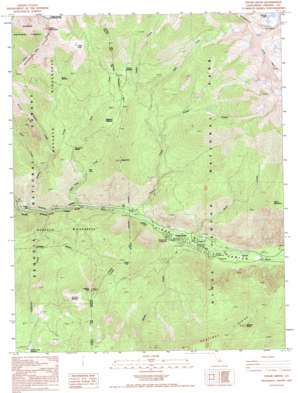
Cedar Grove Topo Map California
To zoom in, hover over the map of Cedar Grove
USGS Topo Quad 36118g6 - 1:24,000 scale
| Topo Map Name: | Cedar Grove |
| USGS Topo Quad ID: | 36118g6 |
| Print Size: | ca. 21 1/4" wide x 27" high |
| Southeast Coordinates: | 36.75° N latitude / 118.625° W longitude |
| Map Center Coordinates: | 36.8125° N latitude / 118.6875° W longitude |
| U.S. State: | CA |
| Filename: | o36118g6.jpg |
| Download Map JPG Image: | Cedar Grove topo map 1:24,000 scale |
| Map Type: | Topographic |
| Topo Series: | 7.5´ |
| Map Scale: | 1:24,000 |
| Source of Map Images: | United States Geological Survey (USGS) |
| Alternate Map Versions: |
Cedar Grove CA 1988, updated 1988 Download PDF Buy paper map Cedar Grove CA 1992, updated 1995 Download PDF Buy paper map Cedar Grove CA 2012 Download PDF Buy paper map Cedar Grove CA 2015 Download PDF Buy paper map |
| FStopo: | US Forest Service topo Cedar Grove is available: Download FStopo PDF Download FStopo TIF |
1:24,000 Topo Quads surrounding Cedar Grove
> Back to 36118e1 at 1:100,000 scale
> Back to 36118a1 at 1:250,000 scale
> Back to U.S. Topo Maps home
Cedar Grove topo map: Gazetteer
Cedar Grove: Basins
Deer Cove elevation 1743m 5718′Cedar Grove: Flats
Burns Meadow elevation 2314m 7591′Frypan Meadow elevation 2289m 7509′
Summit Meadow elevation 2430m 7972′
Wildman Meadow elevation 2278m 7473′
Cedar Grove: Gaps
Deer Creek Saddle elevation 1995m 6545′Cedar Grove: Lakes
Grizzly Lakes elevation 2946m 9665′Cedar Grove: Populated Places
Cedar Grove elevation 1405m 4609′Cedar Grove: Ridges
Comb Spur elevation 3528m 11574′Grand Dike elevation 2522m 8274′
Monarch Divide elevation 3160m 10367′
Sentinel Ridge elevation 2690m 8825′
Cedar Grove: Streams
Choke Creek elevation 1847m 6059′Comb Creek elevation 1810m 5938′
Deer Cove Creek elevation 1330m 4363′
East Fork Grizzley Creek elevation 1898m 6227′
East Fork Lewis Creek elevation 2071m 6794′
Grizzly Creek elevation 1286m 4219′
Hotel Creek elevation 1408m 4619′
Lewis Creek elevation 1398m 4586′
Lightning Creek elevation 1316m 4317′
Roaring River elevation 1460m 4790′
Sheep Creek elevation 1405m 4609′
Wren Creek elevation 1644m 5393′
Cedar Grove: Summits
Lookout Peak elevation 2513m 8244′Mount Harrington elevation 3240m 10629′
North Mountain elevation 2630m 8628′
Sentinel Dome elevation 2737m 8979′
Stag Dome elevation 2323m 7621′
Cedar Grove: Trails
Don Cecil Trail elevation 1702m 5583′Sheep Creek Trail elevation 2627m 8618′
Cedar Grove: Valleys
Kings Canyon elevation 1397m 4583′Cedar Grove digital topo map on disk
Buy this Cedar Grove topo map showing relief, roads, GPS coordinates and other geographical features, as a high-resolution digital map file on DVD:
Southern Sierra Nevada, California & Southern Nevada
Buy digital topo maps: Southern Sierra Nevada, California & Southern Nevada


