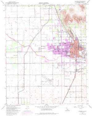
Porterville Topo Map California
To zoom in, hover over the map of Porterville
USGS Topo Quad 36119a1 - 1:24,000 scale
| Topo Map Name: | Porterville |
| USGS Topo Quad ID: | 36119a1 |
| Print Size: | ca. 21 1/4" wide x 27" high |
| Southeast Coordinates: | 36° N latitude / 119° W longitude |
| Map Center Coordinates: | 36.0625° N latitude / 119.0625° W longitude |
| U.S. State: | CA |
| Filename: | o36119a1.jpg |
| Download Map JPG Image: | Porterville topo map 1:24,000 scale |
| Map Type: | Topographic |
| Topo Series: | 7.5´ |
| Map Scale: | 1:24,000 |
| Source of Map Images: | United States Geological Survey (USGS) |
| Alternate Map Versions: |
Porterville CA 1951, updated 1952 Download PDF Buy paper map Porterville CA 1951, updated 1962 Download PDF Buy paper map Porterville CA 1951, updated 1968 Download PDF Buy paper map Porterville CA 1951, updated 1971 Download PDF Buy paper map Porterville CA 1951, updated 1983 Download PDF Buy paper map Porterville CA 2012 Download PDF Buy paper map Porterville CA 2015 Download PDF Buy paper map |
1:24,000 Topo Quads surrounding Porterville
> Back to 36119a1 at 1:100,000 scale
> Back to 36118a1 at 1:250,000 scale
> Back to U.S. Topo Maps home
Porterville topo map: Gazetteer
Porterville: Airports
Porterville Municipal Airport elevation 133m 436′Porterville: Canals
Hubbs Miner Ditch elevation 126m 413′Poplar Ditch elevation 132m 433′
Porter Slough Ditch elevation 125m 410′
Wood Central Ditch elevation 119m 390′
Porterville: Parks
Hayes Field elevation 132m 433′J Claude Nelson Park elevation 141m 462′
Jamison Stadium elevation 140m 459′
Murry Park elevation 146m 479′
North Park elevation 138m 452′
Olivewood Mini Park elevation 140m 459′
Orange Street Mini Park elevation 140m 459′
Porterville Fairgrounds elevation 141m 462′
Veterans Park elevation 132m 433′
Zalud Park elevation 136m 446′
Porterville: Populated Places
Hope (historical) elevation 145m 475′Jones Corner elevation 122m 400′
Lisko elevation 132m 433′
Lois elevation 147m 482′
Monache (historical) elevation 131m 429′
Nanceville elevation 128m 419′
Plano elevation 142m 465′
Ponca elevation 140m 459′
Porterville elevation 140m 459′
Roche elevation 140m 459′
Westfield elevation 130m 426′
Zante elevation 127m 416′
Porterville: Post Offices
Porterville Post Office elevation 139m 456′Porterville: Reservoirs
Lake Heron elevation 140m 459′Porterville: Ridges
Lewis Hill elevation 307m 1007′Scenic Heights elevation 177m 580′
Porterville: Streams
Dead Horse Slough elevation 119m 390′Old Deer Creek Channel elevation 121m 396′
Porterville: Summits
Murry Hill elevation 166m 544′Porterville digital topo map on disk
Buy this Porterville topo map showing relief, roads, GPS coordinates and other geographical features, as a high-resolution digital map file on DVD:
Southern Sierra Nevada, California & Southern Nevada
Buy digital topo maps: Southern Sierra Nevada, California & Southern Nevada


