Paige Topo Map California
To zoom in, hover over the map of Paige
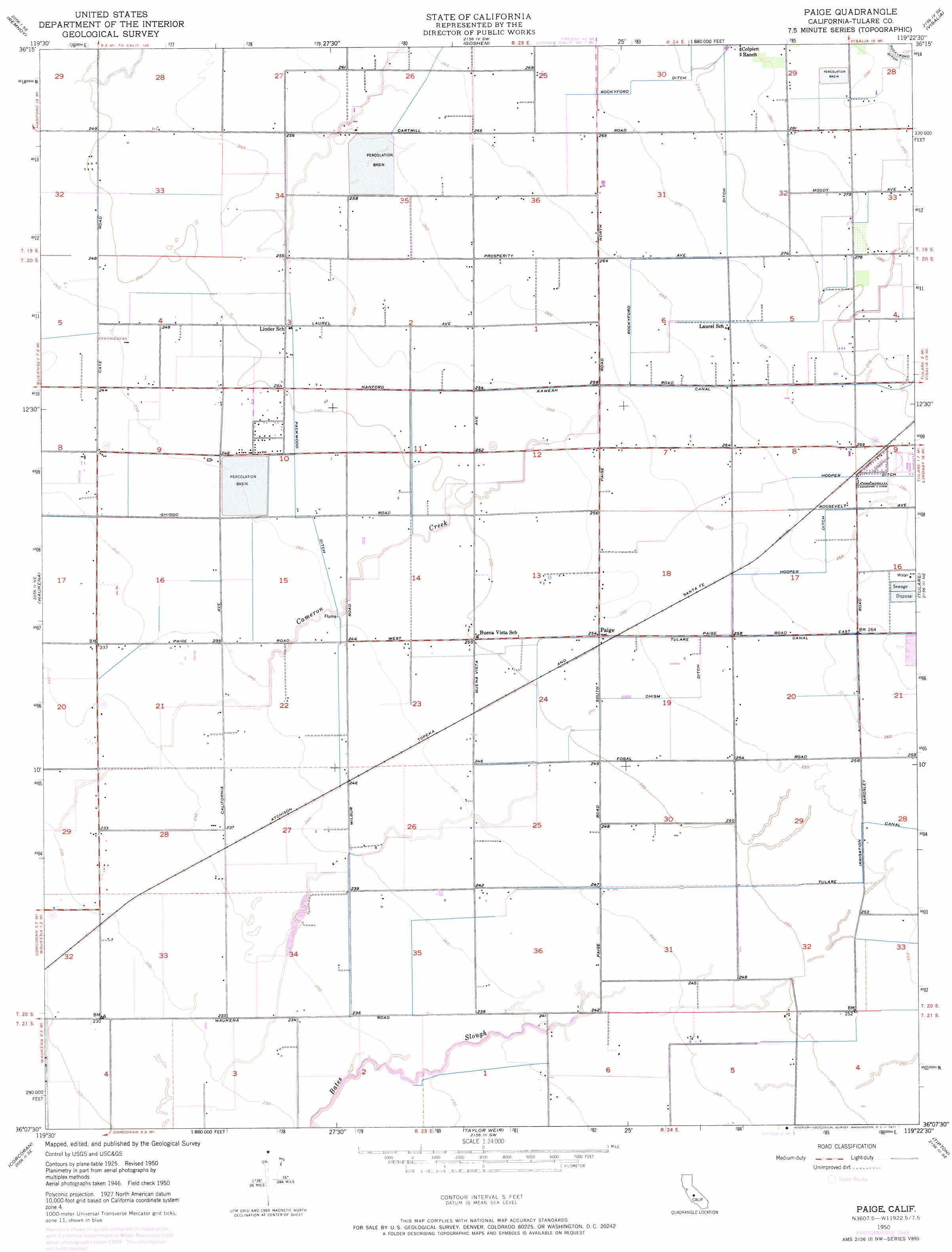
USGS Topo Quad 36119b4 - 1:24,000 scale
| Topo Map Name: | Paige |
| USGS Topo Quad ID: | 36119b4 |
| Print Size: | ca. 21 1/4" wide x 27" high |
| Southeast Coordinates: | 36.125° N latitude / 119.375° W longitude |
| Map Center Coordinates: | 36.1875° N latitude / 119.4375° W longitude |
| U.S. State: | CA |
| Filename: | o36119b4.jpg |
| Download Map JPG Image: | Paige topo map 1:24,000 scale |
| Map Type: | Topographic |
| Topo Series: | 7.5´ |
| Map Scale: | 1:24,000 |
| Source of Map Images: | United States Geological Survey (USGS) |
| Alternate Map Versions: |
Paige CA 1950, updated 1958 Download PDF Buy paper map Paige CA 1950, updated 1971 Download PDF Buy paper map Paige CA 1951 Download PDF Buy paper map Paige CA 2012 Download PDF Buy paper map Paige CA 2015 Download PDF Buy paper map |
1:24,000 Topo Quads surrounding Paige
Laton |
Burris Park |
Traver |
Monson |
Ivanhoe |
Hanford |
Remnoy |
Goshen |
Visalia |
Exeter |
Guernsey |
Waukena |
Paige |
Tulare |
Cairns Corner |
El Rico Ranch |
Corcoran |
Taylor Weir |
Tipton |
Woodville |
Hacienda Ranch Nw |
Hacienda Ranch Ne |
Alpaugh |
Pixley |
Sausalito School |
> Back to 36119a1 at 1:100,000 scale
> Back to 36118a1 at 1:250,000 scale
> Back to U.S. Topo Maps home
Paige topo map: Gazetteer
Paige: Canals
Chism Ditch elevation 79m 259′Hooper Ditch elevation 81m 265′
Kaweah Canal elevation 80m 262′
Packwood Ditch elevation 76m 249′
Tulare Irrigation Canal elevation 79m 259′
Paige: Populated Places
Paige elevation 78m 255′Paige digital topo map on disk
Buy this Paige topo map showing relief, roads, GPS coordinates and other geographical features, as a high-resolution digital map file on DVD:
Southern Sierra Nevada, California & Southern Nevada
Buy digital topo maps: Southern Sierra Nevada, California & Southern Nevada