Traver Topo Map California
To zoom in, hover over the map of Traver
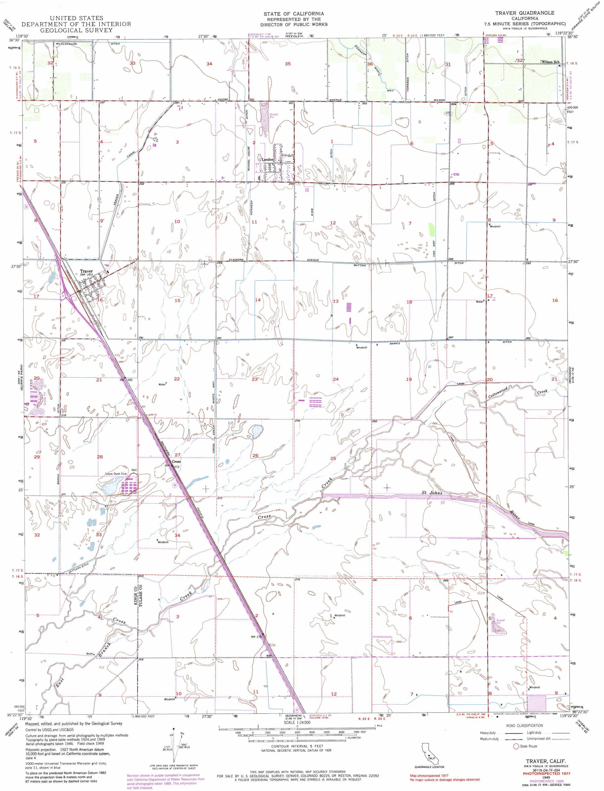
USGS Topo Quad 36119d4 - 1:24,000 scale
| Topo Map Name: | Traver |
| USGS Topo Quad ID: | 36119d4 |
| Print Size: | ca. 21 1/4" wide x 27" high |
| Southeast Coordinates: | 36.375° N latitude / 119.375° W longitude |
| Map Center Coordinates: | 36.4375° N latitude / 119.4375° W longitude |
| U.S. State: | CA |
| Filename: | o36119d4.jpg |
| Download Map JPG Image: | Traver topo map 1:24,000 scale |
| Map Type: | Topographic |
| Topo Series: | 7.5´ |
| Map Scale: | 1:24,000 |
| Source of Map Images: | United States Geological Survey (USGS) |
| Alternate Map Versions: |
Traver CA 1949, updated 1959 Download PDF Buy paper map Traver CA 1949, updated 1971 Download PDF Buy paper map Traver CA 1949, updated 1974 Download PDF Buy paper map Traver CA 1949, updated 1986 Download PDF Buy paper map Traver CA 1950, updated 1950 Download PDF Buy paper map Traver CA 2012 Download PDF Buy paper map Traver CA 2015 Download PDF Buy paper map |
1:24,000 Topo Quads surrounding Traver
Malaga |
Sanger |
Wahtoke |
Orange Cove North |
Tucker Mountain |
Conejo |
Selma |
Reedley |
Orange Cove South |
Stokes Mountain |
Laton |
Burris Park |
Traver |
Monson |
Ivanhoe |
Hanford |
Remnoy |
Goshen |
Visalia |
Exeter |
Guernsey |
Waukena |
Paige |
Tulare |
Cairns Corner |
> Back to 36119a1 at 1:100,000 scale
> Back to 36118a1 at 1:250,000 scale
> Back to U.S. Topo Maps home
Traver topo map: Gazetteer
Traver: Canals
Banks Ditch elevation 88m 288′Kennedy School House Ditch elevation 91m 298′
King Ditch elevation 91m 298′
Traver Canal elevation 89m 291′
Van Noy Ditch elevation 90m 295′
Wilson Ditch elevation 95m 311′
Traver: Populated Places
London elevation 91m 298′Traver elevation 88m 288′
Traver: Post Offices
Traver Post Office elevation 88m 288′Traver: Streams
Cottonwood Creek elevation 86m 282′Elbow Creek elevation 90m 295′
Saint Johns River elevation 85m 278′
Traver digital topo map on disk
Buy this Traver topo map showing relief, roads, GPS coordinates and other geographical features, as a high-resolution digital map file on DVD:
Southern Sierra Nevada, California & Southern Nevada
Buy digital topo maps: Southern Sierra Nevada, California & Southern Nevada