Raisin Topo Map California
To zoom in, hover over the map of Raisin
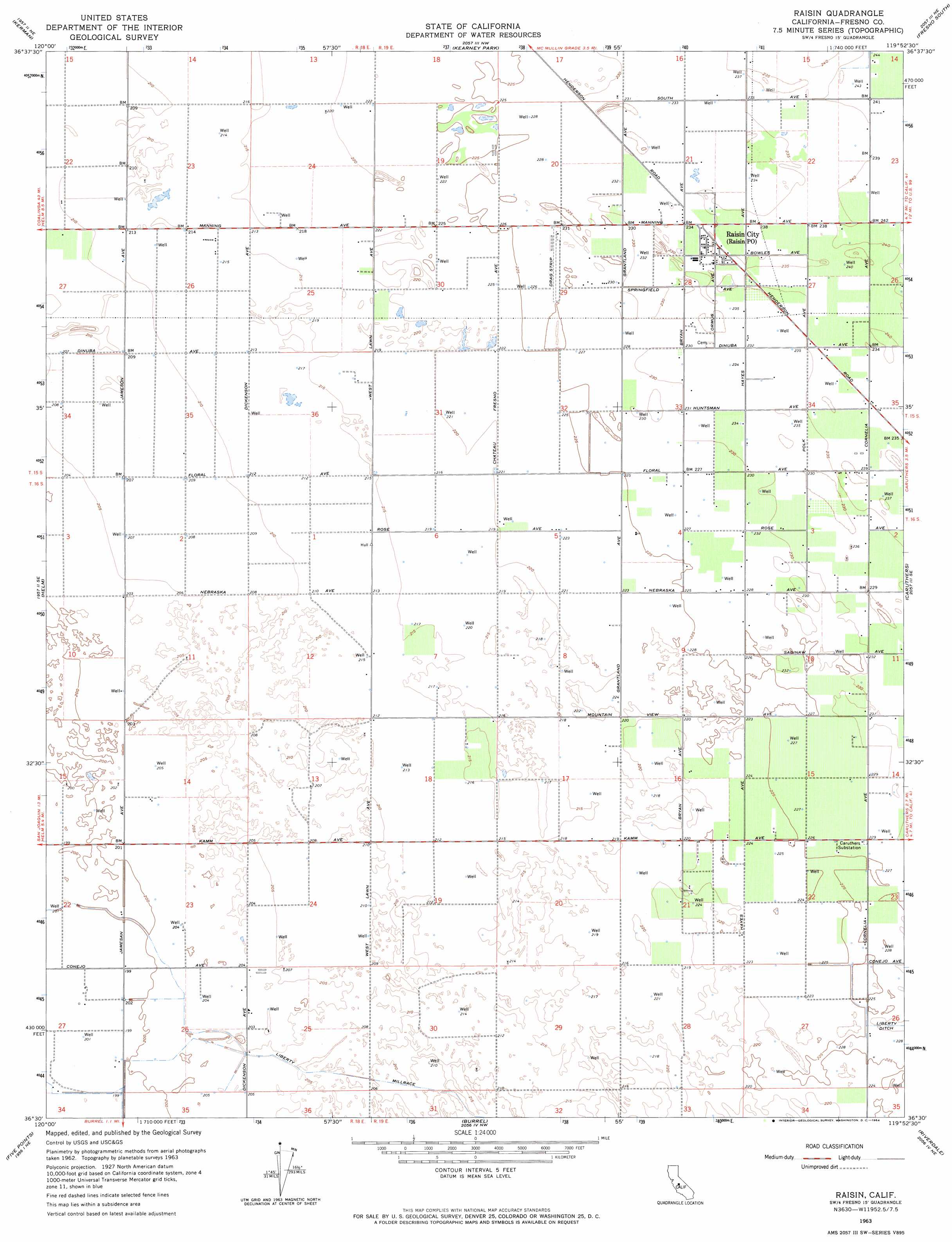
USGS Topo Quad 36119e8 - 1:24,000 scale
| Topo Map Name: | Raisin |
| USGS Topo Quad ID: | 36119e8 |
| Print Size: | ca. 21 1/4" wide x 27" high |
| Southeast Coordinates: | 36.5° N latitude / 119.875° W longitude |
| Map Center Coordinates: | 36.5625° N latitude / 119.9375° W longitude |
| U.S. State: | CA |
| Filename: | o36119e8.jpg |
| Download Map JPG Image: | Raisin topo map 1:24,000 scale |
| Map Type: | Topographic |
| Topo Series: | 7.5´ |
| Map Scale: | 1:24,000 |
| Source of Map Images: | United States Geological Survey (USGS) |
| Alternate Map Versions: |
Raisin CA 1947 Download PDF Buy paper map Raisin CA 1963, updated 1964 Download PDF Buy paper map Raisin CA 2012 Download PDF Buy paper map Raisin CA 2015 Download PDF Buy paper map |
1:24,000 Topo Quads surrounding Raisin
Gravelly Ford |
Biola |
Herndon |
Fresno North |
Clovis |
Jamesan |
Kerman |
Kearney Park |
Fresno South |
Malaga |
San Joaquin |
Helm |
Raisin |
Caruthers |
Conejo |
Westside |
Five Points |
Burrel |
Riverdale |
Laton |
Harris Ranch |
Calflax |
Vanguard |
Lemoore |
Hanford |
> Back to 36119e1 at 1:100,000 scale
> Back to 36118a1 at 1:250,000 scale
> Back to U.S. Topo Maps home
Raisin topo map: Gazetteer
Raisin: Canals
Liberty Millrace elevation 64m 209′Raisin: Populated Places
Raisin City elevation 72m 236′Raisin: Post Offices
Raisin Post Office elevation 72m 236′Raisin Post Office elevation 72m 236′
Raisin digital topo map on disk
Buy this Raisin topo map showing relief, roads, GPS coordinates and other geographical features, as a high-resolution digital map file on DVD:
Southern Sierra Nevada, California & Southern Nevada
Buy digital topo maps: Southern Sierra Nevada, California & Southern Nevada