Orange Cove North Topo Map California
To zoom in, hover over the map of Orange Cove North
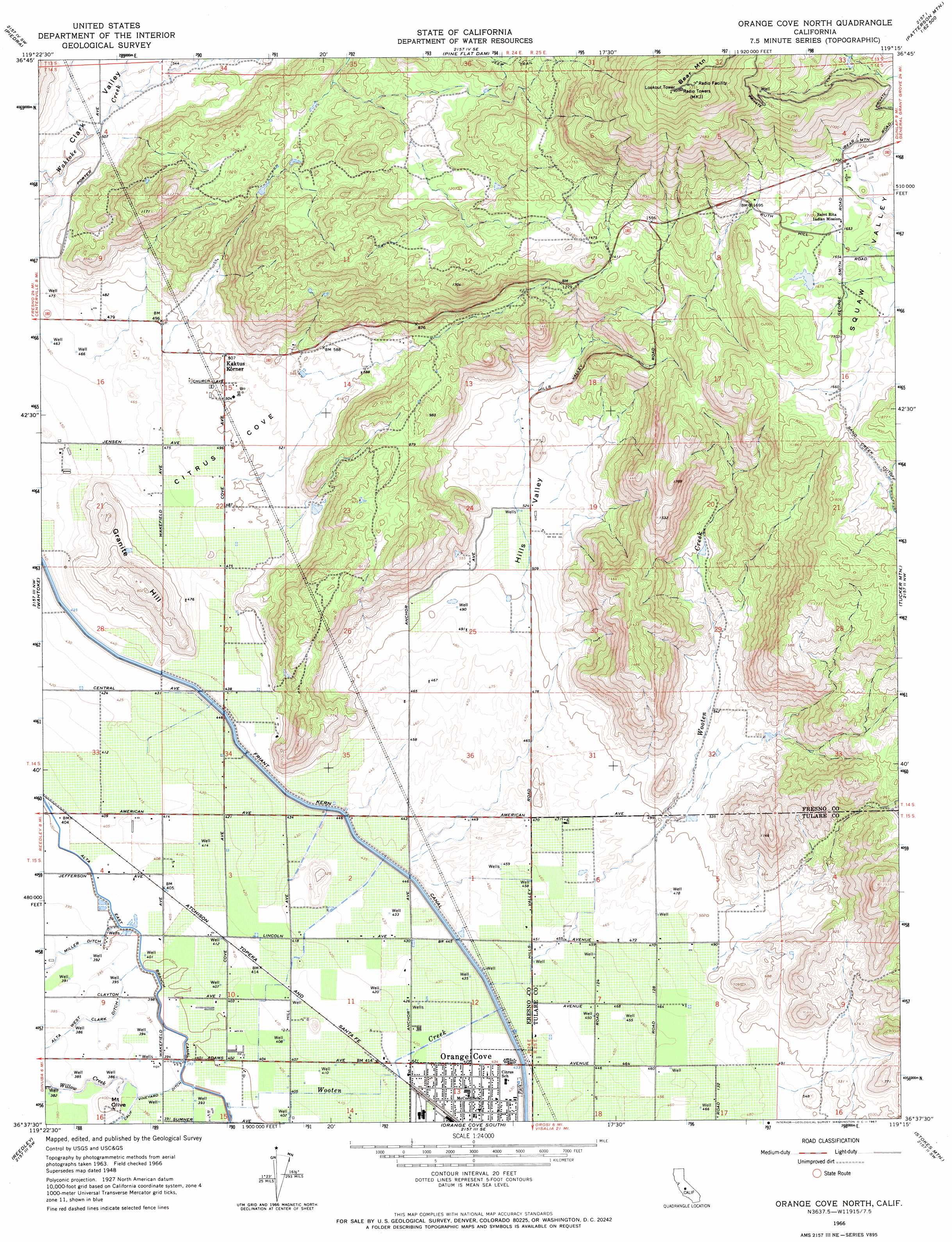
USGS Topo Quad 36119f3 - 1:24,000 scale
| Topo Map Name: | Orange Cove North |
| USGS Topo Quad ID: | 36119f3 |
| Print Size: | ca. 21 1/4" wide x 27" high |
| Southeast Coordinates: | 36.625° N latitude / 119.25° W longitude |
| Map Center Coordinates: | 36.6875° N latitude / 119.3125° W longitude |
| U.S. State: | CA |
| Filename: | o36119f3.jpg |
| Download Map JPG Image: | Orange Cove North topo map 1:24,000 scale |
| Map Type: | Topographic |
| Topo Series: | 7.5´ |
| Map Scale: | 1:24,000 |
| Source of Map Images: | United States Geological Survey (USGS) |
| Alternate Map Versions: |
Orange Cove North CA 1950 Download PDF Buy paper map Orange Cove North CA 1966, updated 1967 Download PDF Buy paper map Orange Cove North CA 2012 Download PDF Buy paper map Orange Cove North CA 2015 Download PDF Buy paper map |
1:24,000 Topo Quads surrounding Orange Cove North
Academy |
Humphreys Station |
Trimmer |
Sacate Ridge |
Patterson Mountain |
Round Mountain |
Piedra |
Pine Flat Dam |
Luckett Mountain |
Verplank Ridge |
Sanger |
Wahtoke |
Orange Cove North |
Tucker Mountain |
Miramonte |
Selma |
Reedley |
Orange Cove South |
Stokes Mountain |
Auckland |
Burris Park |
Traver |
Monson |
Ivanhoe |
Woodlake |
> Back to 36119e1 at 1:100,000 scale
> Back to 36118a1 at 1:250,000 scale
> Back to U.S. Topo Maps home
Orange Cove North topo map: Gazetteer
Orange Cove North: Basins
Citrus Cove elevation 151m 495′Squaw Valley elevation 499m 1637′
Orange Cove North: Canals
Alta West Clark Ditch elevation 118m 387′Orange Cove North: Streams
Wooten Creek elevation 122m 400′Orange Cove North: Summits
Bear Mountain elevation 1022m 3353′Granite Hill elevation 244m 800′
Mount Olive elevation 127m 416′
Orange Cove North: Valleys
Hills Valley elevation 150m 492′Orange Cove North digital topo map on disk
Buy this Orange Cove North topo map showing relief, roads, GPS coordinates and other geographical features, as a high-resolution digital map file on DVD:
Southern Sierra Nevada, California & Southern Nevada
Buy digital topo maps: Southern Sierra Nevada, California & Southern Nevada