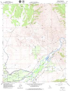
Piedra Topo Map California
To zoom in, hover over the map of Piedra
USGS Topo Quad 36119g4 - 1:24,000 scale
| Topo Map Name: | Piedra |
| USGS Topo Quad ID: | 36119g4 |
| Print Size: | ca. 21 1/4" wide x 27" high |
| Southeast Coordinates: | 36.75° N latitude / 119.375° W longitude |
| Map Center Coordinates: | 36.8125° N latitude / 119.4375° W longitude |
| U.S. State: | CA |
| Filename: | o36119g4.jpg |
| Download Map JPG Image: | Piedra topo map 1:24,000 scale |
| Map Type: | Topographic |
| Topo Series: | 7.5´ |
| Map Scale: | 1:24,000 |
| Source of Map Images: | United States Geological Survey (USGS) |
| Alternate Map Versions: |
Orangedale School CA 1920, updated 1957 Download PDF Buy paper map Piedra CA 1965, updated 1966 Download PDF Buy paper map Piedra CA 1965, updated 1979 Download PDF Buy paper map Piedra CA 2012 Download PDF Buy paper map Piedra CA 2015 Download PDF Buy paper map |
1:24,000 Topo Quads surrounding Piedra
> Back to 36119e1 at 1:100,000 scale
> Back to 36118a1 at 1:250,000 scale
> Back to U.S. Topo Maps home
Piedra topo map: Gazetteer
Piedra: Airports
Harris River Ranch Airport elevation 135m 442′Piedra: Canals
Consolidated Canal elevation 132m 433′Hansen Canal elevation 126m 413′
Lonetree Channel elevation 125m 410′
Piedra: Dams
Giffen Reservoir 699 Dam elevation 175m 574′Piedra: Flats
Tivy Valley elevation 152m 498′Piedra: Lakes
Avocado Lake elevation 147m 482′Piedra: Parks
Winton Park elevation 159m 521′Piedra: Populated Places
Avocado elevation 152m 498′Elk elevation 126m 413′
Gravesboro elevation 147m 482′
Piedra elevation 164m 538′
Piedra: Ridges
Coyote Ridge elevation 212m 695′Piedra: Springs
White Tank Spring elevation 306m 1003′Piedra: Streams
Fish Creek elevation 145m 475′Holland Creek elevation 138m 452′
Hughes Creek elevation 159m 521′
Lewis Creek elevation 166m 544′
North Fork Hughes Creek elevation 289m 948′
West Fork Hughes Creek elevation 289m 948′
Wildcat Creek elevation 271m 889′
Piedra: Summits
Kirkman Hill elevation 162m 531′Red Mountain elevation 730m 2395′
Stephenson Hill elevation 317m 1040′
Stony Point elevation 357m 1171′
Piedra digital topo map on disk
Buy this Piedra topo map showing relief, roads, GPS coordinates and other geographical features, as a high-resolution digital map file on DVD:
Southern Sierra Nevada, California & Southern Nevada
Buy digital topo maps: Southern Sierra Nevada, California & Southern Nevada


