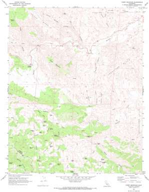
Curry Mountain Topo Map California
To zoom in, hover over the map of Curry Mountain
USGS Topo Quad 36120a4 - 1:24,000 scale
| Topo Map Name: | Curry Mountain |
| USGS Topo Quad ID: | 36120a4 |
| Print Size: | ca. 21 1/4" wide x 27" high |
| Southeast Coordinates: | 36° N latitude / 120.375° W longitude |
| Map Center Coordinates: | 36.0625° N latitude / 120.4375° W longitude |
| U.S. State: | CA |
| Filename: | o36120a4.jpg |
| Download Map JPG Image: | Curry Mountain topo map 1:24,000 scale |
| Map Type: | Topographic |
| Topo Series: | 7.5´ |
| Map Scale: | 1:24,000 |
| Source of Map Images: | United States Geological Survey (USGS) |
| Alternate Map Versions: |
Curry Mountain CA 1969, updated 1973 Download PDF Buy paper map Curry Mountain CA 1969, updated 1973 Download PDF Buy paper map Curry Mountain CA 2012 Download PDF Buy paper map Curry Mountain CA 2015 Download PDF Buy paper map |
1:24,000 Topo Quads surrounding Curry Mountain
> Back to 36120a1 at 1:100,000 scale
> Back to 36120a1 at 1:250,000 scale
> Back to U.S. Topo Maps home
Curry Mountain topo map: Gazetteer
Curry Mountain: Flats
Merrill Pools elevation 747m 2450′Curry Mountain: Gaps
Devils Gate elevation 369m 1210′Curry Mountain: Pillars
Church Rock elevation 593m 1945′Gavilan Rock elevation 832m 2729′
Swallow Rock elevation 702m 2303′
Wildcat Rock elevation 548m 1797′
Curry Mountain: Populated Places
Parkfield Junction elevation 364m 1194′Curry Mountain: Ranges
Jacalitos Hills elevation 576m 1889′Curry Mountain: Ridges
Curry Mountain elevation 690m 2263′Gavilan Ridge elevation 816m 2677′
Curry Mountain: Springs
Buckeye Spring elevation 708m 2322′Castro Spring elevation 478m 1568′
Dripping Spring elevation 564m 1850′
Iron Spring elevation 962m 3156′
Jack Spring elevation 343m 1125′
Marcelin Spring elevation 884m 2900′
Penasco Spring elevation 561m 1840′
Speck Spring elevation 415m 1361′
Sulphur Spring elevation 560m 1837′
Sulphur Spring elevation 489m 1604′
Curry Mountain: Streams
Jasper Creek elevation 323m 1059′Kolingo Creek elevation 278m 912′
Salt Creek elevation 282m 925′
Taylor Creek elevation 392m 1286′
Curry Mountain: Summits
Black Mountain elevation 733m 2404′Busane Peak elevation 671m 2201′
Eagle Rock elevation 681m 2234′
Oliver Rock elevation 685m 2247′
Penasco Rock elevation 686m 2250′
Reason Mountain elevation 1141m 3743′
Rutan Rock elevation 580m 1902′
Curry Mountain: Valleys
Alcalde Canyon elevation 258m 846′Castro Canyon elevation 416m 1364′
Cooper Canyon elevation 241m 790′
Cueva Canyon elevation 353m 1158′
Frank Canyon elevation 366m 1200′
Long Hollow elevation 360m 1181′
Motte Canyon elevation 379m 1243′
Oak Flat Canyon elevation 291m 954′
Oil Well Canyon elevation 367m 1204′
Willow Springs Canyon elevation 349m 1145′
Curry Mountain digital topo map on disk
Buy this Curry Mountain topo map showing relief, roads, GPS coordinates and other geographical features, as a high-resolution digital map file on DVD:


